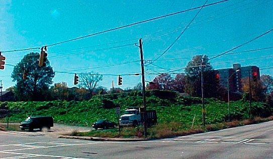
Property Record
488 Formwalt St Sw, Atlanta, GA 30312

NEARBY LISTINGS FOR SALE OR LEASE
Property Detail
488 Formwalt St Sw
Atlanta-Sandy Springs-Roswell, GA
AN VAC LOT
14-0076-0007-103-5
Fulton
Residentialacreage
Georgia
X
76
13121C0357F
0.40 AC
2024
Downtown Atlanta
2025
Atlanta
003500
DEMOGRAPHICS near 488 Formwalt St Sw
1 Mile
3 Mile
5 Mile
2024 Total Population
19,443
183,866
367,800
2029 Population
20,299
191,995
381,742
Pop Growth 2024-2029
+ 4.40%
+ 4.42%
+ 3.79%
Average Age
36
35
36
2024 Total Households
8,097
83,734
167,491
HH Growth 2024-2029
+ 4.92%
+ 4.82%
+ 4.01%
Median Household Inc
$37,599
$69,331
$70,473
Avg Household Size
1.90
1.90
2.00
2024 Avg HH Vehicles
1.00
1.00
1.00
Median Home Value
$341,666
$384,531
$395,216
Median Year Built
1999
1995
1986
Nearby Places
Map Layers
Map Styles
 Street
 Aerial
- Restaurants
- Banks
- Shops
- Fitness
- Groceries
PUBLIC TRANSPORTATION
TRANSIT/SUBWAY
Garnett (Gold Line - Metropolitan Atlanta Rapid Transit Authority (MARTA), Red Line - Metropolitan Atlanta Rapid Transit Authority (MARTA))
DRIVE
WALK
Distance
Garnett (Gold Line - Metropolitan Atlanta Rapid Transit Authority (MARTA), Red Line - Metropolitan Atlanta Rapid Transit Authority (MARTA))
2 min
13 min
0.7 mi
Georgia State (Blue Line - Metropolitan Atlanta Rapid Transit Authority (MARTA), Green Line - Metropolitan Atlanta Rapid Transit Authority (MARTA))
DRIVE
WALK
Distance
Georgia State (Blue Line - Metropolitan Atlanta Rapid Transit Authority (MARTA), Green Line - Metropolitan Atlanta Rapid Transit Authority (MARTA))
2 min
20 min
1.1 mi
Five Points (Blue Line - Metropolitan Atlanta Rapid Transit Authority (MARTA), Gold Line - Metropolitan Atlanta Rapid Transit Authority (MARTA), Green Line - Metropolitan Atlanta Rapid Transit Authority (MARTA), Red Line - Metropolitan Atlanta Rapid Transit Authority (MARTA))
DRIVE
WALK
Distance
Five Points (Blue Line - Metropolitan Atlanta Rapid Transit Authority (MARTA), Gold Line - Metropolitan Atlanta Rapid Transit Authority (MARTA), Green Line - Metropolitan Atlanta Rapid Transit Authority (MARTA), Red Line - Metropolitan Atlanta Rapid Transit Authority (MARTA))
4 min
20 min
1.1 mi
COMMUTER RAIL
Atlanta (Crescent - Amtrak)
DRIVE
WALK
Distance
Atlanta (Crescent - Amtrak)
9 min
5.2 mi
AIRPORT
Hartsfield - Jackson Atlanta International
DRIVE
WALK
Distance
Hartsfield - Jackson Atlanta International
14 min
8.6 mi
Freight Ports
Georgia Ports - Savannah
DRIVE
WALK
Distance
Georgia Ports - Savannah
277 min
247.9 mi
SALE & LEASE HISTORY
LISTING DATE
SALE/LEASE

Sep 25, 2019
For Sale
Sep 24, 2016
For Sale
Jan 17, 2020
For Sale
Nearby Properties
Address
Land Use
TOTAL SIZE
Lot Size
Zoning
Address
Land Use
TOTAL SIZE
Lot Size
Zoning
19.94 AC
SPI1
Address
Land Use
TOTAL SIZE
Lot Size
Zoning
1,585,451 SF
1.97 AC
SPI2
Address
Land Use
TOTAL SIZE
Lot Size
Zoning
2,283,599 SF
12.93 AC
I1
Address
Land Use
TOTAL SIZE
Lot Size
Zoning
11.74 AC
I1
Address
Land Use
TOTAL SIZE
Lot Size
Zoning
9.80 AC
C5
Address
Land Use
TOTAL SIZE
Lot Size
Zoning
3.16 AC
SPI1
Address
Land Use
TOTAL SIZE
Lot Size
Zoning
9 AC
C5
Address
Land Use
TOTAL SIZE
Lot Size
Zoning
10.27 AC
C5
Address
Land Use
TOTAL SIZE
Lot Size
Zoning
1,039,831 SF
0.31 AC
C4
Address
Land Use
TOTAL SIZE
Lot Size
Zoning
1,736,017 SF
3.63 AC
SPI2
Address
Land Use
TOTAL SIZE
Lot Size
Zoning
1,300,309 SF
4.81 AC
SPI1
Address
Land Use
TOTAL SIZE
Lot Size
Zoning
1,434,872 SF
1.89 AC
SPI1
Address
Land Use
TOTAL SIZE
Lot Size
Zoning
61.57 AC
C5
Address
Land Use
TOTAL SIZE
Lot Size
Zoning
10,954,869 SF
28.88 AC
C3
Address
Land Use
TOTAL SIZE
Lot Size
Zoning
1.55 AC
SPI1
Address
Land Use
TOTAL SIZE
Lot Size
Zoning
7 AC
C3
Address
Land Use
TOTAL SIZE
Lot Size
Zoning
342,275 SF
0.70 AC
SPI3
Address
Land Use
TOTAL SIZE
Lot Size
Zoning
467,847 SF
1.62 AC
I2
Address
Land Use
TOTAL SIZE
Lot Size
Zoning
1,314,183 SF
2.61 AC
SPI1
Address
Land Use
TOTAL SIZE
Lot Size
Zoning
2,577,342 SF
2.04 AC
SPI1
Address
Land Use
TOTAL SIZE
Lot Size
Zoning
1,121,700 SF
2.21 AC
I2
Address
Land Use
TOTAL SIZE
Lot Size
Zoning
13,340,229 SF
3.68 AC
SPI1
Address
Land Use
TOTAL SIZE
Lot Size
Zoning
415,551 SF
1.13 AC
C4
Address
Land Use
TOTAL SIZE
Lot Size
Zoning
899,982 SF
2.91 AC
C4
Address
Land Use
TOTAL SIZE
Lot Size
Zoning
935,056 SF
2.35 AC
SPI3
Address
Land Use
TOTAL SIZE
Lot Size
Zoning
0.91 AC
I1
Address
Land Use
TOTAL SIZE
Lot Size
Zoning
1,589,465 SF
3.41 AC
SPI1
Address
Land Use
TOTAL SIZE
Lot Size
Zoning
2,971,832 SF
5.95 AC
SPI2
Address
Land Use
TOTAL SIZE
Lot Size
Zoning
742,537 SF
1.56 AC
C4
Address
Land Use
TOTAL SIZE
Lot Size
Zoning
736,752 SF
3.86 AC
C1
The World's #1 Commercial Real Estate Marketplace
Connect with us
© 2026 CoStar Group
The information above has been obtained from sources believed reliable. While we do not doubt its accuracy we have not verified it and make no guarantee, warranty or representation about it. It is your responsibility to independently confirm its accuracy and completeness. Any projections, opinions, assumptions, or estimates used are for example only and do not represent the current or future performance of the property. The value of this transaction to you depends on tax and other factors which should be evaluated by your tax, financial, and legal advisors. You and your advisors should conduct a careful, independent investigation of the property to determine to your satisfaction the suitability of the property for your needs.