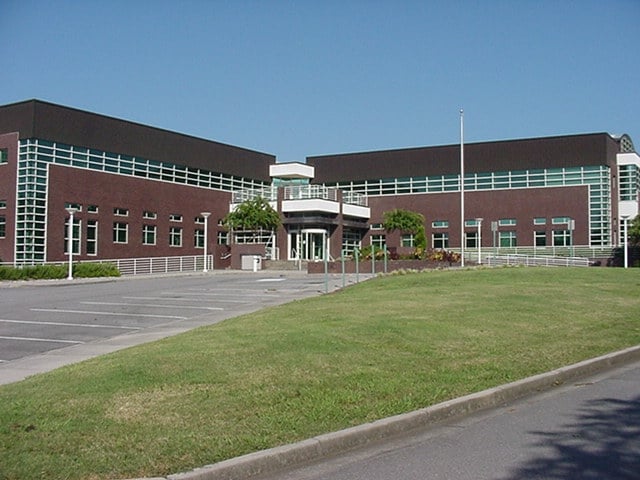
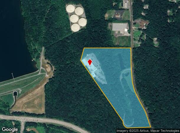
Property Record
475 Reed Rd, Dalton, GA 30720
Current Lease Availabilities
NEARBY LISTINGS FOR SALE OR LEASE
Property Detail
475 Reed Rd
Dalton, GA
Comm Land (Rural)
12-144-02-000
31.69A CHARLES BEARDEN (B A S F)
Commercialnec
Whitfield
X
Georgia
13213C0100D
144
2024
31.69 AC
2024
Georgia Northwest
000501
Other Market Areas
29,520 SF
DEMOGRAPHICS near 475 Reed Rd
1 Mile
3 Mile
5 Mile
2024 Total Population
1,751
35,057
65,288
2029 Population
1,748
35,067
65,350
Pop Growth 2024-2029
(0.17%)
+ 0.03%
+ 0.09%
Average Age
43
37
37
2024 Total Households
746
12,373
22,793
HH Growth 2024-2029
(0.27%)
+ 0.11%
+ 0.10%
Median Household Inc
$52,920
$52,520
$54,758
Avg Household Size
2.30
2.70
2.80
2024 Avg HH Vehicles
2.00
2.00
2.00
Median Home Value
$150,246
$170,898
$175,352
Median Year Built
1997
1985
1983
Nearby Places
- Restaurants
- Banks
- Shops
- Fitness
- Groceries
PUBLIC TRANSPORTATION
AIRPORT
Lovell Field
DRIVE
WALK
Distance
Lovell Field
38 min
27.3 mi
Freight Ports
Georgia Ports - Savannah
DRIVE
WALK
Distance
Georgia Ports - Savannah
381 min
339.5 mi
Nearby Properties
Address
Land Use
TOTAL SIZE
Lot Size
Zoning
Address
Land Use
TOTAL SIZE
Lot Size
Zoning
34,320 SF
13.50 AC
Address
Land Use
TOTAL SIZE
Lot Size
Zoning
230,903 SF
37.16 AC
Address
Land Use
TOTAL SIZE
Lot Size
Zoning
54,546 SF
128.30 AC
Address
Land Use
TOTAL SIZE
Lot Size
Zoning
39,664 SF
27.50 AC
Address
Land Use
TOTAL SIZE
Lot Size
Zoning
784,920 SF
56.60 AC
Address
Land Use
TOTAL SIZE
Lot Size
Zoning
123,430 SF
51.17 AC
Address
Land Use
TOTAL SIZE
Lot Size
Zoning
133,712 SF
14.93 AC
R7
Address
Land Use
TOTAL SIZE
Lot Size
Zoning
195,990 SF
60.25 AC
Address
Land Use
TOTAL SIZE
Lot Size
Zoning
664,020 SF
28.75 AC
Address
Land Use
TOTAL SIZE
Lot Size
Zoning
68,465 SF
0.71 AC
Address
Land Use
TOTAL SIZE
Lot Size
Zoning
100,084 SF
1.47 AC
Address
Land Use
TOTAL SIZE
Lot Size
Zoning
1,188,135 SF
106.61 AC
M2
Address
Land Use
TOTAL SIZE
Lot Size
Zoning
125,756 SF
7 AC
Address
Land Use
TOTAL SIZE
Lot Size
Zoning
160,386 SF
14.21 AC
Address
Land Use
TOTAL SIZE
Lot Size
Zoning
6,650 SF
22.70 AC
Address
Land Use
TOTAL SIZE
Lot Size
Zoning
158,128 SF
13.71 AC
Address
Land Use
TOTAL SIZE
Lot Size
Zoning
75,414 SF
17.51 AC
Address
Land Use
TOTAL SIZE
Lot Size
Zoning
219,744 SF
12.74 AC
Address
Land Use
TOTAL SIZE
Lot Size
Zoning
8,208 SF
11.86 AC
Address
Land Use
TOTAL SIZE
Lot Size
Zoning
18,016 SF
27.65 AC
Address
Land Use
TOTAL SIZE
Lot Size
Zoning
55,020 SF
7.02 AC
Address
Land Use
TOTAL SIZE
Lot Size
Zoning
39,191 SF
1.93 AC
Address
Land Use
TOTAL SIZE
Lot Size
Zoning
31,376 SF
9.64 AC
Address
Land Use
TOTAL SIZE
Lot Size
Zoning
7,276 SF
117.55 AC
Address
Land Use
TOTAL SIZE
Lot Size
Zoning
185,916 SF
24.52 AC
Address
Land Use
TOTAL SIZE
Lot Size
Zoning
193,500 SF
10.95 AC
Address
Land Use
TOTAL SIZE
Lot Size
Zoning
92,416 SF
9.80 AC
R-7
Address
Land Use
TOTAL SIZE
Lot Size
Zoning
97,788 SF
2.76 AC
Address
Land Use
TOTAL SIZE
Lot Size
Zoning
110,044 SF
8.45 AC
Address
Land Use
TOTAL SIZE
Lot Size
Zoning
151,722 SF
15.17 AC
The World's #1 Commercial Real Estate Marketplace
Connect with us
© 2025 CoStar Group
The information above has been obtained from sources believed reliable. While we do not doubt its accuracy we have not verified it and make no guarantee, warranty or representation about it. It is your responsibility to independently confirm its accuracy and completeness. Any projections, opinions, assumptions, or estimates used are for example only and do not represent the current or future performance of the property. The value of this transaction to you depends on tax and other factors which should be evaluated by your tax, financial, and legal advisors. You and your advisors should conduct a careful, independent investigation of the property to determine to your satisfaction the suitability of the property for your needs.