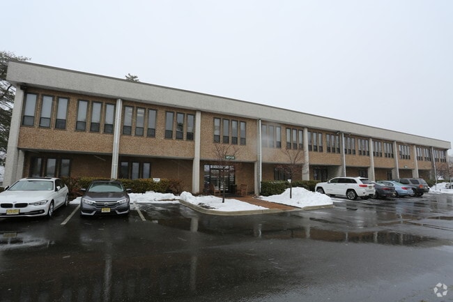
Property Record
1165 State Rd, Princeton, NJ 08540


Current Lease Availabilities
Property Detail
1165 State Rd
13-35001-0000-00011
SOMERSET
Officebuilding
New Jersey
HC
11
B and X Area of moderate flood hazard, usually the area between the limits of the 100-year and 500-year floods.
2.15 AC
2024
Princeton North
2025
Northern New Jersey
004000
Lakewood-New Brunswick, NJ
NEARBY LISTINGS FOR SALE OR LEASE
DEMOGRAPHICS near 1165 State Rd
1 mile
3 mile
5 mile
2025 Total Population
5,556
25,829
83,616
2030 Population
5,817
27,081
87,520
Pop Growth 2025-2030
+ 4.70%
+ 4.85%
+ 4.67%
Average Age
42
42
42
2025 Total Households
2,063
9,279
29,710
HH Growth 2025-2030
+ 4.75%
+ 4.95%
+ 4.92%
Median Household Inc
$162,935
$203,349
$183,564
Avg Household Size
2.60
2.70
2.70
2025 Avg HH Vehicles
2.00
2.00
2.00
Median Home Value
$682,587
$778,824
$774,179
Median Year Built
1996
1986
1986
Nearby Places
Map Layers
Map Styles
 Street
 Aerial
Layers
 Traffic
 Biking
Places
Listings with unknown addresses are not visible on the map
- Restaurants
- Banks
- Shops
- Fitness
- Groceries
PUBLIC TRANSPORTATION
COMMUTER RAIL
Princeton (Princeton Branch - NJ Transit Commuter Rail (NJ Transit))
Drive
Walk
Distance
Princeton (Princeton Branch - NJ Transit Commuter Rail (NJ Transit))
10 min
4.4 mi
Princeton Junction (Northeast Corridor Line - NJ Transit Commuter Rail (NJ Transit), Princeton Branch - NJ Transit Commuter Rail (NJ Transit))
Drive
Walk
Distance
Princeton Junction (Northeast Corridor Line - NJ Transit Commuter Rail (NJ Transit), Princeton Branch - NJ Transit Commuter Rail (NJ Transit))
16 min
7.0 mi
AIRPORT
Trenton Mercer
Drive
Walk
Distance
Trenton Mercer
30 min
16.0 mi
Newark Liberty International
Drive
Walk
Distance
Newark Liberty International
58 min
41.5 mi
Freight Ports
New York Container Terminal
Drive
Walk
Distance
New York Container Terminal
53 min
34.3 mi
Nearby Properties
Address
Land Use
TOTAL SIZE
Lot Size
Zoning
Address
Land Use
TOTAL SIZE
Lot Size
Zoning
115,000 SF
7.98 AC
OR2
Address
Land Use
TOTAL SIZE
Lot Size
Zoning
216,000 SF
22.79 AC
SC
Address
Land Use
TOTAL SIZE
Lot Size
Zoning
Address
Land Use
TOTAL SIZE
Lot Size
Zoning
21.79 AC
R3
Address
Land Use
TOTAL SIZE
Lot Size
Zoning
0.26 AC
OR2
Address
Land Use
TOTAL SIZE
Lot Size
Zoning
30 AC
E4
Address
Land Use
TOTAL SIZE
Lot Size
Zoning
345.28 AC
M3
Address
Land Use
TOTAL SIZE
Lot Size
Zoning
35.71 AC
OR1
Address
Land Use
TOTAL SIZE
Lot Size
Zoning
10 AC
OR1
Address
Land Use
TOTAL SIZE
Lot Size
Zoning
17.45 AC
HC
Address
Land Use
TOTAL SIZE
Lot Size
Zoning
5 AC
REO2
Address
Land Use
TOTAL SIZE
Lot Size
Zoning
4.09 AC
Address
Land Use
TOTAL SIZE
Lot Size
Zoning
9.92 AC
S2
Address
Land Use
TOTAL SIZE
Lot Size
Zoning
114,220 SF
18.28 AC
E2
Address
Land Use
TOTAL SIZE
Lot Size
Zoning
1,268 SF
66.60 AC
ROL
Address
Land Use
TOTAL SIZE
Lot Size
Zoning
11.86 AC
R8
Address
Land Use
TOTAL SIZE
Lot Size
Zoning
17.04 AC
HC
Address
Land Use
TOTAL SIZE
Lot Size
Zoning
125,750 SF
2.27 AC
OR2
Address
Land Use
TOTAL SIZE
Lot Size
Zoning
247.02 AC
Address
Land Use
TOTAL SIZE
Lot Size
Zoning
9.78 AC
R2
Address
Land Use
TOTAL SIZE
Lot Size
Zoning
1.31 AC
E1
Address
Land Use
TOTAL SIZE
Lot Size
Zoning
28.31 AC
R2
Address
Land Use
TOTAL SIZE
Lot Size
Zoning
33,400 SF
9.25 AC
3
Address
Land Use
TOTAL SIZE
Lot Size
Zoning
64,420 SF
10.70 AC
OR2
Address
Land Use
TOTAL SIZE
Lot Size
Zoning
8.59 AC
OR2
Address
Land Use
TOTAL SIZE
Lot Size
Zoning
40.80 AC
MCRZ
Address
Land Use
TOTAL SIZE
Lot Size
Zoning
18.65 AC
REO2
Address
Land Use
TOTAL SIZE
Lot Size
Zoning
64,844 SF
6.27 AC
OR1
Address
Land Use
TOTAL SIZE
Lot Size
Zoning
71.60 AC
R1
Address
Land Use
TOTAL SIZE
Lot Size
Zoning
1.30 AC
R6
The World's #1 Commercial Real Estate Marketplace
Connect with us
© 2026 CoStar Group
The information above has been obtained from sources believed reliable. While we do not doubt its accuracy we have not verified it and make no guarantee, warranty or representation about it. It is your responsibility to independently confirm its accuracy and completeness. Any projections, opinions, assumptions, or estimates used are for example only and do not represent the current or future performance of the property. The value of this transaction to you depends on tax and other factors which should be evaluated by your tax, financial, and legal advisors. You and your advisors should conduct a careful, independent investigation of the property to determine to your satisfaction the suitability of the property for your needs.