Property Record
4750 Sw 91St Dr, Gainesville, FL 32608
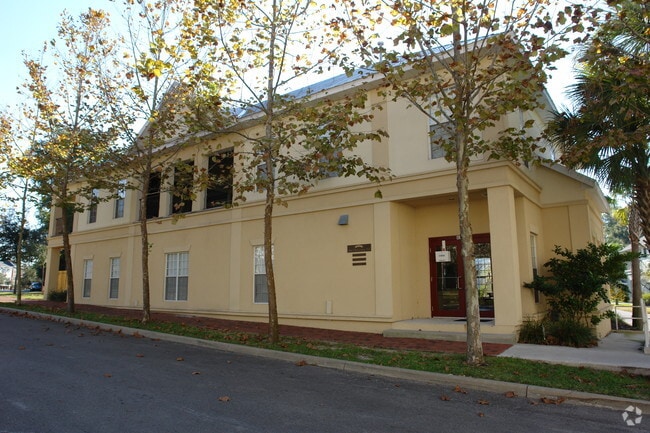

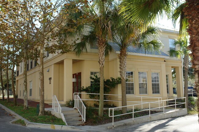
Property Detail
4750 Sw 91St Dr
06860-500-063
COM AT THE MOST NWLY COR OF SW 91ST DR AS PLATTED IN HAILE PLANTATION UNIT 29 S 32 DEG E ALONG W LINE OF SW 91ST DR 16.36 FT S 18 DEG E ALONG W BOUNDARY OF UNIT 29 15.50 FT TO POB CON'T S 18 DEG E ALG W BNDRY 86.15 FT S 72 DEG W 46.20 FT N 18 DEG W 7
Storesoffices
ALACHUA
PD
Florida
B and X Area of moderate flood hazard, usually the area between the limits of the 100-year and 500-year floods.
63
2025
0.09 AC
2025
Gainesville
002222
Other Market Areas
5,813 SF
Gainesville, FL
NEARBY LISTINGS FOR SALE OR LEASE
DEMOGRAPHICS near 4750 Sw 91St Dr
1 mile
3 mile
5 mile
2025 Total Population
7,793
40,339
109,903
2030 Population
8,153
42,522
114,692
Pop Growth 2025-2030
+ 4.62%
+ 5.41%
+ 4.36%
Average Age
43
39
36
2025 Total Households
3,357
16,384
44,647
HH Growth 2025-2030
+ 5.42%
+ 6.05%
+ 4.76%
Median Household Inc
$131,401
$94,957
$64,726
Avg Household Size
2.30
2.40
2.30
2025 Avg HH Vehicles
2.00
2.00
2.00
Median Home Value
$428,342
$395,711
$379,515
Median Year Built
1997
1996
1993
Nearby Places
Map Layers
Map Styles
 Street
 Aerial
Layers
 Traffic
 Biking
Places
Listings with unknown addresses are not visible on the map
- Restaurants
- Banks
- Shops
- Fitness
- Groceries
PUBLIC TRANSPORTATION
AIRPORT
Gainesville Regional
Drive
Walk
Distance
Gainesville Regional
33 min
15.0 mi
Freight Ports
Jacksonville Port
Drive
Walk
Distance
Jacksonville Port
118 min
84.8 mi
Nearby Properties
Address
Land Use
TOTAL SIZE
Lot Size
Zoning
Address
Land Use
TOTAL SIZE
Lot Size
Zoning
318,578 SF
21.24 AC
RMF7
Address
Land Use
TOTAL SIZE
Lot Size
Zoning
170,185 SF
5.14 AC
R-1AA
Address
Land Use
TOTAL SIZE
Lot Size
Zoning
371,933 SF
15 AC
PD
Address
Land Use
TOTAL SIZE
Lot Size
Zoning
332,878 SF
34.15 AC
PD
Address
Land Use
TOTAL SIZE
Lot Size
Zoning
205,412 SF
23.80 AC
R-1A
Address
Land Use
TOTAL SIZE
Lot Size
Zoning
309,967 SF
12.58 AC
PD
Address
Land Use
TOTAL SIZE
Lot Size
Zoning
134,068 SF
3.47 AC
R-2
Address
Land Use
TOTAL SIZE
Lot Size
Zoning
311,673 SF
34.15 AC
R-2
Address
Land Use
TOTAL SIZE
Lot Size
Zoning
307,316 SF
25.99 AC
R-2
Address
Land Use
TOTAL SIZE
Lot Size
Zoning
112,213 SF
18.62 AC
R-1AA
Address
Land Use
TOTAL SIZE
Lot Size
Zoning
87,104 SF
14.59 AC
PD
Address
Land Use
TOTAL SIZE
Lot Size
Zoning
311,290 SF
25.20 AC
R-1A
Address
Land Use
TOTAL SIZE
Lot Size
Zoning
97,648 SF
44.62 AC
A
Address
Land Use
TOTAL SIZE
Lot Size
Zoning
168,512 SF
15.22 AC
R-2
Address
Land Use
TOTAL SIZE
Lot Size
Zoning
168,512 SF
4.78 AC
R-2
Address
Land Use
TOTAL SIZE
Lot Size
Zoning
92,735 SF
1.07 AC
R-1A
Address
Land Use
TOTAL SIZE
Lot Size
Zoning
64,710 SF
8.30 AC
PD
Address
Land Use
TOTAL SIZE
Lot Size
Zoning
140,112 SF
14.60 AC
R-2A
Address
Land Use
TOTAL SIZE
Lot Size
Zoning
133,104 SF
66.88 AC
RM
Address
Land Use
TOTAL SIZE
Lot Size
Zoning
150,324 SF
3.22 AC
R-1AA
Address
Land Use
TOTAL SIZE
Lot Size
Zoning
405,996 SF
2.35 AC
R-1AA
Address
Land Use
TOTAL SIZE
Lot Size
Zoning
106,659 SF
10.21 AC
R-2A
Address
Land Use
TOTAL SIZE
Lot Size
Zoning
49,400 SF
41.99 AC
RM
Address
Land Use
TOTAL SIZE
Lot Size
Zoning
98,278 SF
3.40 AC
MP
Address
Land Use
TOTAL SIZE
Lot Size
Zoning
97,174 SF
11.94 AC
PD
Address
Land Use
TOTAL SIZE
Lot Size
Zoning
129,560 SF
19.10 AC
A
Address
Land Use
TOTAL SIZE
Lot Size
Zoning
72,945 SF
11.77 AC
R-1AA
Address
Land Use
TOTAL SIZE
Lot Size
Zoning
26,334 SF
0.77 AC
R1-AA
Address
Land Use
TOTAL SIZE
Lot Size
Zoning
17,640 SF
7.23 AC
PD
Address
Land Use
TOTAL SIZE
Lot Size
Zoning
50,445 SF
5.39 AC
R-1A
The World's #1 Commercial Real Estate Marketplace
Connect with us
© 2026 CoStar Group
The information above has been obtained from sources believed reliable. While we do not doubt its accuracy we have not verified it and make no guarantee, warranty or representation about it. It is your responsibility to independently confirm its accuracy and completeness. Any projections, opinions, assumptions, or estimates used are for example only and do not represent the current or future performance of the property. The value of this transaction to you depends on tax and other factors which should be evaluated by your tax, financial, and legal advisors. You and your advisors should conduct a careful, independent investigation of the property to determine to your satisfaction the suitability of the property for your needs.