Property Record
4750 Vandalia Rd, Pleasant Hill, IA 50327
NEARBY LISTINGS FOR SALE OR LEASE
-
-
View all Pleasant Hill listings for sale on LoopNet.com
Property Detail
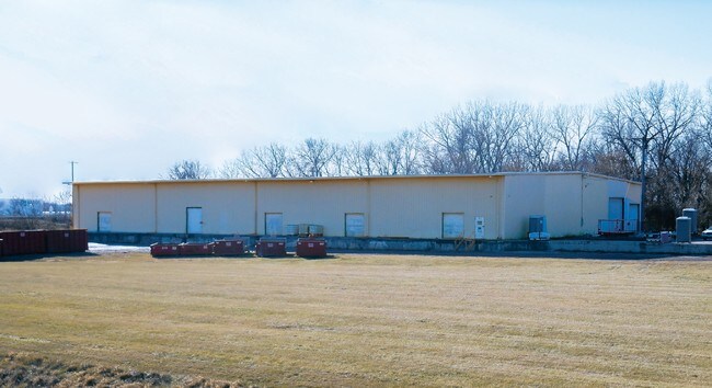
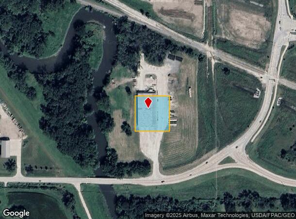
4750 Vandalia Rd
Des Moines-West Des Moines, IA
Sec 08-78-23
221-00053000000
1 ACRE BLDG SITE IN SE COR LT 2 OP SE 1/4 SE 1/4 SEC 8-78-23
Warehouse
Polk
AE
Iowa
19153C0360F
2
2024
1 AC
2025
Northeast
010804
Des Moines
22,000 SF
DEMOGRAPHICS near 4750 Vandalia Rd
1 Mile
3 Mile
5 Mile
2024 Total Population
838
21,858
96,149
2029 Population
877
22,719
100,172
Pop Growth 2024-2029
+ 4.65%
+ 3.94%
+ 4.18%
Average Age
41
39
38
2024 Total Households
309
8,151
37,018
HH Growth 2024-2029
+ 4.85%
+ 4.07%
+ 4.44%
Median Household Inc
$108,189
$73,590
$62,055
Avg Household Size
2.70
2.60
2.50
2024 Avg HH Vehicles
3.00
2.00
2.00
Median Home Value
$309,701
$210,561
$168,242
Median Year Built
1995
1987
1975
Nearby Places
Map Layers
Map Styles
 Street
 Aerial
- Restaurants
- Banks
- Shops
- Fitness
- Groceries
PUBLIC TRANSPORTATION
AIRPORT
Des Moines International
DRIVE
WALK
Distance
Des Moines International
22 min
11.2 mi
Freight Ports
Port Milwaukee
DRIVE
WALK
Distance
Port Milwaukee
416 min
372.9 mi
SALE & LEASE HISTORY
LISTING DATE
SALE/LEASE

Mar 09, 2017
For Sale
Jan 10, 2017
For Sale
Nearby Properties
Address
Land Use
TOTAL SIZE
Lot Size
Zoning
Address
Land Use
TOTAL SIZE
Lot Size
Zoning
475,929 SF
49.86 AC
M2
Address
Land Use
TOTAL SIZE
Lot Size
Zoning
342,000 SF
22.18 AC
Address
Land Use
TOTAL SIZE
Lot Size
Zoning
175,854 SF
22.81 AC
Address
Land Use
TOTAL SIZE
Lot Size
Zoning
1,890,511 SF
39.03 AC
M-2
Address
Land Use
TOTAL SIZE
Lot Size
Zoning
155,276 SF
6.66 AC
R-4
Address
Land Use
TOTAL SIZE
Lot Size
Zoning
201,072 SF
26.81 AC
Address
Land Use
TOTAL SIZE
Lot Size
Zoning
38.16 AC
PUD
Address
Land Use
TOTAL SIZE
Lot Size
Zoning
47,267 SF
22.69 AC
R-4
Address
Land Use
TOTAL SIZE
Lot Size
Zoning
126,830 SF
6.53 AC
Address
Land Use
TOTAL SIZE
Lot Size
Zoning
39,936 SF
4.62 AC
R-4
Address
Land Use
TOTAL SIZE
Lot Size
Zoning
45,004 SF
5.68 AC
Address
Land Use
TOTAL SIZE
Lot Size
Zoning
65,079 SF
6.19 AC
R-2
Address
Land Use
TOTAL SIZE
Lot Size
Zoning
58,366 SF
11.58 AC
Address
Land Use
TOTAL SIZE
Lot Size
Zoning
123,059 SF
27.23 AC
M2
Address
Land Use
TOTAL SIZE
Lot Size
Zoning
71,730 SF
6.39 AC
I-2
Address
Land Use
TOTAL SIZE
Lot Size
Zoning
99,200 SF
7 AC
I-2
Address
Land Use
TOTAL SIZE
Lot Size
Zoning
62,467 SF
4.60 AC
Address
Land Use
TOTAL SIZE
Lot Size
Zoning
1,326 SF
5.15 AC
I-3
Address
Land Use
TOTAL SIZE
Lot Size
Zoning
56,281 SF
5.80 AC
C-1
Address
Land Use
TOTAL SIZE
Lot Size
Zoning
16.80 AC
M-1
Address
Land Use
TOTAL SIZE
Lot Size
Zoning
38,172 SF
3.27 AC
C-2
Address
Land Use
TOTAL SIZE
Lot Size
Zoning
49,708 SF
7.33 AC
R-3
Address
Land Use
TOTAL SIZE
Lot Size
Zoning
54,876 SF
7.05 AC
I-2
Address
Land Use
TOTAL SIZE
Lot Size
Zoning
67,602 SF
3.71 AC
R-3
Address
Land Use
TOTAL SIZE
Lot Size
Zoning
2,368 SF
19.47 AC
I-3
Address
Land Use
TOTAL SIZE
Lot Size
Zoning
23,900 SF
8.49 AC
Address
Land Use
TOTAL SIZE
Lot Size
Zoning
22,046 SF
4.06 AC
C3
Address
Land Use
TOTAL SIZE
Lot Size
Zoning
27,440 SF
3.47 AC
C-3
Address
Land Use
TOTAL SIZE
Lot Size
Zoning
27,996 SF
4.25 AC
R-1
Address
Land Use
TOTAL SIZE
Lot Size
Zoning
22,294 SF
9.93 AC
C-3
The World's #1 Commercial Real Estate Marketplace
Connect with us
© 2025 CoStar Group
The information above has been obtained from sources believed reliable. While we do not doubt its accuracy we have not verified it and make no guarantee, warranty or representation about it. It is your responsibility to independently confirm its accuracy and completeness. Any projections, opinions, assumptions, or estimates used are for example only and do not represent the current or future performance of the property. The value of this transaction to you depends on tax and other factors which should be evaluated by your tax, financial, and legal advisors. You and your advisors should conduct a careful, independent investigation of the property to determine to your satisfaction the suitability of the property for your needs.