Property Record
4752 Alpine Rd, Columbia, SC 29223


NEARBY LISTINGS FOR SALE OR LEASE
-
-
View all Columbia listings for lease on LoopNet.com
Property Detail
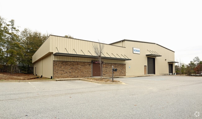
4752 Alpine Rd
19813-06-25
Annacy Park Subdivision Phase 4
Commercialnec
130X7X85.1X135X149.1X133.1 X201.9X82 #SU WILLIAMBURG EAST PH II-A
X
Richland
45079C0258L
South Carolina
2025
1.30 AC
2024
Northeast Columbia
011412
Columbia
10,000 SF
Columbia, SC
DEMOGRAPHICS near 4752 Alpine Rd
1 Mile
3 Mile
5 Mile
2024 Total Population
3,248
33,838
85,169
2029 Population
3,270
34,202
86,490
Pop Growth 2024-2029
+ 0.68%
+ 1.08%
+ 1.55%
Average Age
39
38
39
2024 Total Households
1,235
14,309
35,241
HH Growth 2024-2029
+ 0.73%
+ 1.13%
+ 1.55%
Median Household Inc
$49,416
$50,062
$56,421
Avg Household Size
2.50
2.30
2.30
2024 Avg HH Vehicles
2.00
2.00
2.00
Median Home Value
$157,510
$184,984
$193,106
Median Year Built
1991
1987
1987
Nearby Places
Map Layers
Map Styles
 Street
 Aerial
- Restaurants
- Banks
- Shops
- Fitness
- Groceries
PUBLIC TRANSPORTATION
AIRPORT
Columbia Metro
DRIVE
WALK
Distance
Columbia Metro
37 min
23.0 mi
SALE & LEASE HISTORY
LISTING DATE
SALE/LEASE

Sep 28, 2022
For Sale
Sep 25, 2016
For Lease
Nov 03, 2022
For Lease
Jun 04, 2018
For Sale
Nearby Properties
Address
Land Use
TOTAL SIZE
Lot Size
Zoning
Address
Land Use
TOTAL SIZE
Lot Size
Zoning
1,704.85 AC
RU
Address
Land Use
TOTAL SIZE
Lot Size
Zoning
338,744 SF
21.28 AC
RM-HD
Address
Land Use
TOTAL SIZE
Lot Size
Zoning
343,506 SF
29.94 AC
RM-HD
Address
Land Use
TOTAL SIZE
Lot Size
Zoning
333,825 SF
17.75 AC
GC
Address
Land Use
TOTAL SIZE
Lot Size
Zoning
313,244 SF
12.75 AC
RM-HD
Address
Land Use
TOTAL SIZE
Lot Size
Zoning
278,001 SF
28.82 AC
GC
Address
Land Use
TOTAL SIZE
Lot Size
Zoning
288,000 SF
17.34 AC
OI
Address
Land Use
TOTAL SIZE
Lot Size
Zoning
285,368 SF
16.09 AC
GC
Address
Land Use
TOTAL SIZE
Lot Size
Zoning
155,314 SF
26.04 AC
OI
Address
Land Use
TOTAL SIZE
Lot Size
Zoning
62,878 SF
8.43 AC
RM-HD
Address
Land Use
TOTAL SIZE
Lot Size
Zoning
299,909 SF
14.49 AC
RM-HD
Address
Land Use
TOTAL SIZE
Lot Size
Zoning
360,163 SF
20.11 AC
RM-MD
Address
Land Use
TOTAL SIZE
Lot Size
Zoning
179,652 SF
14.98 AC
RM-HD
Address
Land Use
TOTAL SIZE
Lot Size
Zoning
341,550 SF
20.66 AC
RM-HD
Address
Land Use
TOTAL SIZE
Lot Size
Zoning
183,237 SF
13.65 AC
GC
Address
Land Use
TOTAL SIZE
Lot Size
Zoning
147,062 SF
13.20 AC
GC
Address
Land Use
TOTAL SIZE
Lot Size
Zoning
50,000 SF
18.71 AC
RS-MD
Address
Land Use
TOTAL SIZE
Lot Size
Zoning
113,510 SF
11.60 AC
GC
Address
Land Use
TOTAL SIZE
Lot Size
Zoning
249,536 SF
20.36 AC
RM-HD
Address
Land Use
TOTAL SIZE
Lot Size
Zoning
156,185 SF
12.68 AC
GC
Address
Land Use
TOTAL SIZE
Lot Size
Zoning
194,728 SF
12.28 AC
RM-MD
Address
Land Use
TOTAL SIZE
Lot Size
Zoning
14.77 AC
RM-MD
Address
Land Use
TOTAL SIZE
Lot Size
Zoning
123,647 SF
16.05 AC
GC
Address
Land Use
TOTAL SIZE
Lot Size
Zoning
171,876 SF
9.89 AC
RM-HD
Address
Land Use
TOTAL SIZE
Lot Size
Zoning
117,920 SF
8.44 AC
RM-HD
Address
Land Use
TOTAL SIZE
Lot Size
Zoning
16,030 SF
15 AC
RM-HD
Address
Land Use
TOTAL SIZE
Lot Size
Zoning
83,717 SF
9.79 AC
GC
Address
Land Use
TOTAL SIZE
Lot Size
Zoning
105,920 SF
10.56 AC
PDD
Address
Land Use
TOTAL SIZE
Lot Size
Zoning
1,337.01 AC
GC
Address
Land Use
TOTAL SIZE
Lot Size
Zoning
5,412 SF
6.48 AC
RM-HD
The World's #1 Commercial Real Estate Marketplace
Connect with us
© 2026 CoStar Group
The information above has been obtained from sources believed reliable. While we do not doubt its accuracy we have not verified it and make no guarantee, warranty or representation about it. It is your responsibility to independently confirm its accuracy and completeness. Any projections, opinions, assumptions, or estimates used are for example only and do not represent the current or future performance of the property. The value of this transaction to you depends on tax and other factors which should be evaluated by your tax, financial, and legal advisors. You and your advisors should conduct a careful, independent investigation of the property to determine to your satisfaction the suitability of the property for your needs.