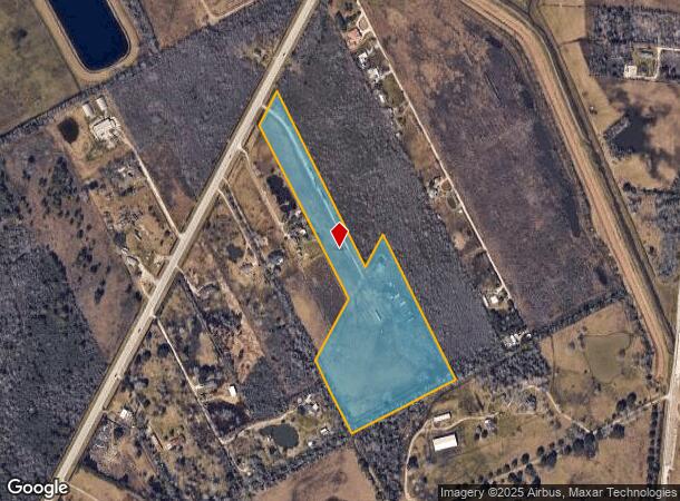
Property Record
4755 S Highway 35, Alvin, TX 77511

NEARBY LISTINGS FOR SALE OR LEASE
Property Detail
4755 S Highway 35
Houston-The Woodlands-Sugar Land, TX
Wm Harris
0072-0040-111
A0072 WM HARRIS TRACT 12B1C-12B1D-12B1F ACRES 17.14
Agriculturalland
Brazoria
X
Texas
48039C0285K
17.14 AC
2024
South Hwy 35
2025
Houston
661400
DEMOGRAPHICS near 4755 S Highway 35
1 Mile
3 Mile
5 Mile
2024 Total Population
296
17,531
38,627
2029 Population
327
19,454
42,976
Pop Growth 2024-2029
+ 10.47%
+ 10.97%
+ 11.26%
Average Age
39
38
38
2024 Total Households
101
6,429
13,953
HH Growth 2024-2029
+ 10.89%
+ 11.12%
+ 11.40%
Median Household Inc
$73,124
$60,624
$64,943
Avg Household Size
2.80
2.60
2.70
2024 Avg HH Vehicles
3.00
2.00
2.00
Median Home Value
$245,454
$178,369
$194,601
Median Year Built
1989
1984
1984
Nearby Places
Map Layers
Map Styles
 Street
 Aerial
- Restaurants
- Banks
- Shops
- Fitness
- Groceries
PUBLIC TRANSPORTATION
AIRPORT
William P Hobby
DRIVE
WALK
Distance
William P Hobby
37 min
21.0 mi
Freight Ports
Port of Houston
DRIVE
WALK
Distance
Port of Houston
49 min
29.2 mi
SALE & LEASE HISTORY
LISTING DATE
SALE/LEASE

Nov 05, 2019
For Sale
Nearby Properties
Address
Land Use
TOTAL SIZE
Lot Size
Zoning
Address
Land Use
TOTAL SIZE
Lot Size
Zoning
64,082 SF
17.62 AC
Address
Land Use
TOTAL SIZE
Lot Size
Zoning
66,557 SF
8.99 AC
0065
Address
Land Use
TOTAL SIZE
Lot Size
Zoning
112,310 SF
10.81 AC
0016
Address
Land Use
TOTAL SIZE
Lot Size
Zoning
231,096 SF
62.69 AC
0072
Address
Land Use
TOTAL SIZE
Lot Size
Zoning
171,971 SF
10 AC
0062
Address
Land Use
TOTAL SIZE
Lot Size
Zoning
42,990 SF
9.74 AC
0108
Address
Land Use
TOTAL SIZE
Lot Size
Zoning
148,812 SF
10.22 AC
Address
Land Use
TOTAL SIZE
Lot Size
Zoning
120,516 SF
5.97 AC
Address
Land Use
TOTAL SIZE
Lot Size
Zoning
100,453 SF
6.02 AC
Address
Land Use
TOTAL SIZE
Lot Size
Zoning
121,249 SF
5.52 AC
0093
Address
Land Use
TOTAL SIZE
Lot Size
Zoning
100,754 SF
5.93 AC
Address
Land Use
TOTAL SIZE
Lot Size
Zoning
146,535 SF
7.32 AC
Address
Land Use
TOTAL SIZE
Lot Size
Zoning
83,252 SF
6.16 AC
Address
Land Use
TOTAL SIZE
Lot Size
Zoning
77,933 SF
3.67 AC
0113
Address
Land Use
TOTAL SIZE
Lot Size
Zoning
30,032 SF
61.64 AC
0009
Address
Land Use
TOTAL SIZE
Lot Size
Zoning
109,608 SF
5.58 AC
0071
Address
Land Use
TOTAL SIZE
Lot Size
Zoning
81,272 SF
5.03 AC
0015
Address
Land Use
TOTAL SIZE
Lot Size
Zoning
70,086 SF
3.16 AC
0115
Address
Land Use
TOTAL SIZE
Lot Size
Zoning
18,426 SF
1.84 AC
0017
Address
Land Use
TOTAL SIZE
Lot Size
Zoning
32,891 SF
6.40 AC
Address
Land Use
TOTAL SIZE
Lot Size
Zoning
70,280 SF
3.71 AC
0037
Address
Land Use
TOTAL SIZE
Lot Size
Zoning
54,952 SF
6.30 AC
Address
Land Use
TOTAL SIZE
Lot Size
Zoning
1,600 SF
8.82 AC
0081
Address
Land Use
TOTAL SIZE
Lot Size
Zoning
52,352 SF
2.27 AC
Address
Land Use
TOTAL SIZE
Lot Size
Zoning
70.66 AC
Address
Land Use
TOTAL SIZE
Lot Size
Zoning
39,420 SF
5 AC
Address
Land Use
TOTAL SIZE
Lot Size
Zoning
9,979 SF
5.37 AC
Address
Land Use
TOTAL SIZE
Lot Size
Zoning
35,955 SF
1.61 AC
0053
Address
Land Use
TOTAL SIZE
Lot Size
Zoning
30,385 SF
3.27 AC
Address
Land Use
TOTAL SIZE
Lot Size
Zoning
61,432 SF
25 AC
The World's #1 Commercial Real Estate Marketplace
Connect with us
© 2025 CoStar Group
The information above has been obtained from sources believed reliable. While we do not doubt its accuracy we have not verified it and make no guarantee, warranty or representation about it. It is your responsibility to independently confirm its accuracy and completeness. Any projections, opinions, assumptions, or estimates used are for example only and do not represent the current or future performance of the property. The value of this transaction to you depends on tax and other factors which should be evaluated by your tax, financial, and legal advisors. You and your advisors should conduct a careful, independent investigation of the property to determine to your satisfaction the suitability of the property for your needs.