Property Record
4759 Bluestem Rd, Roscoe, IL 61073
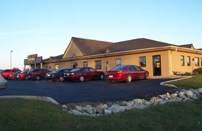

Property Detail
4759 Bluestem Rd
04-29-428-004
PRAIRIE BUSINESS CENTER PLAT NO 2 BNGPT E1/2 SEC 29-46-2 LOT 10
Commercialnec
WINNEBAGO
CPD - COMM
Illinois
B and X Area of moderate flood hazard, usually the area between the limits of the 100-year and 500-year floods.
10
2024
1.03 AC
2024
I-39 Corr/Winnebago Cnty
003904
Chicago
6,600 SF
Rockford, IL
NEARBY LISTINGS FOR SALE OR LEASE
DEMOGRAPHICS near 4759 Bluestem Rd
1 mile
3 mile
5 mile
2025 Total Population
3,259
25,639
57,533
2030 Population
3,285
25,653
57,847
Pop Growth 2025-2030
+ 0.80%
+ 0.05%
+ 0.55%
Average Age
42
40
40
2025 Total Households
1,276
9,690
21,785
HH Growth 2025-2030
+ 0.78%
+ 0.09%
+ 0.59%
Median Household Inc
$101,199
$95,257
$87,599
Avg Household Size
2.60
2.60
2.60
2025 Avg HH Vehicles
2.00
2.00
2.00
Median Home Value
$193,340
$223,603
$215,397
Median Year Built
1982
1994
1989
Nearby Places
Map Layers
Map Styles
 Street
 Aerial
Layers
 Traffic
 Biking
Places
Listings with unknown addresses are not visible on the map
- Restaurants
- Banks
- Shops
- Fitness
- Groceries
SALE & LEASE HISTORY
LISTING DATE
SALE/LEASE

Sep 01, 2017
For Lease
Nearby Properties
Address
Land Use
TOTAL SIZE
Lot Size
Zoning
Address
Land Use
TOTAL SIZE
Lot Size
Zoning
33.53 AC
Address
Land Use
TOTAL SIZE
Lot Size
Zoning
121.46 AC
Address
Land Use
TOTAL SIZE
Lot Size
Zoning
66.74 AC
Address
Land Use
TOTAL SIZE
Lot Size
Zoning
8 AC
CN - COMM
Address
Land Use
TOTAL SIZE
Lot Size
Zoning
Address
Land Use
TOTAL SIZE
Lot Size
Zoning
18.56 AC
Address
Land Use
TOTAL SIZE
Lot Size
Zoning
Address
Land Use
TOTAL SIZE
Lot Size
Zoning
8.61 AC
Address
Land Use
TOTAL SIZE
Lot Size
Zoning
82,123 SF
1 AC
Address
Land Use
TOTAL SIZE
Lot Size
Zoning
218,074 SF
39.93 AC
IG GENERAL
Address
Land Use
TOTAL SIZE
Lot Size
Zoning
13.10 AC
Address
Land Use
TOTAL SIZE
Lot Size
Zoning
Address
Land Use
TOTAL SIZE
Lot Size
Zoning
11.42 AC
Address
Land Use
TOTAL SIZE
Lot Size
Zoning
150,668 SF
89.27 AC
Address
Land Use
TOTAL SIZE
Lot Size
Zoning
4.56 AC
Address
Land Use
TOTAL SIZE
Lot Size
Zoning
Address
Land Use
TOTAL SIZE
Lot Size
Zoning
2.22 AC
Address
Land Use
TOTAL SIZE
Lot Size
Zoning
Address
Land Use
TOTAL SIZE
Lot Size
Zoning
7.70 AC
IL LIGHT I
Address
Land Use
TOTAL SIZE
Lot Size
Zoning
29,795 SF
1 AC
Address
Land Use
TOTAL SIZE
Lot Size
Zoning
41,400 SF
9.92 AC
Address
Land Use
TOTAL SIZE
Lot Size
Zoning
Address
Land Use
TOTAL SIZE
Lot Size
Zoning
2.98 AC
Address
Land Use
TOTAL SIZE
Lot Size
Zoning
Address
Land Use
TOTAL SIZE
Lot Size
Zoning
64,527 SF
4.25 AC
IL
Address
Land Use
TOTAL SIZE
Lot Size
Zoning
6.30 AC
Address
Land Use
TOTAL SIZE
Lot Size
Zoning
61,500 SF
5.36 AC
IL
Address
Land Use
TOTAL SIZE
Lot Size
Zoning
67,185 SF
4 AC
Address
Land Use
TOTAL SIZE
Lot Size
Zoning
86,261 SF
12.72 AC
Address
Land Use
TOTAL SIZE
Lot Size
Zoning
6,112 SF
2.41 AC
CR - COMM
The World's #1 Commercial Real Estate Marketplace
Connect with us
© 2026 CoStar Group
The information above has been obtained from sources believed reliable. While we do not doubt its accuracy we have not verified it and make no guarantee, warranty or representation about it. It is your responsibility to independently confirm its accuracy and completeness. Any projections, opinions, assumptions, or estimates used are for example only and do not represent the current or future performance of the property. The value of this transaction to you depends on tax and other factors which should be evaluated by your tax, financial, and legal advisors. You and your advisors should conduct a careful, independent investigation of the property to determine to your satisfaction the suitability of the property for your needs.