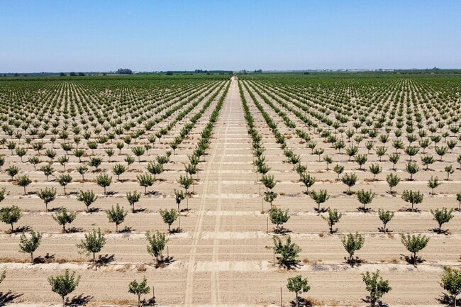
Property Record
4763 Houston Ave, Hanford, CA 93230


NEARBY LISTINGS FOR SALE OR LEASE
Property Detail
4763 Houston Ave
016-210-020-000
POR OF SEC 12/19/22
Farms
Kings
A
California
06031C0225C
239.10 AC
2025
Outlying Kings County
2025
Fresno
000901
Hanford-Corcoran, CA
DEMOGRAPHICS near 4763 Houston Ave
1 Mile
3 Mile
5 Mile
2024 Total Population
46
320
2,048
2029 Population
45
310
2,033
Pop Growth 2024-2029
(2.17%)
(3.13%)
(0.73%)
Average Age
37
36
37
2024 Total Households
15
104
635
HH Growth 2024-2029
0.00%
(2.88%)
(0.79%)
Median Household Inc
$79,167
$71,874
$66,184
Avg Household Size
3.20
3.10
3.10
2024 Avg HH Vehicles
3.00
2.00
2.00
Median Home Value
$425,000
$392,856
$375,454
Median Year Built
1974
1974
1972
Nearby Places
Map Layers
Map Styles
 Street
 Aerial
- Restaurants
- Banks
- Shops
- Fitness
- Groceries
PUBLIC TRANSPORTATION
COMMUTER RAIL
Hanford (San Joaquins - Amtrak)
DRIVE
WALK
Distance
Hanford (San Joaquins - Amtrak)
13 min
8.4 mi
Freight Ports
The Port of Hueneme
DRIVE
WALK
Distance
The Port of Hueneme
240 min
199.7 mi
SALE & LEASE HISTORY
LISTING DATE
SALE/LEASE

Jul 12, 2021
For Sale
Nearby Properties
Address
Land Use
TOTAL SIZE
Lot Size
Zoning
Address
Land Use
TOTAL SIZE
Lot Size
Zoning
2,324 SF
634.85 AC
AG20
Address
Land Use
TOTAL SIZE
Lot Size
Zoning
3,243 SF
307.88 AC
AG20
Address
Land Use
TOTAL SIZE
Lot Size
Zoning
3,110 SF
57.26 AC
AG20
Address
Land Use
TOTAL SIZE
Lot Size
Zoning
3,332 SF
117.19 AC
AG20
Address
Land Use
TOTAL SIZE
Lot Size
Zoning
2,483 SF
83.43 AC
AG20
Address
Land Use
TOTAL SIZE
Lot Size
Zoning
3,719 SF
185.01 AC
AG20
Address
Land Use
TOTAL SIZE
Lot Size
Zoning
2,260 SF
39.08 AC
AG20
Address
Land Use
TOTAL SIZE
Lot Size
Zoning
79.67 AC
AG20
Address
Land Use
TOTAL SIZE
Lot Size
Zoning
320 AC
AG20
Address
Land Use
TOTAL SIZE
Lot Size
Zoning
2,595 SF
79.08 AC
AG20
Address
Land Use
TOTAL SIZE
Lot Size
Zoning
4,128 SF
148.39 AC
AG20
Address
Land Use
TOTAL SIZE
Lot Size
Zoning
3,143 SF
78.64 AC
AG20
Address
Land Use
TOTAL SIZE
Lot Size
Zoning
154 AC
AG20
Address
Land Use
TOTAL SIZE
Lot Size
Zoning
7,466 SF
19.93 AC
AG20
Address
Land Use
TOTAL SIZE
Lot Size
Zoning
1,926 SF
207.67 AC
AG20
Address
Land Use
TOTAL SIZE
Lot Size
Zoning
2,020 SF
109.66 AC
Address
Land Use
TOTAL SIZE
Lot Size
Zoning
1,366 SF
80 AC
AG20
Address
Land Use
TOTAL SIZE
Lot Size
Zoning
2,376 SF
79.70 AC
AG20
Address
Land Use
TOTAL SIZE
Lot Size
Zoning
1,056 SF
80 AC
AG20
Address
Land Use
TOTAL SIZE
Lot Size
Zoning
984 SF
62 AC
AG20
Address
Land Use
TOTAL SIZE
Lot Size
Zoning
107.18 AC
AG20
Address
Land Use
TOTAL SIZE
Lot Size
Zoning
155.72 AC
AG20
Address
Land Use
TOTAL SIZE
Lot Size
Zoning
80 AC
AG20
Address
Land Use
TOTAL SIZE
Lot Size
Zoning
3,563 SF
50 AC
AG20
Address
Land Use
TOTAL SIZE
Lot Size
Zoning
4,241 SF
139.18 AC
AG20
Address
Land Use
TOTAL SIZE
Lot Size
Zoning
2,968 SF
80 AC
AG20
Address
Land Use
TOTAL SIZE
Lot Size
Zoning
149.74 AC
AG20
Address
Land Use
TOTAL SIZE
Lot Size
Zoning
144.61 AC
Address
Land Use
TOTAL SIZE
Lot Size
Zoning
150 AC
AG20
The World's #1 Commercial Real Estate Marketplace
Connect with us
© 2025 CoStar Group
The information above has been obtained from sources believed reliable. While we do not doubt its accuracy we have not verified it and make no guarantee, warranty or representation about it. It is your responsibility to independently confirm its accuracy and completeness. Any projections, opinions, assumptions, or estimates used are for example only and do not represent the current or future performance of the property. The value of this transaction to you depends on tax and other factors which should be evaluated by your tax, financial, and legal advisors. You and your advisors should conduct a careful, independent investigation of the property to determine to your satisfaction the suitability of the property for your needs.