Property Record
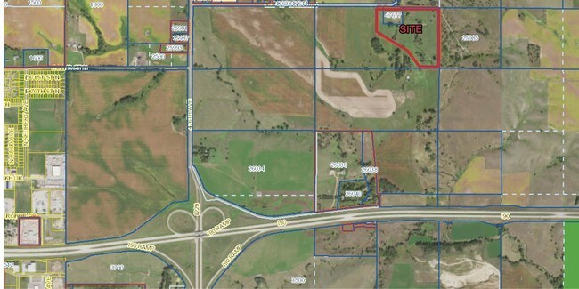
47677 Slip Up Creek Rd, Sioux Falls, SD 57104


NEARBY LISTINGS FOR SALE OR LEASE
Property Detail
47677 Slip Up Creek Rd
Sioux Falls, SD
Laurel Ridge Addition
85162
LOT B TRACT 1 LAUREL RIDGE ADDITION SE14 SE14 23 102 49 MAPLETON TOWNSHIP
Vacantlandnec
Minnehaha
A
South Dakota
46099C0456D
b
2024
3.62 AC
2024
Sioux Falls
010404
Other Market Areas
DEMOGRAPHICS near 47677 Slip Up Creek Rd
1 Mile
3 Mile
5 Mile
2024 Total Population
123
2,414
31,968
2029 Population
133
2,615
34,650
Pop Growth 2024-2029
+ 8.13%
+ 8.33%
+ 8.39%
Average Age
41
41
38
2024 Total Households
42
941
11,428
HH Growth 2024-2029
+ 9.52%
+ 8.61%
+ 8.88%
Median Household Inc
$114,062
$85,686
$73,934
Avg Household Size
2.50
2.50
2.60
2024 Avg HH Vehicles
3.00
2.00
2.00
Median Home Value
$359,999
$301,825
$254,506
Median Year Built
1989
1992
1993
Nearby Places
Map Layers
Map Styles
 Street
 Aerial
- Restaurants
- Banks
- Shops
- Fitness
- Groceries
PUBLIC TRANSPORTATION
AIRPORT
Joe Foss Field
DRIVE
WALK
Distance
Joe Foss Field
27 min
9.4 mi
Freight Ports
Port Milwaukee
DRIVE
WALK
Distance
Port Milwaukee
546 min
502.2 mi
SALE & LEASE HISTORY
LISTING DATE
SALE/LEASE

Aug 01, 2017
For Sale
Nearby Properties
Address
Land Use
TOTAL SIZE
Lot Size
Zoning
Address
Land Use
TOTAL SIZE
Lot Size
Zoning
348,059 SF
32.99 AC
Address
Land Use
TOTAL SIZE
Lot Size
Zoning
300,920 SF
90.58 AC
Address
Land Use
TOTAL SIZE
Lot Size
Zoning
41.01 AC
FP;FP
Address
Land Use
TOTAL SIZE
Lot Size
Zoning
50,160 SF
24.88 AC
Address
Land Use
TOTAL SIZE
Lot Size
Zoning
145,014 SF
14.41 AC
Address
Land Use
TOTAL SIZE
Lot Size
Zoning
33,416 SF
9.87 AC
Address
Land Use
TOTAL SIZE
Lot Size
Zoning
127,332 SF
28.18 AC
Address
Land Use
TOTAL SIZE
Lot Size
Zoning
238,875 SF
21.92 AC
NO;SPECIAL
Address
Land Use
TOTAL SIZE
Lot Size
Zoning
127,500 SF
13.04 AC
Address
Land Use
TOTAL SIZE
Lot Size
Zoning
1,806 SF
170.92 AC
FP;FP
Address
Land Use
TOTAL SIZE
Lot Size
Zoning
13.08 AC
Address
Land Use
TOTAL SIZE
Lot Size
Zoning
144,152 SF
12.89 AC
Address
Land Use
TOTAL SIZE
Lot Size
Zoning
12,454 SF
13.30 AC
Address
Land Use
TOTAL SIZE
Lot Size
Zoning
111,104 SF
9.65 AC
NO;SPECIAL
Address
Land Use
TOTAL SIZE
Lot Size
Zoning
212,500 SF
12 AC
Address
Land Use
TOTAL SIZE
Lot Size
Zoning
95,002 SF
8.32 AC
Address
Land Use
TOTAL SIZE
Lot Size
Zoning
124,626 SF
15 AC
NO;SPECIAL
Address
Land Use
TOTAL SIZE
Lot Size
Zoning
120,000 SF
8.99 AC
Address
Land Use
TOTAL SIZE
Lot Size
Zoning
53,836 SF
9.56 AC
Address
Land Use
TOTAL SIZE
Lot Size
Zoning
15,000 SF
29.88 AC
Address
Land Use
TOTAL SIZE
Lot Size
Zoning
60,680 SF
6.29 AC
Address
Land Use
TOTAL SIZE
Lot Size
Zoning
49,400 SF
4.79 AC
Address
Land Use
TOTAL SIZE
Lot Size
Zoning
134,700 SF
5.74 AC
Address
Land Use
TOTAL SIZE
Lot Size
Zoning
45,318 SF
5.06 AC
Address
Land Use
TOTAL SIZE
Lot Size
Zoning
24,384 SF
24.31 AC
C;COMMERCI
Address
Land Use
TOTAL SIZE
Lot Size
Zoning
73,562 SF
27.71 AC
Address
Land Use
TOTAL SIZE
Lot Size
Zoning
50,401 SF
6.21 AC
Address
Land Use
TOTAL SIZE
Lot Size
Zoning
41,343 SF
4.31 AC
Address
Land Use
TOTAL SIZE
Lot Size
Zoning
63,775 SF
3.04 AC
Address
Land Use
TOTAL SIZE
Lot Size
Zoning
64,334 SF
4.12 AC
The World's #1 Commercial Real Estate Marketplace
Connect with us
© 2025 CoStar Group
The information above has been obtained from sources believed reliable. While we do not doubt its accuracy we have not verified it and make no guarantee, warranty or representation about it. It is your responsibility to independently confirm its accuracy and completeness. Any projections, opinions, assumptions, or estimates used are for example only and do not represent the current or future performance of the property. The value of this transaction to you depends on tax and other factors which should be evaluated by your tax, financial, and legal advisors. You and your advisors should conduct a careful, independent investigation of the property to determine to your satisfaction the suitability of the property for your needs.