Property Record
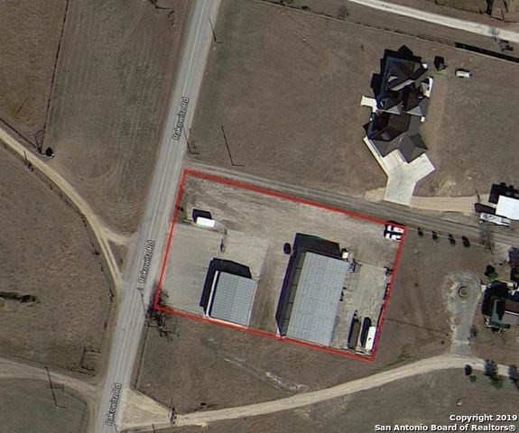
4768 Rakowitz Rd, Adkins, TX 78101


Property Detail
4768 Rakowitz Rd
San Antonio-New Braunfels, TX
CB 5119A P-14A(0.690) & P-14B (15.75) ABS 794 (MH LABEL NTA1460026-NTA1460025) 2021-RSVY PER DEED 20200228788, EXE 09-24-2020.///NEW ACCT FOR 2008 - SPLIT (WD 12757/283)//2011-SPLIT PER DEED 14494/1026 EX 5/28/2010
05119-013-0144
BEXAR
Farms
Texas
A Areas with a 1% annual chance of flooding and a 26% chance of flooding over the life of a 30-year mortgage.
144
2025
16.44 AC
2025
South
131802
San Antonio
1,344 SF
NEARBY LISTINGS FOR SALE OR LEASE
-
-
-
-
No Photo
-
View all Adkins listings for sale on LoopNet.com
DEMOGRAPHICS near 4768 Rakowitz Rd
1 mile
3 mile
5 mile
2025 Total Population
676
5,002
10,358
2030 Population
689
5,171
10,886
Pop Growth 2025-2030
+ 1.92%
+ 3.38%
+ 5.10%
Average Age
41
42
43
2025 Total Households
244
1,837
3,816
HH Growth 2025-2030
+ 2.46%
+ 3.48%
+ 5.11%
Median Household Inc
$72,142
$70,418
$80,919
Avg Household Size
2.70
2.70
2.70
2025 Avg HH Vehicles
2.00
3.00
2.00
Median Home Value
$313,265
$331,830
$343,757
Median Year Built
1985
1987
1990
Nearby Places
Map Layers
Map Styles
 Street
 Aerial
Layers
 Traffic
 Biking
Places
Listings with unknown addresses are not visible on the map
- Restaurants
- Banks
- Shops
- Fitness
- Groceries
PUBLIC TRANSPORTATION
AIRPORT
San Antonio International
Drive
Walk
Distance
San Antonio International
32 min
22.6 mi
Freight Ports
Calhoun Port
Drive
Walk
Distance
Calhoun Port
159 min
132.2 mi
SALE & LEASE HISTORY
LISTING DATE
SALE/LEASE

Oct 01, 2019
For Sale
Mar 16, 2020
For Sale
Jun 09, 2020
For Sale
Dec 21, 2022
For Sale
Nearby Properties
Address
Land Use
TOTAL SIZE
Lot Size
Zoning
Address
Land Use
TOTAL SIZE
Lot Size
Zoning
120,984 SF
5 AC
Address
Land Use
TOTAL SIZE
Lot Size
Zoning
146.09 AC
Address
Land Use
TOTAL SIZE
Lot Size
Zoning
82,430 SF
107.10 AC
Address
Land Use
TOTAL SIZE
Lot Size
Zoning
84.86 AC
Address
Land Use
TOTAL SIZE
Lot Size
Zoning
39,892 SF
3 AC
Address
Land Use
TOTAL SIZE
Lot Size
Zoning
175.05 AC
Address
Land Use
TOTAL SIZE
Lot Size
Zoning
126.97 AC
Address
Land Use
TOTAL SIZE
Lot Size
Zoning
18,960 SF
3.83 AC
Address
Land Use
TOTAL SIZE
Lot Size
Zoning
16,695 SF
3 AC
Address
Land Use
TOTAL SIZE
Lot Size
Zoning
156.02 AC
Address
Land Use
TOTAL SIZE
Lot Size
Zoning
61.33 AC
Address
Land Use
TOTAL SIZE
Lot Size
Zoning
25,440 SF
2.51 AC
Address
Land Use
TOTAL SIZE
Lot Size
Zoning
84.87 AC
Address
Land Use
TOTAL SIZE
Lot Size
Zoning
86.27 AC
Address
Land Use
TOTAL SIZE
Lot Size
Zoning
952 SF
79.04 AC
Address
Land Use
TOTAL SIZE
Lot Size
Zoning
4,458 SF
48.02 AC
Address
Land Use
TOTAL SIZE
Lot Size
Zoning
5,910 SF
40.74 AC
Address
Land Use
TOTAL SIZE
Lot Size
Zoning
Address
Land Use
TOTAL SIZE
Lot Size
Zoning
9,800 SF
2 AC
Address
Land Use
TOTAL SIZE
Lot Size
Zoning
22,915 SF
9.31 AC
Address
Land Use
TOTAL SIZE
Lot Size
Zoning
2,849 SF
107.47 AC
Address
Land Use
TOTAL SIZE
Lot Size
Zoning
4,592 SF
3.71 AC
Address
Land Use
TOTAL SIZE
Lot Size
Zoning
11,087 SF
11.11 AC
Address
Land Use
TOTAL SIZE
Lot Size
Zoning
225.30 AC
Address
Land Use
TOTAL SIZE
Lot Size
Zoning
105.12 AC
Address
Land Use
TOTAL SIZE
Lot Size
Zoning
1,131 SF
62.44 AC
Address
Land Use
TOTAL SIZE
Lot Size
Zoning
Address
Land Use
TOTAL SIZE
Lot Size
Zoning
125.50 AC
Address
Land Use
TOTAL SIZE
Lot Size
Zoning
10,500 SF
1.19 AC
Address
Land Use
TOTAL SIZE
Lot Size
Zoning
1,283 SF
32.80 AC
The World's #1 Commercial Real Estate Marketplace
Connect with us
© 2026 CoStar Group
The information above has been obtained from sources believed reliable. While we do not doubt its accuracy we have not verified it and make no guarantee, warranty or representation about it. It is your responsibility to independently confirm its accuracy and completeness. Any projections, opinions, assumptions, or estimates used are for example only and do not represent the current or future performance of the property. The value of this transaction to you depends on tax and other factors which should be evaluated by your tax, financial, and legal advisors. You and your advisors should conduct a careful, independent investigation of the property to determine to your satisfaction the suitability of the property for your needs.