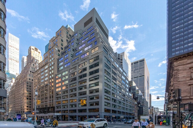
Property Record
477 Madison Ave, New York, NY 10022


NEARBY LISTINGS FOR SALE OR LEASE
Property Detail
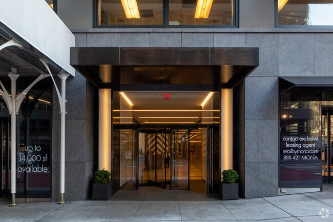
477 Madison Ave
1287-0021
Manhattan
Officebuilding
New York
X
21
3604970088F
0.35 AC
2024
Plaza District
2025
New York City
010200
New York-Jersey City-White Plains, NY-NJ
262,287 SF
DEMOGRAPHICS near 477 Madison Ave
1 Mile
3 Mile
5 Mile
2024 Total Population
184,324
1,297,989
2,812,437
2029 Population
171,847
1,213,279
2,648,705
Pop Growth 2024-2029
(6.77%)
(6.53%)
(5.82%)
Average Age
44
41
40
2024 Total Households
105,545
655,407
1,263,754
HH Growth 2024-2029
(6.90%)
(6.78%)
(6.15%)
Median Household Inc
$125,717
$104,948
$89,768
Avg Household Size
1.70
1.90
2.10
2024 Avg HH Vehicles
.00
.00
.00
Median Home Value
$986,035
$964,973
$859,786
Median Year Built
1961
1957
1957
Nearby Places
Map Layers
Map Styles
 Street
 Aerial
- Restaurants
- Banks
- Shops
- Fitness
- Groceries
Nearby Properties
Address
Land Use
TOTAL SIZE
Lot Size
Zoning
Address
Land Use
TOTAL SIZE
Lot Size
Zoning
4,060,596 SF
22.09 AC
M2-3
Address
Land Use
TOTAL SIZE
Lot Size
Zoning
2,245,112 SF
2.02 AC
C6-6
Address
Land Use
TOTAL SIZE
Lot Size
Zoning
1,783,434 SF
1.94 AC
C5-3
Address
Land Use
TOTAL SIZE
Lot Size
Zoning
2,521,850 SF
1.59 AC
C6-4
Address
Land Use
TOTAL SIZE
Lot Size
Zoning
8,462,176 SF
61.41 AC
R7-2
Address
Land Use
TOTAL SIZE
Lot Size
Zoning
1,445,092 SF
3.10 AC
C6-4
Address
Land Use
TOTAL SIZE
Lot Size
Zoning
2,221,336 SF
1.55 AC
C6-4
Address
Land Use
TOTAL SIZE
Lot Size
Zoning
2,636,182 SF
2.35 AC
C65.5
Address
Land Use
TOTAL SIZE
Lot Size
Zoning
2,161,994 SF
3.79 AC
M1-5
Address
Land Use
TOTAL SIZE
Lot Size
Zoning
2,734,038 SF
4.24 AC
C52.5
Address
Land Use
TOTAL SIZE
Lot Size
Zoning
1,678,135 SF
1.01 AC
C5-3
Address
Land Use
TOTAL SIZE
Lot Size
Zoning
1,897,491 SF
2.06 AC
C52.5
Address
Land Use
TOTAL SIZE
Lot Size
Zoning
1,233,684 SF
16.94 AC
PARK
Address
Land Use
TOTAL SIZE
Lot Size
Zoning
1,638,259 SF
1.43 AC
C52.5
Address
Land Use
TOTAL SIZE
Lot Size
Zoning
2,360,627 SF
2.08 AC
C6-7
Address
Land Use
TOTAL SIZE
Lot Size
Zoning
1,642,675 SF
1.05 AC
C6-7
Address
Land Use
TOTAL SIZE
Lot Size
Zoning
1,984,228 SF
1.95 AC
C65.5
Address
Land Use
TOTAL SIZE
Lot Size
Zoning
1,048,620 SF
5.67 AC
C6-4
Address
Land Use
TOTAL SIZE
Lot Size
Zoning
1,586,876 SF
1.87 AC
C5-3
Address
Land Use
TOTAL SIZE
Lot Size
Zoning
1,962,900 SF
1.89 AC
C66.5
Address
Land Use
TOTAL SIZE
Lot Size
Zoning
1,946,157 SF
1.49 AC
C6-4
Address
Land Use
TOTAL SIZE
Lot Size
Zoning
1,842,991 SF
2.08 AC
C66.5
Address
Land Use
TOTAL SIZE
Lot Size
Zoning
2,535,958 SF
2.94 AC
C6-4
Address
Land Use
TOTAL SIZE
Lot Size
Zoning
1,178,640 SF
0.92 AC
C6-4
Address
Land Use
TOTAL SIZE
Lot Size
Zoning
1,751,641 SF
1.84 AC
C6-4
Address
Land Use
TOTAL SIZE
Lot Size
Zoning
6,877 SF
27.74 AC
UD
Address
Land Use
TOTAL SIZE
Lot Size
Zoning
1,613,847 SF
1.84 AC
C66.5
Address
Land Use
TOTAL SIZE
Lot Size
Zoning
2,215,000 SF
6.43 AC
R9
Address
Land Use
TOTAL SIZE
Lot Size
Zoning
1,596,521 SF
1.34 AC
C6-4
Address
Land Use
TOTAL SIZE
Lot Size
Zoning
2,344,406 SF
1.84 AC
C5-3
The World's #1 Commercial Real Estate Marketplace
Connect with us
© 2025 CoStar Group
The information above has been obtained from sources believed reliable. While we do not doubt its accuracy we have not verified it and make no guarantee, warranty or representation about it. It is your responsibility to independently confirm its accuracy and completeness. Any projections, opinions, assumptions, or estimates used are for example only and do not represent the current or future performance of the property. The value of this transaction to you depends on tax and other factors which should be evaluated by your tax, financial, and legal advisors. You and your advisors should conduct a careful, independent investigation of the property to determine to your satisfaction the suitability of the property for your needs.