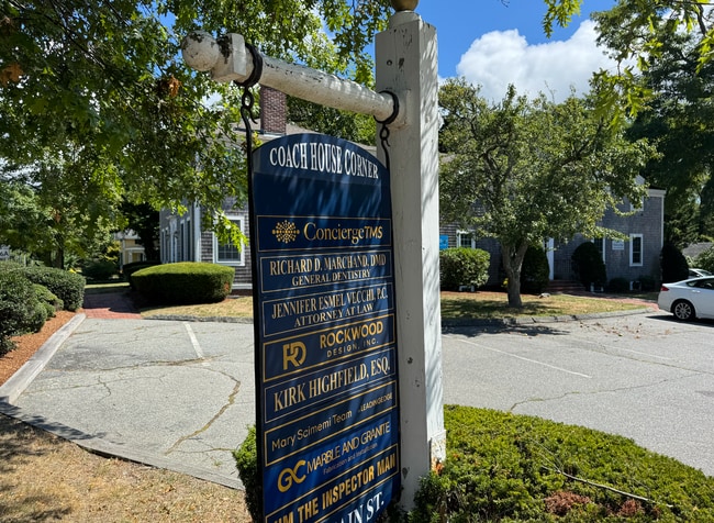
Property Record
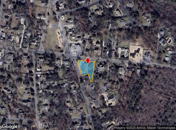
477 Route 6A, Yarmouth Port, MA 02675
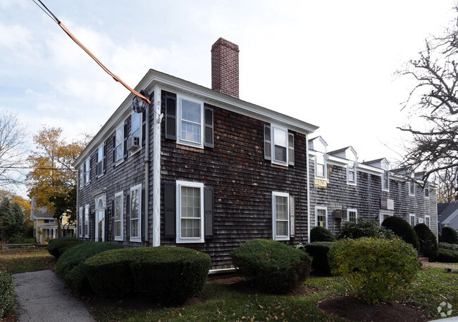
This Property Is For Sale
NEARBY LISTINGS FOR SALE OR LEASE
Property Detail
477 Route 6A
Officebuilding
Barnstable
X
Massachusetts
25001C0578J
0.50 AC
2025
Cape Cod
2025
Other Market Areas
011802
Barnstable Town, MA
5,828 SF
YARM-000124-000122
DEMOGRAPHICS near 477 Route 6A
1 Mile
3 Mile
5 Mile
2024 Total Population
2,876
18,071
49,161
2029 Population
2,919
18,506
50,863
Pop Growth 2024-2029
+ 1.50%
+ 2.41%
+ 3.46%
Average Age
53
51
50
2024 Total Households
1,330
8,193
22,651
HH Growth 2024-2029
+ 1.28%
+ 2.25%
+ 3.40%
Median Household Inc
$93,749
$91,791
$74,650
Avg Household Size
2.10
2.10
2.10
2024 Avg HH Vehicles
2.00
2.00
2.00
Median Home Value
$472,960
$449,672
$461,362
Median Year Built
1976
1975
1973
Nearby Places
Map Layers
Map Styles
 Street
 Aerial
- Restaurants
- Banks
- Shops
- Fitness
- Groceries
PUBLIC TRANSPORTATION
COMMUTER RAIL
DRIVE
WALK
Distance
9 min
4.8 mi
AIRPORT
Nantucket Memorial
DRIVE
WALK
Distance
Nantucket Memorial
159 min
38.6 mi
Martha's Vineyard
DRIVE
WALK
Distance
Martha's Vineyard
112 min
43.2 mi
Freight Ports
Port of New Bedford Harbor
DRIVE
WALK
Distance
Port of New Bedford Harbor
72 min
51.6 mi
Nearby Properties
Address
Land Use
TOTAL SIZE
Lot Size
Zoning
Address
Land Use
TOTAL SIZE
Lot Size
Zoning
221,710 SF
67.02 AC
Address
Land Use
TOTAL SIZE
Lot Size
Zoning
11,698 SF
34.50 AC
Address
Land Use
TOTAL SIZE
Lot Size
Zoning
110,415 SF
70 AC
Address
Land Use
TOTAL SIZE
Lot Size
Zoning
43.50 AC
IN
Address
Land Use
TOTAL SIZE
Lot Size
Zoning
1,228 SF
10.54 AC
Address
Land Use
TOTAL SIZE
Lot Size
Zoning
4,800 SF
414.61 AC
Address
Land Use
TOTAL SIZE
Lot Size
Zoning
11,017 SF
5.52 AC
Address
Land Use
TOTAL SIZE
Lot Size
Zoning
2,084 SF
20.03 AC
Address
Land Use
TOTAL SIZE
Lot Size
Zoning
2,560 SF
100.38 AC
Address
Land Use
TOTAL SIZE
Lot Size
Zoning
110.62 AC
RF-1;R
Address
Land Use
TOTAL SIZE
Lot Size
Zoning
5.42 AC
Address
Land Use
TOTAL SIZE
Lot Size
Zoning
163.08 AC
Address
Land Use
TOTAL SIZE
Lot Size
Zoning
Address
Land Use
TOTAL SIZE
Lot Size
Zoning
59,756 SF
9.56 AC
Address
Land Use
TOTAL SIZE
Lot Size
Zoning
37,182 SF
5.13 AC
Address
Land Use
TOTAL SIZE
Lot Size
Zoning
44,504 SF
5.33 AC
Address
Land Use
TOTAL SIZE
Lot Size
Zoning
Address
Land Use
TOTAL SIZE
Lot Size
Zoning
21,758 SF
6.75 AC
Address
Land Use
TOTAL SIZE
Lot Size
Zoning
10,688 SF
3.65 AC
Address
Land Use
TOTAL SIZE
Lot Size
Zoning
624 SF
193.54 AC
Address
Land Use
TOTAL SIZE
Lot Size
Zoning
72,240 SF
Address
Land Use
TOTAL SIZE
Lot Size
Zoning
16,440 SF
31.55 AC
Address
Land Use
TOTAL SIZE
Lot Size
Zoning
0.65 AC
Address
Land Use
TOTAL SIZE
Lot Size
Zoning
69,156 SF
6.15 AC
Address
Land Use
TOTAL SIZE
Lot Size
Zoning
8,296 SF
7.51 AC
Address
Land Use
TOTAL SIZE
Lot Size
Zoning
2,898 SF
7.10 AC
Address
Land Use
TOTAL SIZE
Lot Size
Zoning
6,281 SF
2.56 AC
Address
Land Use
TOTAL SIZE
Lot Size
Zoning
93.85 AC
Address
Land Use
TOTAL SIZE
Lot Size
Zoning
1,500 SF
3.64 AC
Address
Land Use
TOTAL SIZE
Lot Size
Zoning
24,764 SF
31.83 AC
The World's #1 Commercial Real Estate Marketplace
Connect with us
© 2025 CoStar Group
The information above has been obtained from sources believed reliable. While we do not doubt its accuracy we have not verified it and make no guarantee, warranty or representation about it. It is your responsibility to independently confirm its accuracy and completeness. Any projections, opinions, assumptions, or estimates used are for example only and do not represent the current or future performance of the property. The value of this transaction to you depends on tax and other factors which should be evaluated by your tax, financial, and legal advisors. You and your advisors should conduct a careful, independent investigation of the property to determine to your satisfaction the suitability of the property for your needs.