Property Record
4770 Goer Dr, North Charleston, SC 29406


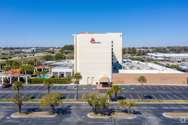

Property Detail
4770 Goer Dr
409-00-00-011
MAPPLATB L20 MAPPLATP 0141 SUBDIVISIONNAME NORTH CHARLESTON TRACT G-2.1
Hotel
Charleston
B and X Area of moderate flood hazard, usually the area between the limits of the 100-year and 500-year floods.
South Carolina
2025
6.26 AC
2024
Charleston Airport
003111
Charleston/N Charleston
190,407 SF
Charleston-North Charleston, SC
NEARBY LISTINGS FOR SALE OR LEASE
DEMOGRAPHICS near 4770 Goer Dr
1 mile
3 mile
5 mile
2025 Total Population
4,835
51,847
121,114
2030 Population
5,157
55,069
127,964
Pop Growth 2025-2030
+ 6.66%
+ 6.21%
+ 5.66%
Average Age
38
39
39
2025 Total Households
2,052
20,822
50,540
HH Growth 2025-2030
+ 6.82%
+ 6.33%
+ 5.69%
Median Household Inc
$62,311
$60,095
$69,210
Avg Household Size
2.30
2.30
2.30
2025 Avg HH Vehicles
1.00
1.00
2.00
Median Home Value
$175,861
$257,296
$340,230
Median Year Built
1980
1973
1982
Nearby Places
Map Layers
Map Styles
 Street
 Aerial
Layers
 Traffic
 Biking
Places
Listings with unknown addresses are not visible on the map
- Restaurants
- Banks
- Shops
- Fitness
- Groceries
PUBLIC TRANSPORTATION
COMMUTER RAIL
Charleston Amtrak Station (Palmetto - Amtrak, Silver Meteor - Amtrak)
Drive
Walk
Distance
Charleston Amtrak Station (Palmetto - Amtrak, Silver Meteor - Amtrak)
3 min
1.3 mi
AIRPORT
Charleston AFB/International
Drive
Walk
Distance
Charleston AFB/International
12 min
7.1 mi
Freight Ports
North Charleston Terminal
Drive
Walk
Distance
North Charleston Terminal
7 min
3.6 mi
Nearby Properties
Address
Land Use
TOTAL SIZE
Lot Size
Zoning
Address
Land Use
TOTAL SIZE
Lot Size
Zoning
1,717 SF
40.95 AC
Address
Land Use
TOTAL SIZE
Lot Size
Zoning
27,900 SF
102.67 AC
Address
Land Use
TOTAL SIZE
Lot Size
Zoning
202,154 SF
16.34 AC
Address
Land Use
TOTAL SIZE
Lot Size
Zoning
68,655 SF
9.48 AC
Address
Land Use
TOTAL SIZE
Lot Size
Zoning
105,666 SF
8.25 AC
Address
Land Use
TOTAL SIZE
Lot Size
Zoning
36,587 SF
17.75 AC
Address
Land Use
TOTAL SIZE
Lot Size
Zoning
10,560 SF
7.50 AC
Address
Land Use
TOTAL SIZE
Lot Size
Zoning
4,740 SF
12.17 AC
Address
Land Use
TOTAL SIZE
Lot Size
Zoning
17,271 SF
3.65 AC
Address
Land Use
TOTAL SIZE
Lot Size
Zoning
112,860 SF
12 AC
Address
Land Use
TOTAL SIZE
Lot Size
Zoning
77,990 SF
8.30 AC
Address
Land Use
TOTAL SIZE
Lot Size
Zoning
48,885 SF
5.02 AC
Address
Land Use
TOTAL SIZE
Lot Size
Zoning
9,691 SF
10.34 AC
Address
Land Use
TOTAL SIZE
Lot Size
Zoning
19,992 SF
11.98 AC
Address
Land Use
TOTAL SIZE
Lot Size
Zoning
42,500 SF
3.62 AC
Address
Land Use
TOTAL SIZE
Lot Size
Zoning
1,303 SF
4.77 AC
Address
Land Use
TOTAL SIZE
Lot Size
Zoning
3,192 SF
34.47 AC
Address
Land Use
TOTAL SIZE
Lot Size
Zoning
1,575 SF
28.28 AC
Address
Land Use
TOTAL SIZE
Lot Size
Zoning
30,064 SF
33.86 AC
Address
Land Use
TOTAL SIZE
Lot Size
Zoning
16,917 SF
2.40 AC
Address
Land Use
TOTAL SIZE
Lot Size
Zoning
50,356 SF
5.19 AC
Address
Land Use
TOTAL SIZE
Lot Size
Zoning
17,127 SF
2.52 AC
Address
Land Use
TOTAL SIZE
Lot Size
Zoning
25.97 AC
Address
Land Use
TOTAL SIZE
Lot Size
Zoning
11,681 SF
1.16 AC
Address
Land Use
TOTAL SIZE
Lot Size
Zoning
86,024 SF
9.69 AC
Address
Land Use
TOTAL SIZE
Lot Size
Zoning
2,438 SF
33.72 AC
Address
Land Use
TOTAL SIZE
Lot Size
Zoning
896 SF
6.09 AC
Address
Land Use
TOTAL SIZE
Lot Size
Zoning
14,250 SF
2.08 AC
Address
Land Use
TOTAL SIZE
Lot Size
Zoning
1,236 SF
1.88 AC
Address
Land Use
TOTAL SIZE
Lot Size
Zoning
The World's #1 Commercial Real Estate Marketplace
Connect with us
© 2026 CoStar Group
The information above has been obtained from sources believed reliable. While we do not doubt its accuracy we have not verified it and make no guarantee, warranty or representation about it. It is your responsibility to independently confirm its accuracy and completeness. Any projections, opinions, assumptions, or estimates used are for example only and do not represent the current or future performance of the property. The value of this transaction to you depends on tax and other factors which should be evaluated by your tax, financial, and legal advisors. You and your advisors should conduct a careful, independent investigation of the property to determine to your satisfaction the suitability of the property for your needs.