Property Record
4770 Highway 90, Milton, FL 32571

NEARBY LISTINGS FOR SALE OR LEASE
Property Detail
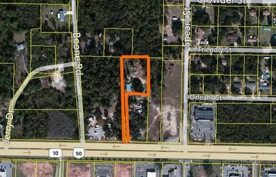
4770 Highway 90
11-1N-29-0000-02401-0000
*DESCRIPTION UPDATED FOR 2023* COMMENCING AT THE SOUTHEAST CORNER OF THE SOUTHEAST QUARTE R OF THE SOUTHWEST QUARTER OF 11-1N-29W THENCE GO NORTH 02 DEGREES 34 MINUTES 43 SECONDS EAST ALONG THE EAST LINE OF SAID SOUTHEAST QUARTER OF THE SOUTHWEST QUA
Supermarket
Santa Rosa
X
Florida
12113C0426H
2.80 AC
2024
Avalon Beach/Milton
2025
Pensacola
010704
Pensacola-Ferry Pass-Brent, FL
25,326 SF
DEMOGRAPHICS near 4770 Highway 90
1 Mile
3 Mile
5 Mile
2024 Total Population
4,302
29,586
63,552
2029 Population
4,894
33,879
72,795
Pop Growth 2024-2029
+ 13.76%
+ 14.51%
+ 14.54%
Average Age
38
39
40
2024 Total Households
1,579
11,010
23,743
HH Growth 2024-2029
+ 14.06%
+ 14.81%
+ 14.85%
Median Household Inc
$71,097
$74,227
$78,705
Avg Household Size
2.70
2.70
2.60
2024 Avg HH Vehicles
2.00
2.00
2.00
Median Home Value
$226,530
$226,065
$246,870
Median Year Built
1995
1994
1995
Nearby Places
Map Layers
Map Styles
 Street
 Aerial
- Restaurants
- Banks
- Shops
- Fitness
- Groceries
PUBLIC TRANSPORTATION
AIRPORT
Pensacola International
DRIVE
WALK
Distance
Pensacola International
26 min
14.6 mi
Freight Ports
Port of Mobile
DRIVE
WALK
Distance
Port of Mobile
77 min
63.4 mi
Nearby Properties
Address
Land Use
TOTAL SIZE
Lot Size
Zoning
Address
Land Use
TOTAL SIZE
Lot Size
Zoning
374,114 SF
27.61 AC
R2
Address
Land Use
TOTAL SIZE
Lot Size
Zoning
118,887 SF
19.24 AC
HCD
Address
Land Use
TOTAL SIZE
Lot Size
Zoning
196,877 SF
20.28 AC
HCD
Address
Land Use
TOTAL SIZE
Lot Size
Zoning
130,379 SF
18.18 AC
HCD
Address
Land Use
TOTAL SIZE
Lot Size
Zoning
79,708 SF
9.62 AC
HCD
Address
Land Use
TOTAL SIZE
Lot Size
Zoning
232,988 SF
24.57 AC
HCD
Address
Land Use
TOTAL SIZE
Lot Size
Zoning
154,042 SF
10.36 AC
HCD
Address
Land Use
TOTAL SIZE
Lot Size
Zoning
130,603 SF
14.30 AC
R2
Address
Land Use
TOTAL SIZE
Lot Size
Zoning
47.05 AC
AG-RR
Address
Land Use
TOTAL SIZE
Lot Size
Zoning
151,084 SF
19.01 AC
HCD
Address
Land Use
TOTAL SIZE
Lot Size
Zoning
199,775 SF
8.83 AC
HCD
Address
Land Use
TOTAL SIZE
Lot Size
Zoning
113,899 SF
3.05 AC
HCD
Address
Land Use
TOTAL SIZE
Lot Size
Zoning
76.81 AC
R1
Address
Land Use
TOTAL SIZE
Lot Size
Zoning
81,123 SF
8.78 AC
HCD
Address
Land Use
TOTAL SIZE
Lot Size
Zoning
615,804 SF
16.46 AC
M2
Address
Land Use
TOTAL SIZE
Lot Size
Zoning
60,129 SF
0.11 AC
HCD
Address
Land Use
TOTAL SIZE
Lot Size
Zoning
81,150 SF
4.86 AC
HCD
Address
Land Use
TOTAL SIZE
Lot Size
Zoning
20.76 AC
AG-RR
Address
Land Use
TOTAL SIZE
Lot Size
Zoning
13.70 AC
HCD
Address
Land Use
TOTAL SIZE
Lot Size
Zoning
43,644 SF
5.54 AC
HCD
Address
Land Use
TOTAL SIZE
Lot Size
Zoning
115,095 SF
7.44 AC
HCD
Address
Land Use
TOTAL SIZE
Lot Size
Zoning
76,674 SF
2.80 AC
HCD
Address
Land Use
TOTAL SIZE
Lot Size
Zoning
43,613 SF
3.44 AC
HCD
Address
Land Use
TOTAL SIZE
Lot Size
Zoning
389.54 AC
AG-RR
Address
Land Use
TOTAL SIZE
Lot Size
Zoning
9.61 AC
R1
Address
Land Use
TOTAL SIZE
Lot Size
Zoning
112,196 SF
343.01 AC
HCD
Address
Land Use
TOTAL SIZE
Lot Size
Zoning
37,820 SF
16.98 AC
HCD
Address
Land Use
TOTAL SIZE
Lot Size
Zoning
50,616 SF
2.56 AC
R3
Address
Land Use
TOTAL SIZE
Lot Size
Zoning
30,564 SF
11.12 AC
HCD
Address
Land Use
TOTAL SIZE
Lot Size
Zoning
51,760 SF
5.50 AC
HCD
The World's #1 Commercial Real Estate Marketplace
Connect with us
© 2025 CoStar Group
The information above has been obtained from sources believed reliable. While we do not doubt its accuracy we have not verified it and make no guarantee, warranty or representation about it. It is your responsibility to independently confirm its accuracy and completeness. Any projections, opinions, assumptions, or estimates used are for example only and do not represent the current or future performance of the property. The value of this transaction to you depends on tax and other factors which should be evaluated by your tax, financial, and legal advisors. You and your advisors should conduct a careful, independent investigation of the property to determine to your satisfaction the suitability of the property for your needs.