Property Record
4770 Saffold Rd, Wimauma, FL 33598

Property Detail
4770 Saffold Rd
U-33-32-20-ZZZ-000003-27140.0
SECS 28 & 33-32-20 TRACT LYING IN SEC 28 & 33 DESC AS BEG AT SW COR OF SEC 28 RUN N 2644.49 FT TO NW COR OF S 1/2 OF SEC 28 THN E 2490.06 FT S 2645.20 FT TO PT ON NLY R/W LINE OF SAFFORD RD THN ALG R/W LINE AN ARC DIST 511.19 FT CHD BRG S 52 DEG 55 M
Pasture
HILLSBOROUGH
PD
Florida
AE The base floodplain where base flood elevations are provided. AE Zones are now used on new format FIRMs instead of A1-A30 Zones.
27140
2024
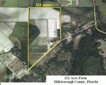
207.45 AC
2025
Eastern Outlying
013914
Tampa/St Petersburg
45,606 SF
Tampa-St. Petersburg-Clearwater, FL
NEARBY LISTINGS FOR SALE OR LEASE
DEMOGRAPHICS near 4770 Saffold Rd
1 mile
3 mile
5 mile
2025 Total Population
88
7,216
37,897
2030 Population
101
8,270
42,154
Pop Growth 2025-2030
+ 14.77%
+ 14.61%
+ 11.23%
Average Age
36
36
52
2025 Total Households
25
2,019
16,320
HH Growth 2025-2030
+ 16.00%
+ 14.61%
+ 10.71%
Median Household Inc
$55,000
$64,723
$66,297
Avg Household Size
3.20
3.30
2.20
2025 Avg HH Vehicles
2.00
3.00
2.00
Median Home Value
$483,333
$440,983
$338,168
Median Year Built
2002
2010
2000
Nearby Places
Map Layers
Map Styles
 Street
 Aerial
Layers
 Traffic
 Biking
Places
Listings with unknown addresses are not visible on the map
- Restaurants
- Banks
- Shops
- Fitness
- Groceries
PUBLIC TRANSPORTATION
AIRPORT
Sarasota/Bradenton International
Drive
Walk
Distance
Sarasota/Bradenton International
54 min
33.0 mi
Tampa International
Drive
Walk
Distance
Tampa International
58 min
37.4 mi
St Pete-Clearwater International
Drive
Walk
Distance
St Pete-Clearwater International
72 min
49.5 mi
Freight Ports
Port Manatee
Drive
Walk
Distance
Port Manatee
34 min
20.7 mi
Nearby Properties
Address
Land Use
TOTAL SIZE
Lot Size
Zoning
Address
Land Use
TOTAL SIZE
Lot Size
Zoning
2,051.62 AC
AR
Address
Land Use
TOTAL SIZE
Lot Size
Zoning
857.12 AC
AM
Address
Land Use
TOTAL SIZE
Lot Size
Zoning
737.49 AC
AM
Address
Land Use
TOTAL SIZE
Lot Size
Zoning
62,648 SF
19.54 AC
AR
Address
Land Use
TOTAL SIZE
Lot Size
Zoning
38,547 SF
26.88 AC
AS-1
Address
Land Use
TOTAL SIZE
Lot Size
Zoning
291.65 AC
AR
Address
Land Use
TOTAL SIZE
Lot Size
Zoning
370.60 AC
AR
Address
Land Use
TOTAL SIZE
Lot Size
Zoning
2,686 SF
83.76 AC
AM
Address
Land Use
TOTAL SIZE
Lot Size
Zoning
1,620 SF
223.11 AC
PD
Address
Land Use
TOTAL SIZE
Lot Size
Zoning
22,733 SF
156.25 AC
PD
Address
Land Use
TOTAL SIZE
Lot Size
Zoning
263.90 AC
AM
Address
Land Use
TOTAL SIZE
Lot Size
Zoning
236.20 AC
AR
Address
Land Use
TOTAL SIZE
Lot Size
Zoning
215.53 AC
AM
Address
Land Use
TOTAL SIZE
Lot Size
Zoning
196.30 AC
AR
Address
Land Use
TOTAL SIZE
Lot Size
Zoning
62.35 AC
PD
Address
Land Use
TOTAL SIZE
Lot Size
Zoning
130.66 AC
A
Address
Land Use
TOTAL SIZE
Lot Size
Zoning
77.84 AC
AR
Address
Land Use
TOTAL SIZE
Lot Size
Zoning
66.49 AC
AR
Address
Land Use
TOTAL SIZE
Lot Size
Zoning
520 SF
72.42 AC
AR
Address
Land Use
TOTAL SIZE
Lot Size
Zoning
10,915 SF
9.86 AC
AR
Address
Land Use
TOTAL SIZE
Lot Size
Zoning
69.76 AC
A
Address
Land Use
TOTAL SIZE
Lot Size
Zoning
61.36 AC
AR
Address
Land Use
TOTAL SIZE
Lot Size
Zoning
10,374 SF
4.72 AC
AS-1
Address
Land Use
TOTAL SIZE
Lot Size
Zoning
4,148 SF
695.29 AC
A GENERAL
Address
Land Use
TOTAL SIZE
Lot Size
Zoning
20,000 SF
15.03 AC
AR
Address
Land Use
TOTAL SIZE
Lot Size
Zoning
5,325 SF
4.86 AC
CG
Address
Land Use
TOTAL SIZE
Lot Size
Zoning
8,850 SF
9.47 AC
AS-1
Address
Land Use
TOTAL SIZE
Lot Size
Zoning
39.74 AC
AR
The World's #1 Commercial Real Estate Marketplace
Connect with us
© 2026 CoStar Group
The information above has been obtained from sources believed reliable. While we do not doubt its accuracy we have not verified it and make no guarantee, warranty or representation about it. It is your responsibility to independently confirm its accuracy and completeness. Any projections, opinions, assumptions, or estimates used are for example only and do not represent the current or future performance of the property. The value of this transaction to you depends on tax and other factors which should be evaluated by your tax, financial, and legal advisors. You and your advisors should conduct a careful, independent investigation of the property to determine to your satisfaction the suitability of the property for your needs.