Property Record
47720 School St, Oakridge, OR 97463


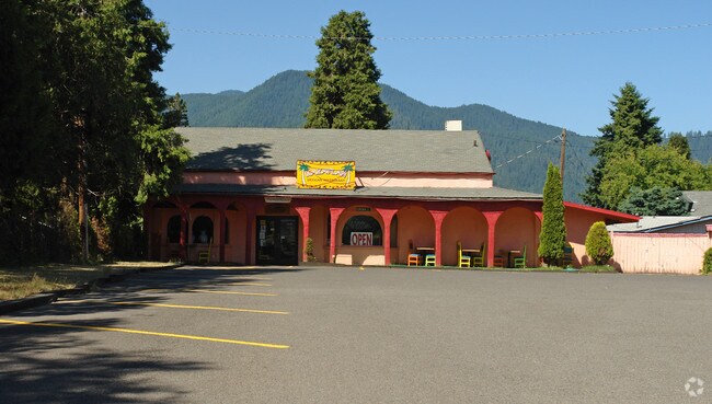
Property Detail
47720 School St
Eugene-Springfield, OR
TL 02200
0964369
Lane
Commercialnec
Oregon
R1
2200
C and X Area of minimal flood hazard, usually depicted on FIRMs as above the 500-year flood level.
0.54 AC
2025
Lane County
2025
Portland
001500
NEARBY LISTINGS FOR SALE OR LEASE
-
-
View all Oakridge listings for sale on LoopNet.com
DEMOGRAPHICS near 47720 School St
1 mile
3 mile
5 mile
2025 Total Population
2,630
4,857
5,167
2030 Population
2,690
4,982
5,302
Pop Growth 2025-2030
+ 2.28%
+ 2.57%
+ 2.61%
Average Age
46
46
46
2025 Total Households
1,229
2,178
2,303
HH Growth 2025-2030
+ 2.20%
+ 2.48%
+ 2.52%
Median Household Inc
$34,027
$34,860
$34,967
Avg Household Size
2.10
2.20
2.20
2025 Avg HH Vehicles
2.00
2.00
2.00
Median Home Value
$234,296
$246,721
$249,450
Median Year Built
1973
1970
1971
Nearby Places
Map Layers
Map Styles
 Street
 Aerial
Layers
 Traffic
 Biking
Places
Listings with unknown addresses are not visible on the map
- Restaurants
- Banks
- Shops
- Fitness
- Groceries
Nearby Properties
Address
Land Use
TOTAL SIZE
Lot Size
Zoning
Address
Land Use
TOTAL SIZE
Lot Size
Zoning
5.58 AC
R1
Address
Land Use
TOTAL SIZE
Lot Size
Zoning
5,615.58 AC
F1
Address
Land Use
TOTAL SIZE
Lot Size
Zoning
1,024 SF
395.48 AC
F1
Address
Land Use
TOTAL SIZE
Lot Size
Zoning
248.60 AC
C3
Address
Land Use
TOTAL SIZE
Lot Size
Zoning
2.85 AC
F2
Address
Land Use
TOTAL SIZE
Lot Size
Zoning
16.05 AC
RPF
Address
Land Use
TOTAL SIZE
Lot Size
Zoning
1.24 AC
C3
Address
Land Use
TOTAL SIZE
Lot Size
Zoning
2.09 AC
C3
Address
Land Use
TOTAL SIZE
Lot Size
Zoning
0.95 AC
C3
Address
Land Use
TOTAL SIZE
Lot Size
Zoning
0.61 AC
C3
Address
Land Use
TOTAL SIZE
Lot Size
Zoning
0.80 AC
C3
Address
Land Use
TOTAL SIZE
Lot Size
Zoning
2.12 AC
PRO-S
Address
Land Use
TOTAL SIZE
Lot Size
Zoning
0.95 AC
C3
Address
Land Use
TOTAL SIZE
Lot Size
Zoning
5.11 AC
R1
Address
Land Use
TOTAL SIZE
Lot Size
Zoning
39.24 AC
F2
Address
Land Use
TOTAL SIZE
Lot Size
Zoning
0.73 AC
R1
Address
Land Use
TOTAL SIZE
Lot Size
Zoning
4.89 AC
R1
Address
Land Use
TOTAL SIZE
Lot Size
Zoning
0.73 AC
C3
Address
Land Use
TOTAL SIZE
Lot Size
Zoning
0.64 AC
C2
Address
Land Use
TOTAL SIZE
Lot Size
Zoning
1.19 AC
C3
Address
Land Use
TOTAL SIZE
Lot Size
Zoning
91.20 AC
PR
Address
Land Use
TOTAL SIZE
Lot Size
Zoning
0.54 AC
C3
Address
Land Use
TOTAL SIZE
Lot Size
Zoning
6.12 AC
I2
Address
Land Use
TOTAL SIZE
Lot Size
Zoning
956.81 AC
F1
Address
Land Use
TOTAL SIZE
Lot Size
Zoning
4.48 AC
I1
Address
Land Use
TOTAL SIZE
Lot Size
Zoning
1.27 AC
R1
Address
Land Use
TOTAL SIZE
Lot Size
Zoning
3.07 AC
C3
Address
Land Use
TOTAL SIZE
Lot Size
Zoning
0.36 AC
F2
Address
Land Use
TOTAL SIZE
Lot Size
Zoning
0.79 AC
C3
Address
Land Use
TOTAL SIZE
Lot Size
Zoning
810 SF
1 AC
C3
The World's #1 Commercial Real Estate Marketplace
Connect with us
© 2026 CoStar Group
The information above has been obtained from sources believed reliable. While we do not doubt its accuracy we have not verified it and make no guarantee, warranty or representation about it. It is your responsibility to independently confirm its accuracy and completeness. Any projections, opinions, assumptions, or estimates used are for example only and do not represent the current or future performance of the property. The value of this transaction to you depends on tax and other factors which should be evaluated by your tax, financial, and legal advisors. You and your advisors should conduct a careful, independent investigation of the property to determine to your satisfaction the suitability of the property for your needs.