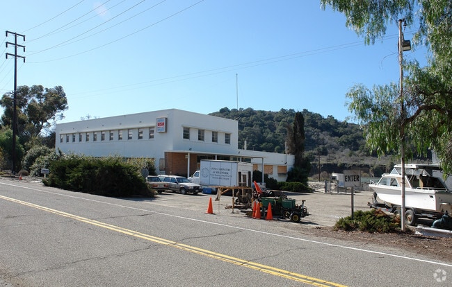
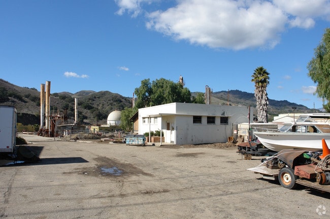
Property Record
4777 Crooked Palm Rd, Ventura, CA 93001

Property Detail
4777 Crooked Palm Rd
063-0-120-165
PR APN 0630040050
Industrialacreage
VENTURA
M3
California
AE The base floodplain where base flood elevations are provided. AE Zones are now used on new format FIRMs instead of A1-A30 Zones.
16.45 AC
0
Ventura
2025
Los Angeles
009500
Oxnard-Thousand Oaks-Ventura, CA
NEARBY LISTINGS FOR SALE OR LEASE
DEMOGRAPHICS near 4777 Crooked Palm Rd
1 mile
3 mile
5 mile
2025 Total Population
2,190
14,853
44,084
2030 Population
2,156
14,852
44,156
Pop Growth 2025-2030
(1.55%)
(0.01%)
+ 0.16%
Average Age
41
38
42
2025 Total Households
661
4,785
17,030
HH Growth 2025-2030
(1.82%)
(0.19%)
+ 0.14%
Median Household Inc
$87,727
$87,831
$97,032
Avg Household Size
3.00
2.90
2.50
2025 Avg HH Vehicles
3.00
2.00
2.00
Median Home Value
$648,876
$744,011
$888,115
Median Year Built
1965
1973
1961
Nearby Places
Map Layers
Map Styles
 Street
 Aerial
Layers
 Traffic
 Biking
Places
Listings with unknown addresses are not visible on the map
- Restaurants
- Banks
- Shops
- Fitness
- Groceries
PUBLIC TRANSPORTATION
COMMUTER RAIL
Ventura Amtrak (Pacific Surfliner - Amtrak)
Drive
Walk
Distance
Ventura Amtrak (Pacific Surfliner - Amtrak)
10 min
5.7 mi
Freight Ports
The Port of Hueneme
Drive
Walk
Distance
The Port of Hueneme
29 min
18.4 mi
SALE & LEASE HISTORY
LISTING DATE
SALE/LEASE

Jan 16, 2019
For Sale
Nearby Properties
Address
Land Use
TOTAL SIZE
Lot Size
Zoning
Address
Land Use
TOTAL SIZE
Lot Size
Zoning
11,444 SF
6.57 AC
Address
Land Use
TOTAL SIZE
Lot Size
Zoning
168 SF
7.87 AC
M3
Address
Land Use
TOTAL SIZE
Lot Size
Zoning
1.54 AC
Address
Land Use
TOTAL SIZE
Lot Size
Zoning
11,970 SF
5.18 AC
M1
Address
Land Use
TOTAL SIZE
Lot Size
Zoning
462 SF
0.77 AC
C-2
Address
Land Use
TOTAL SIZE
Lot Size
Zoning
20,600 SF
5.92 AC
M2
Address
Land Use
TOTAL SIZE
Lot Size
Zoning
22.02 AC
M2
Address
Land Use
TOTAL SIZE
Lot Size
Zoning
1,716 SF
7.30 AC
M2
Address
Land Use
TOTAL SIZE
Lot Size
Zoning
1.08 AC
Address
Land Use
TOTAL SIZE
Lot Size
Zoning
33,482 SF
6.23 AC
M2
Address
Land Use
TOTAL SIZE
Lot Size
Zoning
17,136 SF
5.61 AC
R3-2
Address
Land Use
TOTAL SIZE
Lot Size
Zoning
6,527 SF
0.97 AC
M1
Address
Land Use
TOTAL SIZE
Lot Size
Zoning
1,590 SF
1.36 AC
M3
Address
Land Use
TOTAL SIZE
Lot Size
Zoning
1.01 AC
Address
Land Use
TOTAL SIZE
Lot Size
Zoning
2,753 SF
0.68 AC
C2
Address
Land Use
TOTAL SIZE
Lot Size
Zoning
8,764 SF
15.74 AC
M3
Address
Land Use
TOTAL SIZE
Lot Size
Zoning
1,140 SF
7.90 AC
M2
Address
Land Use
TOTAL SIZE
Lot Size
Zoning
0.89 AC
Address
Land Use
TOTAL SIZE
Lot Size
Zoning
30,254 SF
2.47 AC
M2
Address
Land Use
TOTAL SIZE
Lot Size
Zoning
2.53 AC
M2
Address
Land Use
TOTAL SIZE
Lot Size
Zoning
21,840 SF
0.82 AC
R3-5
Address
Land Use
TOTAL SIZE
Lot Size
Zoning
2.38 AC
MPD
Address
Land Use
TOTAL SIZE
Lot Size
Zoning
6,730 SF
7.14 AC
R1-1
Address
Land Use
TOTAL SIZE
Lot Size
Zoning
12,606 SF
0.86 AC
C2
Address
Land Use
TOTAL SIZE
Lot Size
Zoning
33,716 SF
1.52 AC
Address
Land Use
TOTAL SIZE
Lot Size
Zoning
28,338 SF
1.65 AC
Address
Land Use
TOTAL SIZE
Lot Size
Zoning
55,610 SF
3.44 AC
The World's #1 Commercial Real Estate Marketplace
Connect with us
© 2026 CoStar Group
The information above has been obtained from sources believed reliable. While we do not doubt its accuracy we have not verified it and make no guarantee, warranty or representation about it. It is your responsibility to independently confirm its accuracy and completeness. Any projections, opinions, assumptions, or estimates used are for example only and do not represent the current or future performance of the property. The value of this transaction to you depends on tax and other factors which should be evaluated by your tax, financial, and legal advisors. You and your advisors should conduct a careful, independent investigation of the property to determine to your satisfaction the suitability of the property for your needs.