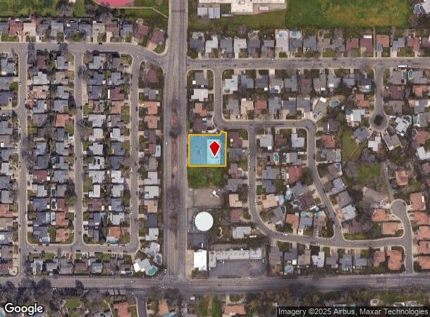
Property Record
4778 Dewey Dr, Fair Oaks, CA 95628
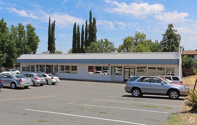
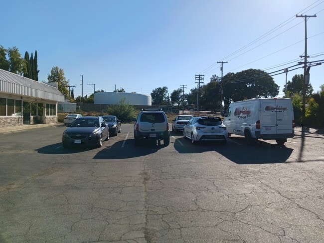
This Property Is For Sale
NEARBY LISTINGS FOR SALE OR LEASE
Property Detail
4778 Dewey Dr
239-0300-048
POR NE 1/4 SEC 10, T 9N, R 6E, MDB&M, DESC AS BEG AT SE COR LOT 739 LARCHMONT HILLS UNIT NO 10,TH FROM SD POB N 17%36E 13.60
Officebuilding
Sacramento
X
California
06067C0093H
739
2024
0.56 AC
2025
Carmichael/Fair Oaks
007904
Sacramento
5,710 SF
Sacramento--Roseville--Arden-Arcade, CA
DEMOGRAPHICS near 4778 Dewey Dr
1 Mile
3 Mile
5 Mile
2024 Total Population
16,112
143,713
378,991
2029 Population
16,145
144,343
380,479
Pop Growth 2024-2029
+ 0.20%
+ 0.44%
+ 0.39%
Average Age
43
41
40
2024 Total Households
6,300
58,162
144,226
HH Growth 2024-2029
+ 0.16%
+ 0.39%
+ 0.37%
Median Household Inc
$97,395
$76,065
$76,202
Avg Household Size
2.50
2.40
2.60
2024 Avg HH Vehicles
2.00
2.00
2.00
Median Home Value
$478,724
$462,817
$445,554
Median Year Built
1967
1973
1974
Nearby Places
- Restaurants
- Banks
- Shops
- Fitness
- Groceries
PUBLIC TRANSPORTATION
COMMUTER RAIL
DRIVE
WALK
Distance
18 min
8.5 mi
AIRPORT
Sacramento International
DRIVE
WALK
Distance
Sacramento International
31 min
21.0 mi
Freight Ports
Port of Stockton
DRIVE
WALK
Distance
Port of Stockton
73 min
61.2 mi
Nearby Properties
Address
Land Use
TOTAL SIZE
Lot Size
Zoning
Address
Land Use
TOTAL SIZE
Lot Size
Zoning
512,630 SF
37.68 AC
SPA (NPA)
Address
Land Use
TOTAL SIZE
Lot Size
Zoning
187,369 SF
15.24 AC
RD20
Address
Land Use
TOTAL SIZE
Lot Size
Zoning
251,225 SF
23.54 AC
SC
Address
Land Use
TOTAL SIZE
Lot Size
Zoning
180,595 SF
10.74 AC
RD-30
Address
Land Use
TOTAL SIZE
Lot Size
Zoning
212,037 SF
17.20 AC
BP
Address
Land Use
TOTAL SIZE
Lot Size
Zoning
199,580 SF
10.29 AC
RD20
Address
Land Use
TOTAL SIZE
Lot Size
Zoning
145,334 SF
8.84 AC
RD-20
Address
Land Use
TOTAL SIZE
Lot Size
Zoning
58.14 AC
RD-2
Address
Land Use
TOTAL SIZE
Lot Size
Zoning
75,700 SF
4.02 AC
RD-40
Address
Land Use
TOTAL SIZE
Lot Size
Zoning
4.40 AC
RD20
Address
Land Use
TOTAL SIZE
Lot Size
Zoning
21,890 SF
0.50 AC
SC
Address
Land Use
TOTAL SIZE
Lot Size
Zoning
99,408 SF
3.53 AC
BP
Address
Land Use
TOTAL SIZE
Lot Size
Zoning
4.90 AC
RD30
Address
Land Use
TOTAL SIZE
Lot Size
Zoning
12,548 SF
14.36 AC
RD-30
Address
Land Use
TOTAL SIZE
Lot Size
Zoning
4.02 AC
RD20
Address
Land Use
TOTAL SIZE
Lot Size
Zoning
156,365 SF
12.81 AC
SC
Address
Land Use
TOTAL SIZE
Lot Size
Zoning
166,268 SF
9.50 AC
RD30
Address
Land Use
TOTAL SIZE
Lot Size
Zoning
99,568 SF
10.92 AC
RD-5
Address
Land Use
TOTAL SIZE
Lot Size
Zoning
148,663 SF
13.19 AC
SPA
Address
Land Use
TOTAL SIZE
Lot Size
Zoning
140,102 SF
3.30 AC
RD-20
Address
Land Use
TOTAL SIZE
Lot Size
Zoning
137,732 SF
12.87 AC
SC
Address
Land Use
TOTAL SIZE
Lot Size
Zoning
112,065 SF
8.52 AC
RD20
Address
Land Use
TOTAL SIZE
Lot Size
Zoning
78,379 SF
4.91 AC
RD20
Address
Land Use
TOTAL SIZE
Lot Size
Zoning
220,691 SF
18.28 AC
RD20
Address
Land Use
TOTAL SIZE
Lot Size
Zoning
72,119 SF
2.38 AC
BP (NPA)
Address
Land Use
TOTAL SIZE
Lot Size
Zoning
141,279 SF
11.56 AC
SPA
Address
Land Use
TOTAL SIZE
Lot Size
Zoning
52,595 SF
4.48 AC
LC
Address
Land Use
TOTAL SIZE
Lot Size
Zoning
1,484 SF
4.94 AC
RD-20
Address
Land Use
TOTAL SIZE
Lot Size
Zoning
90,972 SF
2.36 AC
RD-40
Address
Land Use
TOTAL SIZE
Lot Size
Zoning
2,940 SF
4.97 AC
RD10
The World's #1 Commercial Real Estate Marketplace
Connect with us
© 2025 CoStar Group
The information above has been obtained from sources believed reliable. While we do not doubt its accuracy we have not verified it and make no guarantee, warranty or representation about it. It is your responsibility to independently confirm its accuracy and completeness. Any projections, opinions, assumptions, or estimates used are for example only and do not represent the current or future performance of the property. The value of this transaction to you depends on tax and other factors which should be evaluated by your tax, financial, and legal advisors. You and your advisors should conduct a careful, independent investigation of the property to determine to your satisfaction the suitability of the property for your needs.