Property Record
4779 71St St, La Mesa, CA 91942
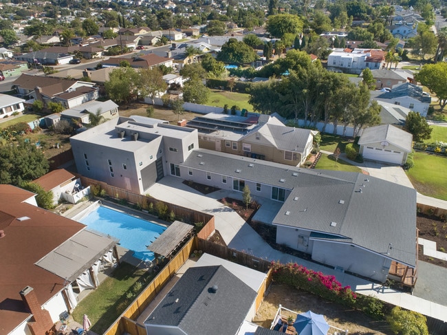


Property Detail
4779 71St St
469-242-23
LOT 2 POR TR 000728
Multifamilydwelling
San Diego
R1
California
B and X Area of moderate flood hazard, usually the area between the limits of the 100-year and 500-year floods.
2
2024
0.24 AC
2025
La Mesa
014702
San Diego
3,557 SF
San Diego-Chula Vista-Carlsbad, CA
NEARBY LISTINGS FOR SALE OR LEASE
DEMOGRAPHICS near 4779 71St St
1 mile
3 mile
5 mile
2025 Total Population
28,555
201,178
503,940
2030 Population
28,704
201,691
504,647
Pop Growth 2025-2030
+ 0.52%
+ 0.25%
+ 0.14%
Average Age
37
38
39
2025 Total Households
11,443
72,408
178,470
HH Growth 2025-2030
+ 0.36%
+ 0.18%
+ 0.07%
Median Household Inc
$87,073
$88,835
$91,331
Avg Household Size
2.40
2.60
2.70
2025 Avg HH Vehicles
2.00
2.00
2.00
Median Home Value
$722,349
$792,111
$768,571
Median Year Built
1968
1968
1970
Nearby Places
Map Layers
Map Styles
 Street
 Aerial
Layers
 Traffic
 Biking
Places
Listings with unknown addresses are not visible on the map
- Restaurants
- Banks
- Shops
- Fitness
- Groceries
PUBLIC TRANSPORTATION
TRANSIT/SUBWAY
70th Street (Green Line - San Diego Metropolitan Transit System Trolley (San Diego Trolley))
Drive
Walk
Distance
70th Street (Green Line - San Diego Metropolitan Transit System Trolley (San Diego Trolley))
3 min
17 min
0.9 mi
AIRPORT
San Diego International
Drive
Walk
Distance
San Diego International
17 min
11.5 mi
Freight Ports
Port of San Diego
Drive
Walk
Distance
Port of San Diego
17 min
10.1 mi
SALE & LEASE HISTORY
LISTING DATE
SALE/LEASE

Oct 08, 2019
For Sale
Nearby Properties
Address
Land Use
TOTAL SIZE
Lot Size
Zoning
Address
Land Use
TOTAL SIZE
Lot Size
Zoning
30.38 AC
RB
Address
Land Use
TOTAL SIZE
Lot Size
Zoning
8.23 AC
CUPD-CU-2-
Address
Land Use
TOTAL SIZE
Lot Size
Zoning
62.04 AC
C
Address
Land Use
TOTAL SIZE
Lot Size
Zoning
6.79 AC
C
Address
Land Use
TOTAL SIZE
Lot Size
Zoning
6.68 AC
RM-3-7
Address
Land Use
TOTAL SIZE
Lot Size
Zoning
4.77 AC
C
Address
Land Use
TOTAL SIZE
Lot Size
Zoning
5.02 AC
RM-4-10
Address
Land Use
TOTAL SIZE
Lot Size
Zoning
8.65 AC
R3
Address
Land Use
TOTAL SIZE
Lot Size
Zoning
135,165 SF
12.24 AC
CC-5-3
Address
Land Use
TOTAL SIZE
Lot Size
Zoning
92,500 SF
7.05 AC
R3
Address
Land Use
TOTAL SIZE
Lot Size
Zoning
1.54 AC
RM-3-9
Address
Land Use
TOTAL SIZE
Lot Size
Zoning
2.82 AC
R3
Address
Land Use
TOTAL SIZE
Lot Size
Zoning
4.10 AC
RB
Address
Land Use
TOTAL SIZE
Lot Size
Zoning
11.28 AC
C
Address
Land Use
TOTAL SIZE
Lot Size
Zoning
9,999 SF
5.47 AC
R3
Address
Land Use
TOTAL SIZE
Lot Size
Zoning
6.14 AC
R3
Address
Land Use
TOTAL SIZE
Lot Size
Zoning
2.39 AC
RM-3-9
Address
Land Use
TOTAL SIZE
Lot Size
Zoning
Address
Land Use
TOTAL SIZE
Lot Size
Zoning
6.31 AC
CC-1-3
Address
Land Use
TOTAL SIZE
Lot Size
Zoning
98,463 SF
0.98 AC
RM-3-9
Address
Land Use
TOTAL SIZE
Lot Size
Zoning
60,480 SF
0.18 AC
RM-3-9
Address
Land Use
TOTAL SIZE
Lot Size
Zoning
84,900 SF
3.54 AC
R3
Address
Land Use
TOTAL SIZE
Lot Size
Zoning
92,988 SF
6.12 AC
RB
Address
Land Use
TOTAL SIZE
Lot Size
Zoning
89,332 SF
1.14 AC
C
Address
Land Use
TOTAL SIZE
Lot Size
Zoning
5.67 AC
RM-2-4
Address
Land Use
TOTAL SIZE
Lot Size
Zoning
4.73 AC
RM-4-10
Address
Land Use
TOTAL SIZE
Lot Size
Zoning
6.72 AC
RM-3-7
Address
Land Use
TOTAL SIZE
Lot Size
Zoning
17.63 AC
RM-1-3
Address
Land Use
TOTAL SIZE
Lot Size
Zoning
63,964 SF
5.25 AC
R3
Address
Land Use
TOTAL SIZE
Lot Size
Zoning
53,798 SF
1 AC
RM-3-9
The World's #1 Commercial Real Estate Marketplace
Connect with us
© 2026 CoStar Group
The information above has been obtained from sources believed reliable. While we do not doubt its accuracy we have not verified it and make no guarantee, warranty or representation about it. It is your responsibility to independently confirm its accuracy and completeness. Any projections, opinions, assumptions, or estimates used are for example only and do not represent the current or future performance of the property. The value of this transaction to you depends on tax and other factors which should be evaluated by your tax, financial, and legal advisors. You and your advisors should conduct a careful, independent investigation of the property to determine to your satisfaction the suitability of the property for your needs.