Property Record
478 Us 41 Byp N, Venice, FL 34285
NEARBY LISTINGS FOR SALE OR LEASE
Property Detail
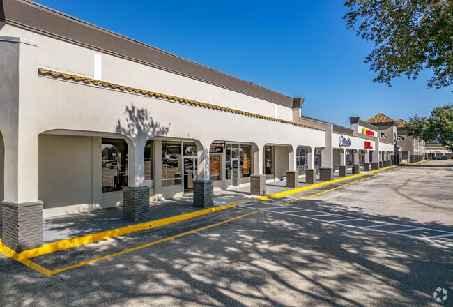
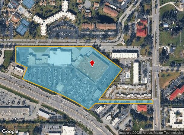
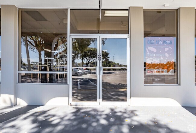
478 Us 41 Byp N
0407-01-0001
Not Part Of A Subdivision
Regionalshoppingcenterormallwithanchorstore
BEG NE COR SEC 7-39-19 TH W 722.9 FT FOR POB TH W 874.71 FT TH S 189.62 FT TH S 66-04-00 E 146 FT TH S-23-56-00 W 140 FT TH SELY ALG N R/W SR 45A 843.16 FT TH N 46-40-57 E 111.62 FT TH S 89-46-43
X
Sarasota
12115C0331G
Florida
2024
13.95 AC
2025
Sarasota
002404
Tampa/St Petersburg
131,489 SF
North Port-Sarasota-Bradenton, FL
DEMOGRAPHICS near 478 Us 41 Byp N
1 Mile
3 Mile
5 Mile
2024 Total Population
9,568
47,965
87,963
2029 Population
11,167
56,084
102,503
Pop Growth 2024-2029
+ 16.71%
+ 16.93%
+ 16.53%
Average Age
62
61
58
2024 Total Households
5,100
25,360
44,427
HH Growth 2024-2029
+ 16.84%
+ 17.01%
+ 16.60%
Median Household Inc
$53,979
$64,305
$69,454
Avg Household Size
1.70
1.80
1.90
2024 Avg HH Vehicles
1.00
1.00
2.00
Median Home Value
$216,222
$313,074
$328,844
Median Year Built
1978
1981
1986
Nearby Places
Map Layers
Map Styles
 Street
 Aerial
- Restaurants
- Banks
- Shops
- Fitness
- Groceries
PUBLIC TRANSPORTATION
AIRPORT
Sarasota/Bradenton International
DRIVE
WALK
Distance
Sarasota/Bradenton International
42 min
23.2 mi
Punta Gorda
DRIVE
WALK
Distance
Punta Gorda
49 min
37.3 mi
Freight Ports
Port Manatee
DRIVE
WALK
Distance
Port Manatee
55 min
41.4 mi
SALE & LEASE HISTORY
LISTING DATE
SALE/LEASE

Sep 25, 2016
For Lease
Nearby Properties
Address
Land Use
TOTAL SIZE
Lot Size
Zoning
Address
Land Use
TOTAL SIZE
Lot Size
Zoning
738,835 SF
65.43 AC
LW
Address
Land Use
TOTAL SIZE
Lot Size
Zoning
26,265 SF
210.50 AC
RMH
Address
Land Use
TOTAL SIZE
Lot Size
Zoning
592,021 SF
75.99 AC
G
Address
Land Use
TOTAL SIZE
Lot Size
Zoning
565,625 SF
15.61 AC
ST2A
Address
Land Use
TOTAL SIZE
Lot Size
Zoning
421,272 SF
31.96 AC
PUD
Address
Land Use
TOTAL SIZE
Lot Size
Zoning
273,036 SF
28.76 AC
RMF3
Address
Land Use
TOTAL SIZE
Lot Size
Zoning
263,056 SF
25.54 AC
LW
Address
Land Use
TOTAL SIZE
Lot Size
Zoning
181,657 SF
56.90 AC
GU
Address
Land Use
TOTAL SIZE
Lot Size
Zoning
8,562 SF
58.92 AC
RMH
Address
Land Use
TOTAL SIZE
Lot Size
Zoning
23,348 SF
77.03 AC
RMH
Address
Land Use
TOTAL SIZE
Lot Size
Zoning
190,485 SF
5.81 AC
NTG
Address
Land Use
TOTAL SIZE
Lot Size
Zoning
48,681 SF
5 AC
OPI
Address
Land Use
TOTAL SIZE
Lot Size
Zoning
362,000 SF
41.51 AC
PID
Address
Land Use
TOTAL SIZE
Lot Size
Zoning
183,584 SF
14.54 AC
PUD
Address
Land Use
TOTAL SIZE
Lot Size
Zoning
223,397 SF
453.78 AC
G
Address
Land Use
TOTAL SIZE
Lot Size
Zoning
133,773 SF
6.29 AC
OPI
Address
Land Use
TOTAL SIZE
Lot Size
Zoning
5,396 SF
33.59 AC
RMH
Address
Land Use
TOTAL SIZE
Lot Size
Zoning
5,208 SF
38.03 AC
CG
Address
Land Use
TOTAL SIZE
Lot Size
Zoning
63,549 SF
6.26 AC
OPI
Address
Land Use
TOTAL SIZE
Lot Size
Zoning
127,135 SF
12.37 AC
CG
Address
Land Use
TOTAL SIZE
Lot Size
Zoning
111,306 SF
9.35 AC
CSC
Address
Land Use
TOTAL SIZE
Lot Size
Zoning
138,547 SF
18.63 AC
CSC
Address
Land Use
TOTAL SIZE
Lot Size
Zoning
121,747 SF
17.54 AC
OUE1
Address
Land Use
TOTAL SIZE
Lot Size
Zoning
101,219 SF
4.90 AC
OPI
Address
Land Use
TOTAL SIZE
Lot Size
Zoning
112,415 SF
8.77 AC
CSC
Address
Land Use
TOTAL SIZE
Lot Size
Zoning
76,247 SF
13.89 AC
CG
Address
Land Use
TOTAL SIZE
Lot Size
Zoning
70,220 SF
9.31 AC
LW
Address
Land Use
TOTAL SIZE
Lot Size
Zoning
8,040 SF
46.23 AC
RMH
Address
Land Use
TOTAL SIZE
Lot Size
Zoning
3,447 SF
65.66 AC
ROS
Address
Land Use
TOTAL SIZE
Lot Size
Zoning
49,400 SF
4.51 AC
OPI
The World's #1 Commercial Real Estate Marketplace
Connect with us
© 2026 CoStar Group
The information above has been obtained from sources believed reliable. While we do not doubt its accuracy we have not verified it and make no guarantee, warranty or representation about it. It is your responsibility to independently confirm its accuracy and completeness. Any projections, opinions, assumptions, or estimates used are for example only and do not represent the current or future performance of the property. The value of this transaction to you depends on tax and other factors which should be evaluated by your tax, financial, and legal advisors. You and your advisors should conduct a careful, independent investigation of the property to determine to your satisfaction the suitability of the property for your needs.