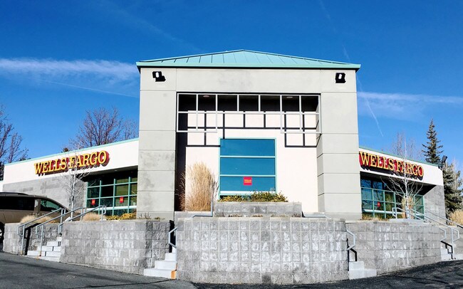
Property Record
4780 Caughlin Pky, Reno, NV 89519


Property Detail
4780 Caughlin Pky
041-243-10
PM 2457 LOT 3C
Commercialnec
Washoe
PD
Nevada
B and X Area of moderate flood hazard, usually the area between the limits of the 100-year and 500-year floods.
3c
2025
0.70 AC
2026
Southwest Reno
001103
Reno/Sparks
3,732 SF
Reno, NV
NEARBY LISTINGS FOR SALE OR LEASE
DEMOGRAPHICS near 4780 Caughlin Pky
1 mile
3 mile
5 mile
2025 Total Population
5,915
50,857
156,141
2030 Population
6,030
51,975
159,798
Pop Growth 2025-2030
+ 1.94%
+ 2.20%
+ 2.34%
Average Age
47
44
41
2025 Total Households
2,440
23,156
67,755
HH Growth 2025-2030
+ 2.05%
+ 2.21%
+ 2.41%
Median Household Inc
$174,935
$90,481
$72,194
Avg Household Size
2.40
2.10
2.20
2025 Avg HH Vehicles
2.00
2.00
2.00
Median Home Value
$843,948
$776,911
$635,857
Median Year Built
1992
1983
1983
Nearby Places
Map Layers
Map Styles
 Street
 Aerial
Layers
 Traffic
 Biking
Places
Listings with unknown addresses are not visible on the map
- Restaurants
- Banks
- Shops
- Fitness
- Groceries
PUBLIC TRANSPORTATION
COMMUTER RAIL
Reno (California Zephyr - Amtrak)
Drive
Walk
Distance
Reno (California Zephyr - Amtrak)
11 min
5.8 mi
AIRPORT
Reno/Tahoe International
Drive
Walk
Distance
Reno/Tahoe International
29 min
9.5 mi
Freight Ports
Port of Stockton
Drive
Walk
Distance
Port of Stockton
209 min
179.7 mi
Nearby Properties
Address
Land Use
TOTAL SIZE
Lot Size
Zoning
Address
Land Use
TOTAL SIZE
Lot Size
Zoning
55,187 SF
116.12 AC
GC
Address
Land Use
TOTAL SIZE
Lot Size
Zoning
477,926 SF
54.37 AC
MF14
Address
Land Use
TOTAL SIZE
Lot Size
Zoning
306,626 SF
17.61 AC
MF14 44% /
Address
Land Use
TOTAL SIZE
Lot Size
Zoning
304,344 SF
10.24 AC
GC
Address
Land Use
TOTAL SIZE
Lot Size
Zoning
272,580 SF
18.90 AC
MF21
Address
Land Use
TOTAL SIZE
Lot Size
Zoning
303,512 SF
20.60 AC
MF30
Address
Land Use
TOTAL SIZE
Lot Size
Zoning
293,364 SF
21.87 AC
MF14
Address
Land Use
TOTAL SIZE
Lot Size
Zoning
182,838 SF
8.02 AC
MS
Address
Land Use
TOTAL SIZE
Lot Size
Zoning
254,180 SF
15.99 AC
MF14
Address
Land Use
TOTAL SIZE
Lot Size
Zoning
259,461 SF
16.24 AC
MF30
Address
Land Use
TOTAL SIZE
Lot Size
Zoning
342,672 SF
18.39 AC
MS
Address
Land Use
TOTAL SIZE
Lot Size
Zoning
92,930 SF
2.68 AC
MF21
Address
Land Use
TOTAL SIZE
Lot Size
Zoning
205,936 SF
6.93 AC
MF30
Address
Land Use
TOTAL SIZE
Lot Size
Zoning
273,109 SF
17.93 AC
MU
Address
Land Use
TOTAL SIZE
Lot Size
Zoning
299,798 SF
17.77 AC
SF5
Address
Land Use
TOTAL SIZE
Lot Size
Zoning
77,545 SF
4.82 AC
PF
Address
Land Use
TOTAL SIZE
Lot Size
Zoning
73,904 SF
4.86 AC
PO
Address
Land Use
TOTAL SIZE
Lot Size
Zoning
170,791 SF
9.37 AC
MF30
Address
Land Use
TOTAL SIZE
Lot Size
Zoning
62,792 SF
3.98 AC
MF21
Address
Land Use
TOTAL SIZE
Lot Size
Zoning
263,136 SF
43.49 AC
PF
Address
Land Use
TOTAL SIZE
Lot Size
Zoning
116,495 SF
4.99 AC
MF30
Address
Land Use
TOTAL SIZE
Lot Size
Zoning
27.54 AC
PSP
Address
Land Use
TOTAL SIZE
Lot Size
Zoning
55,994 SF
3.09 AC
MF14
Address
Land Use
TOTAL SIZE
Lot Size
Zoning
87,139 SF
7.04 AC
PF
Address
Land Use
TOTAL SIZE
Lot Size
Zoning
243,888 SF
5.90 AC
MF30
Address
Land Use
TOTAL SIZE
Lot Size
Zoning
166,421 SF
8.93 AC
GC
Address
Land Use
TOTAL SIZE
Lot Size
Zoning
102,040 SF
10.98 AC
PD
Address
Land Use
TOTAL SIZE
Lot Size
Zoning
122,068 SF
15.81 AC
SF5
Address
Land Use
TOTAL SIZE
Lot Size
Zoning
60,011 SF
1.69 AC
PO
Address
Land Use
TOTAL SIZE
Lot Size
Zoning
105,810 SF
13.39 AC
GC
The World's #1 Commercial Real Estate Marketplace
Connect with us
© 2026 CoStar Group
The information above has been obtained from sources believed reliable. While we do not doubt its accuracy we have not verified it and make no guarantee, warranty or representation about it. It is your responsibility to independently confirm its accuracy and completeness. Any projections, opinions, assumptions, or estimates used are for example only and do not represent the current or future performance of the property. The value of this transaction to you depends on tax and other factors which should be evaluated by your tax, financial, and legal advisors. You and your advisors should conduct a careful, independent investigation of the property to determine to your satisfaction the suitability of the property for your needs.