Property Record
4783 Peachtree Rd, Atlanta, GA 30341


NEARBY LISTINGS FOR SALE OR LEASE
Property Detail
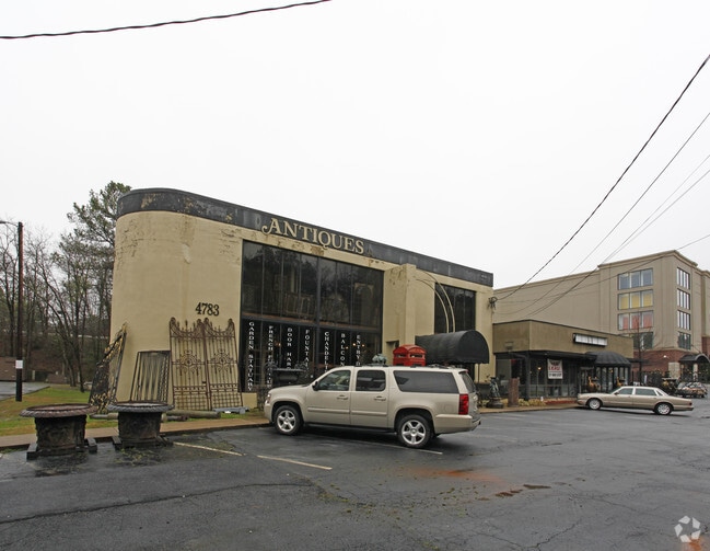
4783 Peachtree Rd
18-277-02-004
84 X 146 X 181 X 113 X 15 X 73 X 201 0.8205AC 1-14-9 230 X 181.9 X 113 X 15 X 73 X 201 0.80AC 2-22-
Storebuilding
DeKalb
X
Georgia
13089C0014K
4
2025
0.80 AC
2025
Chamblee/Doraville
021208
Atlanta
10,043 SF
Atlanta-Sandy Springs-Roswell, GA
DEMOGRAPHICS near 4783 Peachtree Rd
1 Mile
3 Mile
5 Mile
2024 Total Population
11,904
110,751
319,227
2029 Population
11,959
110,862
322,690
Pop Growth 2024-2029
+ 0.46%
+ 0.10%
+ 1.08%
Average Age
36
37
38
2024 Total Households
5,394
47,038
145,217
HH Growth 2024-2029
+ 0.54%
+ 0.13%
+ 1.38%
Median Household Inc
$112,914
$100,674
$95,404
Avg Household Size
2.10
2.30
2.10
2024 Avg HH Vehicles
2.00
2.00
2.00
Median Home Value
$594,881
$572,517
$504,781
Median Year Built
2000
1989
1990
Nearby Places
Map Layers
Map Styles
 Street
 Aerial
- Restaurants
- Banks
- Shops
- Fitness
- Groceries
PUBLIC TRANSPORTATION
COMMUTER RAIL
DRIVE
WALK
Distance
14 min
7.8 mi
AIRPORT
Hartsfield - Jackson Atlanta International
DRIVE
WALK
Distance
Hartsfield - Jackson Atlanta International
34 min
20.8 mi
SALE & LEASE HISTORY
LISTING DATE
SALE/LEASE

Sep 25, 2016
For Lease
Sep 24, 2016
For Sale
Jul 25, 2018
For Sale
Dec 29, 2017
For Sale
Dec 15, 2017
For Sale
Apr 23, 2019
For Sale
Apr 18, 2018
For Sale
Nearby Properties
Address
Land Use
TOTAL SIZE
Lot Size
Zoning
Address
Land Use
TOTAL SIZE
Lot Size
Zoning
705,518 SF
39.09 AC
M
Address
Land Use
TOTAL SIZE
Lot Size
Zoning
12,600 SF
508.30 AC
M
Address
Land Use
TOTAL SIZE
Lot Size
Zoning
188,648 SF
4.39 AC
X
Address
Land Use
TOTAL SIZE
Lot Size
Zoning
376,010 SF
3.76 AC
OI
Address
Land Use
TOTAL SIZE
Lot Size
Zoning
2,820,296 SF
9.58 AC
RG5
Address
Land Use
TOTAL SIZE
Lot Size
Zoning
458,822 SF
2.86 AC
RG2
Address
Land Use
TOTAL SIZE
Lot Size
Zoning
299,993 SF
4.72 AC
I1
Address
Land Use
TOTAL SIZE
Lot Size
Zoning
701,195 SF
20.76 AC
X
Address
Land Use
TOTAL SIZE
Lot Size
Zoning
439,052 SF
4.57 AC
OI
Address
Land Use
TOTAL SIZE
Lot Size
Zoning
213,408 SF
6.35 AC
I1
Address
Land Use
TOTAL SIZE
Lot Size
Zoning
389,560 SF
4.01 AC
C1
Address
Land Use
TOTAL SIZE
Lot Size
Zoning
432,424 SF
3.87 AC
MC
Address
Land Use
TOTAL SIZE
Lot Size
Zoning
276,504 SF
3.40 AC
C1
Address
Land Use
TOTAL SIZE
Lot Size
Zoning
490,090 SF
2.27 AC
C3
Address
Land Use
TOTAL SIZE
Lot Size
Zoning
191,941 SF
3.02 AC
OCR
Address
Land Use
TOTAL SIZE
Lot Size
Zoning
140,183 SF
4.20 AC
OI
Address
Land Use
TOTAL SIZE
Lot Size
Zoning
257,989 SF
12.41 AC
OI
Address
Land Use
TOTAL SIZE
Lot Size
Zoning
600,502 SF
4.46 AC
R3
Address
Land Use
TOTAL SIZE
Lot Size
Zoning
157,133 SF
5.03 AC
M
Address
Land Use
TOTAL SIZE
Lot Size
Zoning
912,649 SF
5.21 AC
OIC
Address
Land Use
TOTAL SIZE
Lot Size
Zoning
166,377 SF
7.56 AC
X
Address
Land Use
TOTAL SIZE
Lot Size
Zoning
321,334 SF
12.70 AC
RM-HD
Address
Land Use
TOTAL SIZE
Lot Size
Zoning
150,894 SF
3.85 AC
C2
Address
Land Use
TOTAL SIZE
Lot Size
Zoning
457,330 SF
20.49 AC
RM-HD
Address
Land Use
TOTAL SIZE
Lot Size
Zoning
345,441 SF
25.78 AC
C1
Address
Land Use
TOTAL SIZE
Lot Size
Zoning
144,380 SF
3.84 AC
X
Address
Land Use
TOTAL SIZE
Lot Size
Zoning
504,949 SF
2.86 AC
R3
Address
Land Use
TOTAL SIZE
Lot Size
Zoning
395,191 SF
2.78 AC
OIC
Address
Land Use
TOTAL SIZE
Lot Size
Zoning
267,983 SF
13 AC
X
Address
Land Use
TOTAL SIZE
Lot Size
Zoning
3,056,580 SF
9.12 AC
RG4C
The World's #1 Commercial Real Estate Marketplace
Connect with us
© 2026 CoStar Group
The information above has been obtained from sources believed reliable. While we do not doubt its accuracy we have not verified it and make no guarantee, warranty or representation about it. It is your responsibility to independently confirm its accuracy and completeness. Any projections, opinions, assumptions, or estimates used are for example only and do not represent the current or future performance of the property. The value of this transaction to you depends on tax and other factors which should be evaluated by your tax, financial, and legal advisors. You and your advisors should conduct a careful, independent investigation of the property to determine to your satisfaction the suitability of the property for your needs.