Property Record
479 Route 28, Inlet, NY 13360


NEARBY LISTINGS FOR SALE OR LEASE
-
-
View all Inlet listings for sale on LoopNet.com
Property Detail
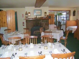
479 Route 28
202800-060-017-0002-008-000-0000
Hamilton
Restaurantbuilding
New York
2025
8.000
2024
1.60 AC
950100
Hamilton County
3,734 SF
Albany/Schenectady/Troy
DEMOGRAPHICS near 479 Route 28
1 Mile
3 Mile
5 Mile
2024 Total Population
130
334
637
2029 Population
130
335
649
Pop Growth 2024-2029
0.00%
+ 0.30%
+ 1.88%
Average Age
51
51
52
2024 Total Households
64
166
325
HH Growth 2024-2029
+ 1.56%
+ 0.60%
+ 1.85%
Median Household Inc
$76,562
$75,915
$78,360
Avg Household Size
2.00
2.00
2.00
2024 Avg HH Vehicles
3.00
3.00
2.00
Median Home Value
$276,922
$281,428
$278,471
Median Year Built
1955
1955
1961
Nearby Places
Map Layers
Map Styles
 Street
 Aerial
- Restaurants
- Banks
- Shops
- Fitness
- Groceries
SALE & LEASE HISTORY
LISTING DATE
SALE/LEASE

Sep 23, 2016
For Sale
Aug 10, 2017
For Sale
Nearby Properties
Address
Land Use
TOTAL SIZE
Lot Size
Zoning
Address
Land Use
TOTAL SIZE
Lot Size
Zoning
14,986.12 AC
R1
Address
Land Use
TOTAL SIZE
Lot Size
Zoning
17,390 SF
8.50 AC
R1
Address
Land Use
TOTAL SIZE
Lot Size
Zoning
Address
Land Use
TOTAL SIZE
Lot Size
Zoning
6,494 SF
3.70 AC
C2
Address
Land Use
TOTAL SIZE
Lot Size
Zoning
157.70 AC
R1
Address
Land Use
TOTAL SIZE
Lot Size
Zoning
1,872 SF
9.80 AC
R1
Address
Land Use
TOTAL SIZE
Lot Size
Zoning
20.90 AC
C2
Address
Land Use
TOTAL SIZE
Lot Size
Zoning
3,658 SF
4 AC
R1
Address
Land Use
TOTAL SIZE
Lot Size
Zoning
9,326 SF
6.23 AC
C3
Address
Land Use
TOTAL SIZE
Lot Size
Zoning
2,040 SF
135.10 AC
RR
Address
Land Use
TOTAL SIZE
Lot Size
Zoning
2,712 SF
2.20 AC
C2
Address
Land Use
TOTAL SIZE
Lot Size
Zoning
1,972 SF
7.80 AC
RR
Address
Land Use
TOTAL SIZE
Lot Size
Zoning
1,632 SF
13.90 AC
R1
Address
Land Use
TOTAL SIZE
Lot Size
Zoning
3,870 SF
0.98 AC
C1
Address
Land Use
TOTAL SIZE
Lot Size
Zoning
2,682 SF
2.50 AC
RR
Address
Land Use
TOTAL SIZE
Lot Size
Zoning
3,168 SF
1.50 AC
08 - GOVER
Address
Land Use
TOTAL SIZE
Lot Size
Zoning
160 AC
R1
Address
Land Use
TOTAL SIZE
Lot Size
Zoning
810 SF
11.80 AC
C2
Address
Land Use
TOTAL SIZE
Lot Size
Zoning
2,127 SF
1.87 AC
RR
Address
Land Use
TOTAL SIZE
Lot Size
Zoning
Address
Land Use
TOTAL SIZE
Lot Size
Zoning
1,624 SF
3.30 AC
C1
Address
Land Use
TOTAL SIZE
Lot Size
Zoning
1,056 SF
3.20 AC
C1
Address
Land Use
TOTAL SIZE
Lot Size
Zoning
6,161 SF
21.20 AC
PD
Address
Land Use
TOTAL SIZE
Lot Size
Zoning
1,144 SF
1 AC
C2
Address
Land Use
TOTAL SIZE
Lot Size
Zoning
1,476 SF
1.20 AC
C2
Address
Land Use
TOTAL SIZE
Lot Size
Zoning
146 AC
R1
Address
Land Use
TOTAL SIZE
Lot Size
Zoning
1,824 SF
3.20 AC
C1
Address
Land Use
TOTAL SIZE
Lot Size
Zoning
1,632 SF
2.60 AC
C1
Address
Land Use
TOTAL SIZE
Lot Size
Zoning
4,564 SF
10.37 AC
C2
Address
Land Use
TOTAL SIZE
Lot Size
Zoning
840 SF
0.46 AC
RR
The World's #1 Commercial Real Estate Marketplace
Connect with us
© 2026 CoStar Group
The information above has been obtained from sources believed reliable. While we do not doubt its accuracy we have not verified it and make no guarantee, warranty or representation about it. It is your responsibility to independently confirm its accuracy and completeness. Any projections, opinions, assumptions, or estimates used are for example only and do not represent the current or future performance of the property. The value of this transaction to you depends on tax and other factors which should be evaluated by your tax, financial, and legal advisors. You and your advisors should conduct a careful, independent investigation of the property to determine to your satisfaction the suitability of the property for your needs.