Property Record
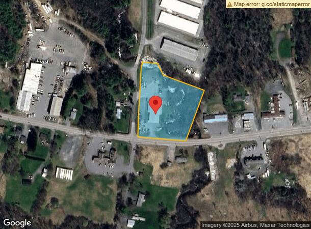
479 Us Route 4, Enfield, NH 03748
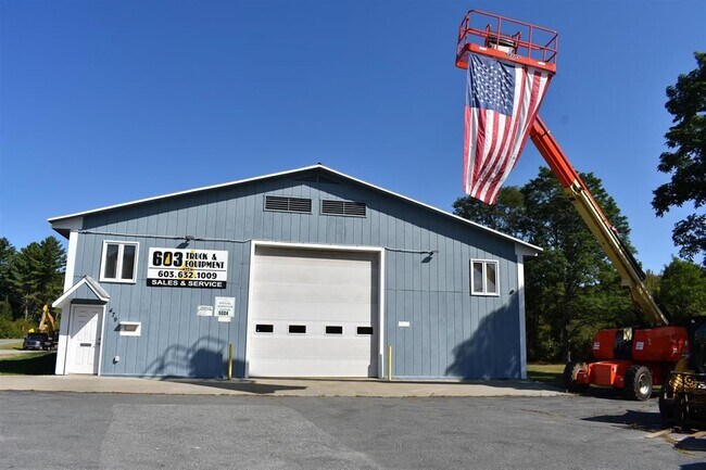
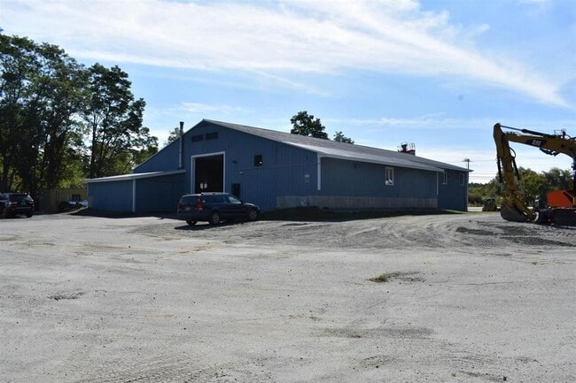
This Property Is For Sale
NEARBY LISTINGS FOR SALE OR LEASE
-
-
View all Enfield listings for sale on LoopNet.com
Property Detail
479 Us Route 4
Commercialbuilding
Grafton
AE
New Hampshire
33009C0919E
2.59 AC
2024
Concord/New Hampshire North Area
2024
Other Market Areas
961500
Claremont-Lebanon, NH-VT
7,176 SF
EFLD-000015-000006
DEMOGRAPHICS near 479 Us Route 4
1 Mile
3 Mile
5 Mile
2024 Total Population
1,173
4,382
7,550
2029 Population
1,225
4,596
7,918
Pop Growth 2024-2029
+ 4.43%
+ 4.88%
+ 4.87%
Average Age
45
46
46
2024 Total Households
549
1,994
3,327
HH Growth 2024-2029
+ 4.01%
+ 4.41%
+ 4.45%
Median Household Inc
$88,214
$104,307
$107,994
Avg Household Size
2.10
2.10
2.20
2024 Avg HH Vehicles
2.00
2.00
2.00
Median Home Value
$262,313
$279,604
$276,280
Median Year Built
1977
1979
1979
Nearby Places
Map Layers
Map Styles
 Street
 Aerial
- Restaurants
- Banks
- Shops
- Fitness
- Groceries
Nearby Properties
Address
Land Use
TOTAL SIZE
Lot Size
Zoning
Address
Land Use
TOTAL SIZE
Lot Size
Zoning
52,078 SF
98 AC
RURL1
Address
Land Use
TOTAL SIZE
Lot Size
Zoning
13,366 SF
3.60 AC
RL1
Address
Land Use
TOTAL SIZE
Lot Size
Zoning
9,400 SF
2.41 AC
RT4 -
Address
Land Use
TOTAL SIZE
Lot Size
Zoning
23,840 SF
3.59 AC
CB - W
Address
Land Use
TOTAL SIZE
Lot Size
Zoning
20,399 SF
27.30 AC
R3 - R
Address
Land Use
TOTAL SIZE
Lot Size
Zoning
7,832 SF
3.92 AC
CB - W
Address
Land Use
TOTAL SIZE
Lot Size
Zoning
36,382 SF
4.62 AC
RURL1
Address
Land Use
TOTAL SIZE
Lot Size
Zoning
23,152 SF
8.91 AC
INDL
Address
Land Use
TOTAL SIZE
Lot Size
Zoning
24,224 SF
4.42 AC
R1 W/O
Address
Land Use
TOTAL SIZE
Lot Size
Zoning
1,199 SF
23.60 AC
R1 W/O
Address
Land Use
TOTAL SIZE
Lot Size
Zoning
13,789 SF
4.30 AC
R1 W/O
Address
Land Use
TOTAL SIZE
Lot Size
Zoning
3,652 SF
2.85 AC
CB - W
Address
Land Use
TOTAL SIZE
Lot Size
Zoning
6,552 SF
6 AC
CB - W
Address
Land Use
TOTAL SIZE
Lot Size
Zoning
6,240 SF
27 AC
R1 W/O
Address
Land Use
TOTAL SIZE
Lot Size
Zoning
1,720 SF
2.43 AC
CB - W
Address
Land Use
TOTAL SIZE
Lot Size
Zoning
2,295.68 AC
R5 - R
Address
Land Use
TOTAL SIZE
Lot Size
Zoning
4,400 SF
2.74 AC
CB - W
Address
Land Use
TOTAL SIZE
Lot Size
Zoning
1,136 SF
0.46 AC
CB W/O
Address
Land Use
TOTAL SIZE
Lot Size
Zoning
2,916 SF
0.55 AC
R1 W/O
Address
Land Use
TOTAL SIZE
Lot Size
Zoning
1,696 SF
2.72 AC
R1 W/O
Address
Land Use
TOTAL SIZE
Lot Size
Zoning
33,020 SF
40 AC
RURL1
Address
Land Use
TOTAL SIZE
Lot Size
Zoning
19,784 SF
2.06 AC
RT4 -
Address
Land Use
TOTAL SIZE
Lot Size
Zoning
2,352 SF
7.79 AC
RT4 -
Address
Land Use
TOTAL SIZE
Lot Size
Zoning
3,912 SF
83.97 AC
R3 - R
Address
Land Use
TOTAL SIZE
Lot Size
Zoning
8,177 SF
1.91 AC
RT4 -
Address
Land Use
TOTAL SIZE
Lot Size
Zoning
8,394 SF
0.47 AC
CB - W
Address
Land Use
TOTAL SIZE
Lot Size
Zoning
1,080 AC
R1 W/O
Address
Land Use
TOTAL SIZE
Lot Size
Zoning
6,230 SF
0.42 AC
R1 - W
Address
Land Use
TOTAL SIZE
Lot Size
Zoning
9,886 SF
0.49 AC
R1 W/O
Address
Land Use
TOTAL SIZE
Lot Size
Zoning
8,794 SF
2.60 AC
R1 W/O
The World's #1 Commercial Real Estate Marketplace
Connect with us
© 2025 CoStar Group
The information above has been obtained from sources believed reliable. While we do not doubt its accuracy we have not verified it and make no guarantee, warranty or representation about it. It is your responsibility to independently confirm its accuracy and completeness. Any projections, opinions, assumptions, or estimates used are for example only and do not represent the current or future performance of the property. The value of this transaction to you depends on tax and other factors which should be evaluated by your tax, financial, and legal advisors. You and your advisors should conduct a careful, independent investigation of the property to determine to your satisfaction the suitability of the property for your needs.