Property Record
4792 Mcbryde St, Linden, NC 28356
Property Detail
4792 Mcbryde St
Fayetteville, NC
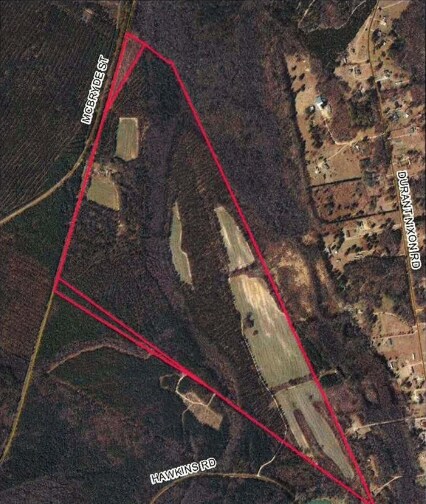
197.34 ACS MCDUFFIE LD
0574-50-0676
Cumberland
Agriculturalland
North Carolina
A1
676
B and X Area of moderate flood hazard, usually the area between the limits of the 100-year and 500-year floods.
197.34 AC
2025
East Fayetteville
2025
Fayetteville
003700
NEARBY LISTINGS FOR SALE OR LEASE
-
-
View all Linden listings for sale on LoopNet.com
DEMOGRAPHICS near 4792 Mcbryde St
1 mile
3 mile
5 mile
2025 Total Population
306
1,859
5,587
2030 Population
314
1,930
5,782
Pop Growth 2025-2030
+ 2.61%
+ 3.82%
+ 3.49%
Average Age
43
41
41
2025 Total Households
114
702
2,153
HH Growth 2025-2030
+ 2.63%
+ 4.13%
+ 3.58%
Median Household Inc
$44,867
$54,937
$62,449
Avg Household Size
2.60
2.60
2.60
2025 Avg HH Vehicles
2.00
2.00
2.00
Median Home Value
$213,207
$233,772
$251,291
Median Year Built
1981
1990
1990
Nearby Places
Map Layers
Map Styles
 Street
 Aerial
Layers
 Traffic
 Biking
Places
Listings with unknown addresses are not visible on the map
- Restaurants
- Banks
- Shops
- Fitness
- Groceries
PUBLIC TRANSPORTATION
AIRPORT
Fayetteville Regional/Grannis Field
Drive
Walk
Distance
Fayetteville Regional/Grannis Field
41 min
25.0 mi
Freight Ports
Port of Wilmington
Drive
Walk
Distance
Port of Wilmington
146 min
117.3 mi
SALE & LEASE HISTORY
LISTING DATE
SALE/LEASE

Sep 24, 2016
For Sale
Nearby Properties
Address
Land Use
TOTAL SIZE
Lot Size
Zoning
Address
Land Use
TOTAL SIZE
Lot Size
Zoning
5,000 SF
10.42 AC
CP
Address
Land Use
TOTAL SIZE
Lot Size
Zoning
304.90 AC
A1
Address
Land Use
TOTAL SIZE
Lot Size
Zoning
23,500 SF
5.06 AC
CP
Address
Land Use
TOTAL SIZE
Lot Size
Zoning
357.43 AC
A1
Address
Land Use
TOTAL SIZE
Lot Size
Zoning
1,525 SF
736.18 AC
A1
Address
Land Use
TOTAL SIZE
Lot Size
Zoning
2,062 SF
2.44 AC
NZ
Address
Land Use
TOTAL SIZE
Lot Size
Zoning
1,890 SF
345.98 AC
A1-AGRI DI
Address
Land Use
TOTAL SIZE
Lot Size
Zoning
3,078 SF
1.36 AC
A1
Address
Land Use
TOTAL SIZE
Lot Size
Zoning
10,238 SF
6.05 AC
NZ
Address
Land Use
TOTAL SIZE
Lot Size
Zoning
7,200 SF
27.95 AC
A1
Address
Land Use
TOTAL SIZE
Lot Size
Zoning
39.28 AC
A1
Address
Land Use
TOTAL SIZE
Lot Size
Zoning
291.26 AC
A1
Address
Land Use
TOTAL SIZE
Lot Size
Zoning
6,682 SF
7 AC
A1
Address
Land Use
TOTAL SIZE
Lot Size
Zoning
4,780 SF
3.81 AC
CP
Address
Land Use
TOTAL SIZE
Lot Size
Zoning
14 AC
A1
Address
Land Use
TOTAL SIZE
Lot Size
Zoning
1,232 SF
36.91 AC
NZ-NO ZONI
Address
Land Use
TOTAL SIZE
Lot Size
Zoning
19.97 AC
R20
Address
Land Use
TOTAL SIZE
Lot Size
Zoning
71.91 AC
A1
Address
Land Use
TOTAL SIZE
Lot Size
Zoning
6,593 SF
1.23 AC
NZ
Address
Land Use
TOTAL SIZE
Lot Size
Zoning
112.59 AC
RA30
Address
Land Use
TOTAL SIZE
Lot Size
Zoning
136.80 AC
A1
Address
Land Use
TOTAL SIZE
Lot Size
Zoning
5,189 SF
1.20 AC
R6A
Address
Land Use
TOTAL SIZE
Lot Size
Zoning
1,248 SF
7.08 AC
CP
Address
Land Use
TOTAL SIZE
Lot Size
Zoning
2,405 SF
2.90 AC
A1-AGRI DI
Address
Land Use
TOTAL SIZE
Lot Size
Zoning
102 AC
A1
Address
Land Use
TOTAL SIZE
Lot Size
Zoning
122.66 AC
A1
Address
Land Use
TOTAL SIZE
Lot Size
Zoning
2,878 SF
1.01 AC
A1-AGRI DI
Address
Land Use
TOTAL SIZE
Lot Size
Zoning
123.20 AC
A1
Address
Land Use
TOTAL SIZE
Lot Size
Zoning
2,272 SF
2.01 AC
A1-AGRI DI
The World's #1 Commercial Real Estate Marketplace
Connect with us
© 2026 CoStar Group
The information above has been obtained from sources believed reliable. While we do not doubt its accuracy we have not verified it and make no guarantee, warranty or representation about it. It is your responsibility to independently confirm its accuracy and completeness. Any projections, opinions, assumptions, or estimates used are for example only and do not represent the current or future performance of the property. The value of this transaction to you depends on tax and other factors which should be evaluated by your tax, financial, and legal advisors. You and your advisors should conduct a careful, independent investigation of the property to determine to your satisfaction the suitability of the property for your needs.