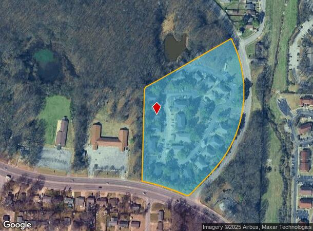
Property Record
4795 Hoover Dr, Memphis, TN 38128

NEARBY LISTINGS FOR SALE OR LEASE
Property Detail
4795 Hoover Dr
08-8008-0-0156
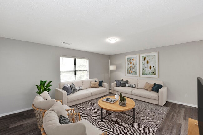
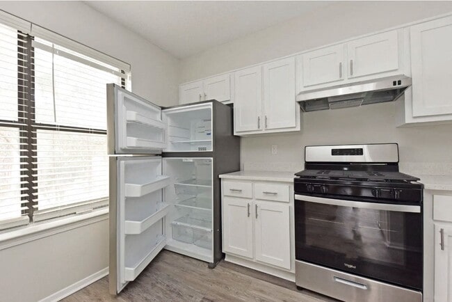
Calvin Howell Property
Apartment
NS RALEIGH-LAGRANGE RD COR HOOVER DR NW
X
Shelby
47157C0285F
Tennessee
2024
10.11 AC
2025
Raleigh
020541
Memphis
29,236 SF
Memphis, TN-MS-AR
DEMOGRAPHICS near 4795 Hoover Dr
1 Mile
3 Mile
5 Mile
2024 Total Population
8,598
71,497
180,335
2029 Population
8,418
70,150
177,174
Pop Growth 2024-2029
(2.09%)
(1.88%)
(1.75%)
Average Age
34
36
37
2024 Total Households
3,304
26,653
68,465
HH Growth 2024-2029
(2.15%)
(1.97%)
(1.86%)
Median Household Inc
$48,580
$47,839
$51,228
Avg Household Size
2.50
2.60
2.60
2024 Avg HH Vehicles
2.00
2.00
2.00
Median Home Value
$138,480
$138,523
$167,312
Median Year Built
1975
1972
1972
Nearby Places
- Restaurants
- Banks
- Shops
- Fitness
- Groceries
PUBLIC TRANSPORTATION
AIRPORT
Memphis International
DRIVE
WALK
Distance
Memphis International
24 min
15.1 mi
Freight Ports
Port of Shreveport
DRIVE
WALK
Distance
Port of Shreveport
413 min
379.8 mi
SALE & LEASE HISTORY
LISTING DATE
SALE/LEASE

Sep 24, 2016
For Sale
Feb 28, 2017
For Sale
Apr 04, 2017
For Sale
Nearby Properties
Address
Land Use
TOTAL SIZE
Lot Size
Zoning
Address
Land Use
TOTAL SIZE
Lot Size
Zoning
31,305 SF
17.89 AC
RU-3
Address
Land Use
TOTAL SIZE
Lot Size
Zoning
78,603 SF
23.30 AC
R-6
Address
Land Use
TOTAL SIZE
Lot Size
Zoning
38,200 SF
22.60 AC
RU-3
Address
Land Use
TOTAL SIZE
Lot Size
Zoning
198,103 SF
17.75 AC
CG-MS
Address
Land Use
TOTAL SIZE
Lot Size
Zoning
11,446 SF
29.76 AC
RU-3
Address
Land Use
TOTAL SIZE
Lot Size
Zoning
37,490 SF
4.42 AC
CMU-2
Address
Land Use
TOTAL SIZE
Lot Size
Zoning
62,400 SF
38.29 AC
RU-3
Address
Land Use
TOTAL SIZE
Lot Size
Zoning
56,983 SF
12.34 AC
RU-3
Address
Land Use
TOTAL SIZE
Lot Size
Zoning
39,018 SF
22.21 AC
RU-2
Address
Land Use
TOTAL SIZE
Lot Size
Zoning
50,818 SF
13.30 AC
RU-3
Address
Land Use
TOTAL SIZE
Lot Size
Zoning
78,948 SF
33.77 AC
RU-3
Address
Land Use
TOTAL SIZE
Lot Size
Zoning
45,939 SF
5.70 AC
R-10
Address
Land Use
TOTAL SIZE
Lot Size
Zoning
181,319 SF
14.82 AC
CMU-2
Address
Land Use
TOTAL SIZE
Lot Size
Zoning
50,447 SF
6.28 AC
R-10
Address
Land Use
TOTAL SIZE
Lot Size
Zoning
26,716 SF
11.37 AC
RU-2
Address
Land Use
TOTAL SIZE
Lot Size
Zoning
33,442 SF
22.51 AC
RU-3
Address
Land Use
TOTAL SIZE
Lot Size
Zoning
127,456 SF
15.05 AC
EMP
Address
Land Use
TOTAL SIZE
Lot Size
Zoning
180,630 SF
21.89 AC
CMU-2
Address
Land Use
TOTAL SIZE
Lot Size
Zoning
50,538 SF
5 AC
R-10
Address
Land Use
TOTAL SIZE
Lot Size
Zoning
58,484 SF
19.95 AC
RU-3
Address
Land Use
TOTAL SIZE
Lot Size
Zoning
69,158 SF
7.75 AC
RU-3
Address
Land Use
TOTAL SIZE
Lot Size
Zoning
30,158 SF
18.83 AC
R-6
Address
Land Use
TOTAL SIZE
Lot Size
Zoning
136,505 SF
6.76 AC
RU-3
Address
Land Use
TOTAL SIZE
Lot Size
Zoning
36,388 SF
13.09 AC
RU-3
Address
Land Use
TOTAL SIZE
Lot Size
Zoning
52,598 SF
6.78 AC
CMU-3
Address
Land Use
TOTAL SIZE
Lot Size
Zoning
26,544 SF
17.63 AC
RU-3
Address
Land Use
TOTAL SIZE
Lot Size
Zoning
101,800 SF
15.97 AC
CMU-2
Address
Land Use
TOTAL SIZE
Lot Size
Zoning
66.90 AC
CMU-2
Address
Land Use
TOTAL SIZE
Lot Size
Zoning
54,845 SF
9.31 AC
RU-3
Address
Land Use
TOTAL SIZE
Lot Size
Zoning
28,512 SF
7 AC
CMU-3
The World's #1 Commercial Real Estate Marketplace
Connect with us
© 2025 CoStar Group
The information above has been obtained from sources believed reliable. While we do not doubt its accuracy we have not verified it and make no guarantee, warranty or representation about it. It is your responsibility to independently confirm its accuracy and completeness. Any projections, opinions, assumptions, or estimates used are for example only and do not represent the current or future performance of the property. The value of this transaction to you depends on tax and other factors which should be evaluated by your tax, financial, and legal advisors. You and your advisors should conduct a careful, independent investigation of the property to determine to your satisfaction the suitability of the property for your needs.