Property Record
4795 Troy Ct, Jurupa Valley, CA 92509
NEARBY LISTINGS FOR SALE OR LEASE
-
-
-
10513-10567 San Sevaine Way
Jurupa Valley, CA 91752
$3,222,139 - $3,427,861
10,212 - 10,864 SF
Industrial
-
-
-
-
-
View all Jurupa Valley listings for sale on LoopNet.com
Property Detail
4795 Troy Ct
Riverside-San Bernardino-Ontario, CA
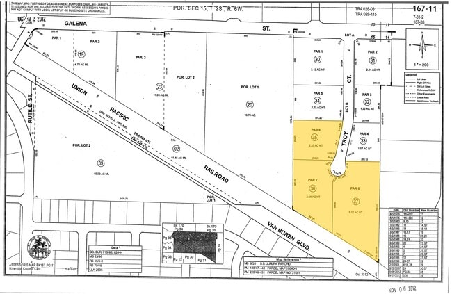
Parcel Map No 31081
167-110-036
2.33 ACRES NET IN PAR 6 PM 220/049 PM 31081
Warehouse
Riverside
X
California
06065C0038G
6
2024
3.08 AC
2025
Riverside
040501
Inland Empire (California)
62,619 SF
DEMOGRAPHICS near 4795 Troy Ct
1 Mile
3 Mile
5 Mile
2024 Total Population
8,826
74,249
201,267
2029 Population
9,128
76,814
209,455
Pop Growth 2024-2029
+ 3.42%
+ 3.45%
+ 4.07%
Average Age
35
36
36
2024 Total Households
2,129
19,803
52,821
HH Growth 2024-2029
+ 2.72%
+ 3.02%
+ 3.68%
Median Household Inc
$82,963
$88,129
$90,913
Avg Household Size
3.90
3.60
3.60
2024 Avg HH Vehicles
3.00
3.00
3.00
Median Home Value
$452,661
$474,444
$480,342
Median Year Built
1970
1982
1983
Nearby Places
Map Layers
Map Styles
 Street
 Aerial
- Restaurants
- Banks
- Shops
- Fitness
- Groceries
PUBLIC TRANSPORTATION
COMMUTER RAIL
Pedley (Riverside Line - Southern California Regional Rail Authority (Metrolink))
DRIVE
WALK
Distance
Pedley (Riverside Line - Southern California Regional Rail Authority (Metrolink))
7 min
2.9 mi
East Ontario (Riverside Line - Southern California Regional Rail Authority (Metrolink))
DRIVE
WALK
Distance
East Ontario (Riverside Line - Southern California Regional Rail Authority (Metrolink))
12 min
6.6 mi
AIRPORT
Ontario International
DRIVE
WALK
Distance
Ontario International
16 min
9.2 mi
John Wayne/Orange County
DRIVE
WALK
Distance
John Wayne/Orange County
54 min
40.4 mi
Nearby Properties
Address
Land Use
TOTAL SIZE
Lot Size
Zoning
Address
Land Use
TOTAL SIZE
Lot Size
Zoning
329,831 SF
15.51 AC
MSC
Address
Land Use
TOTAL SIZE
Lot Size
Zoning
560,025 SF
25.85 AC
Address
Land Use
TOTAL SIZE
Lot Size
Zoning
210,615 SF
9.42 AC
MM
Address
Land Use
TOTAL SIZE
Lot Size
Zoning
310,406 SF
13.74 AC
Address
Land Use
TOTAL SIZE
Lot Size
Zoning
2,107,892 SF
71.83 AC
MSC
Address
Land Use
TOTAL SIZE
Lot Size
Zoning
784,500 SF
44.37 AC
MM
Address
Land Use
TOTAL SIZE
Lot Size
Zoning
Address
Land Use
TOTAL SIZE
Lot Size
Zoning
880,000 SF
41.72 AC
MSC
Address
Land Use
TOTAL SIZE
Lot Size
Zoning
31.13 AC
MSC
Address
Land Use
TOTAL SIZE
Lot Size
Zoning
380,650 SF
10.54 AC
Address
Land Use
TOTAL SIZE
Lot Size
Zoning
199,301 SF
18.24 AC
R-3
Address
Land Use
TOTAL SIZE
Lot Size
Zoning
606,112 SF
24.42 AC
Address
Land Use
TOTAL SIZE
Lot Size
Zoning
682,564 SF
30.13 AC
MM
Address
Land Use
TOTAL SIZE
Lot Size
Zoning
121,054 SF
6.03 AC
MSC
Address
Land Use
TOTAL SIZE
Lot Size
Zoning
118,644 SF
6.42 AC
Address
Land Use
TOTAL SIZE
Lot Size
Zoning
180,840 SF
9.36 AC
Address
Land Use
TOTAL SIZE
Lot Size
Zoning
517,903 SF
24.42 AC
Address
Land Use
TOTAL SIZE
Lot Size
Zoning
209,551 SF
10.66 AC
MM
Address
Land Use
TOTAL SIZE
Lot Size
Zoning
381,264 SF
20.47 AC
M1
Address
Land Use
TOTAL SIZE
Lot Size
Zoning
216,239 SF
9.95 AC
MSC
Address
Land Use
TOTAL SIZE
Lot Size
Zoning
525,700 SF
7.56 AC
MSC5
Address
Land Use
TOTAL SIZE
Lot Size
Zoning
217,508 SF
14.05 AC
MM
Address
Land Use
TOTAL SIZE
Lot Size
Zoning
136,850 SF
6.55 AC
MSC
Address
Land Use
TOTAL SIZE
Lot Size
Zoning
201,022 SF
9.87 AC
MSC
Address
Land Use
TOTAL SIZE
Lot Size
Zoning
353,742 SF
18.33 AC
M-SC
Address
Land Use
TOTAL SIZE
Lot Size
Zoning
341,000 SF
16.07 AC
M1
Address
Land Use
TOTAL SIZE
Lot Size
Zoning
409,998 SF
18.60 AC
MSC
Address
Land Use
TOTAL SIZE
Lot Size
Zoning
375,636 SF
23.97 AC
MM
Address
Land Use
TOTAL SIZE
Lot Size
Zoning
80,257 SF
5.02 AC
C1CP
Address
Land Use
TOTAL SIZE
Lot Size
Zoning
417,716 SF
17.18 AC
MSC
The World's #1 Commercial Real Estate Marketplace
Connect with us
© 2025 CoStar Group
The information above has been obtained from sources believed reliable. While we do not doubt its accuracy we have not verified it and make no guarantee, warranty or representation about it. It is your responsibility to independently confirm its accuracy and completeness. Any projections, opinions, assumptions, or estimates used are for example only and do not represent the current or future performance of the property. The value of this transaction to you depends on tax and other factors which should be evaluated by your tax, financial, and legal advisors. You and your advisors should conduct a careful, independent investigation of the property to determine to your satisfaction the suitability of the property for your needs.