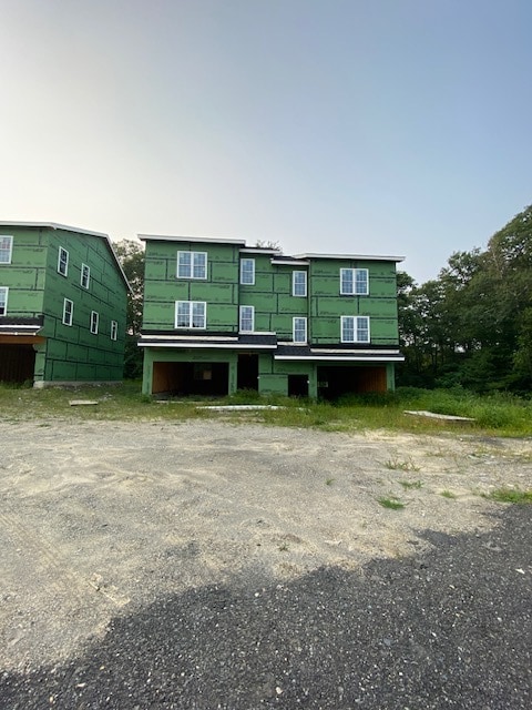
Property Record
47R 4Th St, Worcester, MA 01602

NEARBY LISTINGS FOR SALE OR LEASE
Property Detail
47R 4Th St
WORC-000042-000035-000100
Worcester
Multifamilydwelling
Massachusetts
X
100
25027C0613E
2.51 AC
2025
Webster Square
2025
Boston
731002
Worcester, MA
DEMOGRAPHICS near 47R 4Th St
1 Mile
3 Mile
5 Mile
2024 Total Population
13,759
106,077
208,736
2029 Population
13,904
107,049
211,224
Pop Growth 2024-2029
+ 1.05%
+ 0.92%
+ 1.19%
Average Age
39
38
39
2024 Total Households
4,856
40,606
81,490
HH Growth 2024-2029
+ 1.15%
+ 1.03%
+ 1.29%
Median Household Inc
$74,952
$67,113
$74,135
Avg Household Size
2.50
2.40
2.40
2024 Avg HH Vehicles
2.00
1.00
1.00
Median Home Value
$348,422
$387,013
$389,262
Median Year Built
1962
1948
1951
Nearby Places
Map Layers
Map Styles
 Street
 Aerial
- Restaurants
- Banks
- Shops
- Fitness
- Groceries
PUBLIC TRANSPORTATION
COMMUTER RAIL
Worcester Union Station (Lake Shore Limited - Amtrak)
DRIVE
WALK
Distance
Worcester Union Station (Lake Shore Limited - Amtrak)
7 min
3.8 mi
Worcester (Framingham/Worcester Line - Massachusetts Bay Transportation Authority Commuter Rail (Purple Line))
DRIVE
WALK
Distance
Worcester (Framingham/Worcester Line - Massachusetts Bay Transportation Authority Commuter Rail (Purple Line))
7 min
4.0 mi
AIRPORT
Worcester Regional
DRIVE
WALK
Distance
Worcester Regional
9 min
3.6 mi
Freight Ports
Port of Boston
DRIVE
WALK
Distance
Port of Boston
67 min
49.1 mi
SALE & LEASE HISTORY
LISTING DATE
SALE/LEASE

Dec 23, 2025
For Sale
Nearby Properties
Address
Land Use
TOTAL SIZE
Lot Size
Zoning
Address
Land Use
TOTAL SIZE
Lot Size
Zoning
669,637 SF
17.46 AC
BG-6
Address
Land Use
TOTAL SIZE
Lot Size
Zoning
49.08 AC
SA
Address
Land Use
TOTAL SIZE
Lot Size
Zoning
49.51 AC
IN-S
Address
Land Use
TOTAL SIZE
Lot Size
Zoning
381,440 SF
2.74 AC
BG-6
Address
Land Use
TOTAL SIZE
Lot Size
Zoning
612,538 SF
3.98 AC
BG-6
Address
Land Use
TOTAL SIZE
Lot Size
Zoning
244,486 SF
42.64 AC
RL-7
Address
Land Use
TOTAL SIZE
Lot Size
Zoning
142.98 AC
Address
Land Use
TOTAL SIZE
Lot Size
Zoning
3.85 AC
RG-5
Address
Land Use
TOTAL SIZE
Lot Size
Zoning
117,645 SF
3.11 AC
BO-1
Address
Land Use
TOTAL SIZE
Lot Size
Zoning
311,604 SF
2.37 AC
MG-2
Address
Land Use
TOTAL SIZE
Lot Size
Zoning
16,404 SF
10.80 AC
RS-10
Address
Land Use
TOTAL SIZE
Lot Size
Zoning
1,760 SF
105.54 AC
ML10
Address
Land Use
TOTAL SIZE
Lot Size
Zoning
157,385 SF
3.45 AC
BG-6
Address
Land Use
TOTAL SIZE
Lot Size
Zoning
177.12 AC
RL-7
Address
Land Use
TOTAL SIZE
Lot Size
Zoning
3.55 AC
RG-5
Address
Land Use
TOTAL SIZE
Lot Size
Zoning
69.46 AC
RS-7
Address
Land Use
TOTAL SIZE
Lot Size
Zoning
159,355 SF
207.62 AC
RL-7
Address
Land Use
TOTAL SIZE
Lot Size
Zoning
3.43 AC
ML10
Address
Land Use
TOTAL SIZE
Lot Size
Zoning
3.97 AC
BG-6
Address
Land Use
TOTAL SIZE
Lot Size
Zoning
181,408 SF
1.50 AC
BG-6
Address
Land Use
TOTAL SIZE
Lot Size
Zoning
41.84 AC
Address
Land Use
TOTAL SIZE
Lot Size
Zoning
643,250 SF
35.17 AC
RL-7
Address
Land Use
TOTAL SIZE
Lot Size
Zoning
175,200 SF
2.26 AC
BL-1
Address
Land Use
TOTAL SIZE
Lot Size
Zoning
120,732 SF
28.92 AC
RS-10
Address
Land Use
TOTAL SIZE
Lot Size
Zoning
121,780 SF
1.39 AC
BG-6
Address
Land Use
TOTAL SIZE
Lot Size
Zoning
2.78 AC
MG-2
Address
Land Use
TOTAL SIZE
Lot Size
Zoning
188,980 SF
20 AC
RL-7
Address
Land Use
TOTAL SIZE
Lot Size
Zoning
64,709 SF
1.80 AC
RS-10
Address
Land Use
TOTAL SIZE
Lot Size
Zoning
221,400 SF
4.66 AC
ML40
Address
Land Use
TOTAL SIZE
Lot Size
Zoning
115,117 SF
1.53 AC
BG10
The World's #1 Commercial Real Estate Marketplace
Connect with us
© 2026 CoStar Group
The information above has been obtained from sources believed reliable. While we do not doubt its accuracy we have not verified it and make no guarantee, warranty or representation about it. It is your responsibility to independently confirm its accuracy and completeness. Any projections, opinions, assumptions, or estimates used are for example only and do not represent the current or future performance of the property. The value of this transaction to you depends on tax and other factors which should be evaluated by your tax, financial, and legal advisors. You and your advisors should conduct a careful, independent investigation of the property to determine to your satisfaction the suitability of the property for your needs.