Property Record
48 Marway Cir, Rochester, NY 14624


NEARBY LISTINGS FOR SALE OR LEASE
Property Detail
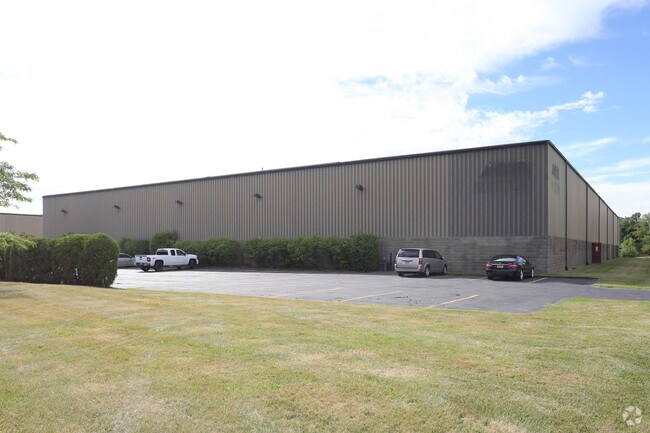
48 Marway Cir
262600 119.17-1-6.1
TWP 1 SHT RNG WESTMAR PARK RESUB L304 P17 MAY 2,2000
Manufacturinglight
Monroe
X
New York
36055C0189G
6.100
2024
7.52 AC
2024
Southwest
014202
Rochester
53,755 SF
Rochester, NY
DEMOGRAPHICS near 48 Marway Cir
1 Mile
3 Mile
5 Mile
2024 Total Population
3,966
50,471
161,752
2029 Population
3,907
49,672
159,163
Pop Growth 2024-2029
(1.49%)
(1.58%)
(1.60%)
Average Age
47
42
38
2024 Total Households
1,706
21,438
64,178
HH Growth 2024-2029
(1.64%)
(1.71%)
(1.71%)
Median Household Inc
$73,303
$68,974
$54,685
Avg Household Size
2.20
2.30
2.30
2024 Avg HH Vehicles
2.00
2.00
1.00
Median Home Value
$150,929
$146,190
$142,549
Median Year Built
1968
1965
1960
Nearby Places
Map Layers
Map Styles
 Street
 Aerial
- Restaurants
- Banks
- Shops
- Fitness
- Groceries
PUBLIC TRANSPORTATION
COMMUTER RAIL
Rochester (Empire Service - VIA Rail, Lake Shore Limited - VIA Rail, Maple Leaf - VIA Rail, Toronto - New York - VIA Rail)
DRIVE
WALK
Distance
Rochester (Empire Service - VIA Rail, Lake Shore Limited - VIA Rail, Maple Leaf - VIA Rail, Toronto - New York - VIA Rail)
12 min
8.0 mi
AIRPORT
Frederick Douglass/Greater Rochester International
DRIVE
WALK
Distance
Frederick Douglass/Greater Rochester International
9 min
5.6 mi
Freight Ports
Albany, NY Port
DRIVE
WALK
Distance
Albany, NY Port
275 min
231.2 mi
SALE & LEASE HISTORY
LISTING DATE
SALE/LEASE

Oct 21, 2019
For Lease
Nov 14, 2016
For Lease
Nearby Properties
Address
Land Use
TOTAL SIZE
Lot Size
Zoning
Address
Land Use
TOTAL SIZE
Lot Size
Zoning
796,051 SF
100.85 AC
06 - INDUS
Address
Land Use
TOTAL SIZE
Lot Size
Zoning
Address
Land Use
TOTAL SIZE
Lot Size
Zoning
Address
Land Use
TOTAL SIZE
Lot Size
Zoning
628,572 SF
134.14 AC
06 - INDUS
Address
Land Use
TOTAL SIZE
Lot Size
Zoning
348,895 SF
76.07 AC
06 - INDUS
Address
Land Use
TOTAL SIZE
Lot Size
Zoning
11,408 SF
98.28 AC
02 - SINGL
Address
Land Use
TOTAL SIZE
Lot Size
Zoning
522,321 SF
95.70 AC
06 - INDUS
Address
Land Use
TOTAL SIZE
Lot Size
Zoning
2,080 SF
14.39 AC
03 - MULTI
Address
Land Use
TOTAL SIZE
Lot Size
Zoning
18,496 SF
19.38 AC
03 - MULTI
Address
Land Use
TOTAL SIZE
Lot Size
Zoning
540,000 SF
39.70 AC
06 - INDUS
Address
Land Use
TOTAL SIZE
Lot Size
Zoning
63,134 SF
7.46 AC
02 - SINGL
Address
Land Use
TOTAL SIZE
Lot Size
Zoning
3,780 SF
33.10 AC
02 - SINGL
Address
Land Use
TOTAL SIZE
Lot Size
Zoning
1,440 SF
5.40 AC
02 - SINGL
Address
Land Use
TOTAL SIZE
Lot Size
Zoning
671,599 SF
33.10 AC
06 - INDUS
Address
Land Use
TOTAL SIZE
Lot Size
Zoning
109,772 SF
10.42 AC
06 - INDUS
Address
Land Use
TOTAL SIZE
Lot Size
Zoning
97,320 SF
19.54 AC
05 - COMME
Address
Land Use
TOTAL SIZE
Lot Size
Zoning
201,774 SF
17.17 AC
05 - COMME
Address
Land Use
TOTAL SIZE
Lot Size
Zoning
14,268 SF
36.20 AC
MFR
Address
Land Use
TOTAL SIZE
Lot Size
Zoning
99,886 SF
18.28 AC
05 - COMME
Address
Land Use
TOTAL SIZE
Lot Size
Zoning
22,116 SF
42.83 AC
02 - SINGL
Address
Land Use
TOTAL SIZE
Lot Size
Zoning
6,960 SF
20.31 AC
02 - SINGL
Address
Land Use
TOTAL SIZE
Lot Size
Zoning
119,706 SF
16.43 AC
05 - COMME
Address
Land Use
TOTAL SIZE
Lot Size
Zoning
127,786 SF
11.31 AC
05 - COMME
Address
Land Use
TOTAL SIZE
Lot Size
Zoning
290 AC
06 - INDUS
Address
Land Use
TOTAL SIZE
Lot Size
Zoning
23,940 SF
6.45 AC
05 - COMME
Address
Land Use
TOTAL SIZE
Lot Size
Zoning
44,132 SF
30.45 AC
06 - INDUS
Address
Land Use
TOTAL SIZE
Lot Size
Zoning
4,448 SF
18.78 AC
05 - COMME
Address
Land Use
TOTAL SIZE
Lot Size
Zoning
186,687 SF
13.90 AC
LI
Address
Land Use
TOTAL SIZE
Lot Size
Zoning
62,915 SF
6.77 AC
02 - SINGL
Address
Land Use
TOTAL SIZE
Lot Size
Zoning
7,490 SF
50.50 AC
06 - INDUS
The World's #1 Commercial Real Estate Marketplace
Connect with us
© 2026 CoStar Group
The information above has been obtained from sources believed reliable. While we do not doubt its accuracy we have not verified it and make no guarantee, warranty or representation about it. It is your responsibility to independently confirm its accuracy and completeness. Any projections, opinions, assumptions, or estimates used are for example only and do not represent the current or future performance of the property. The value of this transaction to you depends on tax and other factors which should be evaluated by your tax, financial, and legal advisors. You and your advisors should conduct a careful, independent investigation of the property to determine to your satisfaction the suitability of the property for your needs.