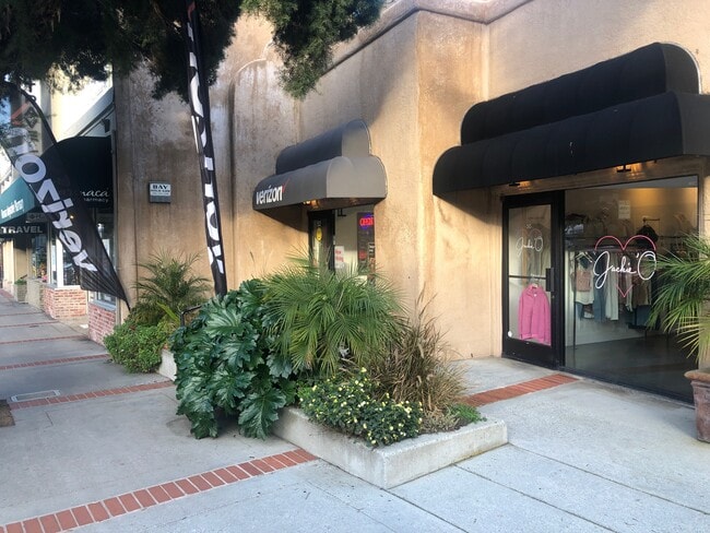
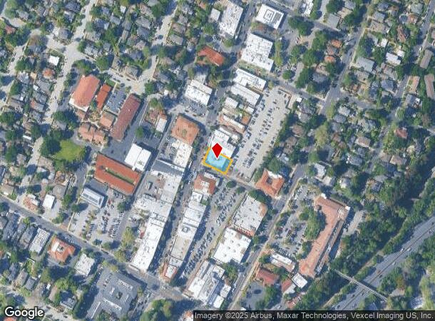
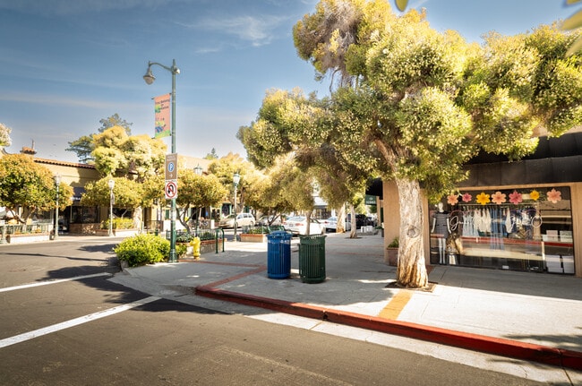
Property Record
52 N Santa Cruz Ave, Los Gatos, CA 95030

NEARBY LISTINGS FOR SALE OR LEASE
Property Detail
52 N Santa Cruz Ave
529-03-035
Lyndons
Storebuilding
Santa Clara
X
California
06087C0150E
0.21 AC
2024
Los Gatos/Saratoga
2025
South Bay/San Jose
507004
San Jose-Sunnyvale-Santa Clara, CA
4,401 SF
DEMOGRAPHICS near 52 N Santa Cruz Ave
1 Mile
3 Mile
5 Mile
2024 Total Population
10,502
45,615
169,867
2029 Population
10,187
43,916
163,151
Pop Growth 2024-2029
(3.00%)
(3.72%)
(3.95%)
Average Age
45
45
42
2024 Total Households
4,404
17,276
61,343
HH Growth 2024-2029
(3.34%)
(3.98%)
(4.22%)
Median Household Inc
$183,718
$196,700
$176,329
Avg Household Size
2.40
2.60
2.70
2024 Avg HH Vehicles
2.00
2.00
2.00
Median Home Value
$1,142,355
$1,139,579
$1,134,906
Median Year Built
1964
1969
1967
Nearby Places
- Restaurants
- Banks
- Shops
- Fitness
- Groceries
PUBLIC TRANSPORTATION
AIRPORT
Norman Y Mineta San Jose International
DRIVE
WALK
Distance
Norman Y Mineta San Jose International
18 min
12.1 mi
San Francisco International
DRIVE
WALK
Distance
San Francisco International
52 min
41.0 mi
Freight Ports
Port of Redwood City
DRIVE
WALK
Distance
Port of Redwood City
37 min
27.9 mi
SALE & LEASE HISTORY
LISTING DATE
SALE/LEASE

Jun 11, 2025
For Lease
Jan 30, 2020
For Lease
Aug 09, 2023
For Lease
Apr 25, 2024
For Lease
Nearby Properties
Address
Land Use
TOTAL SIZE
Lot Size
Zoning
Address
Land Use
TOTAL SIZE
Lot Size
Zoning
13.17 AC
C1
Address
Land Use
TOTAL SIZE
Lot Size
Zoning
148,429 SF
0.97 AC
CMPD
Address
Land Use
TOTAL SIZE
Lot Size
Zoning
147,459 SF
0.97 AC
CMPD
Address
Land Use
TOTAL SIZE
Lot Size
Zoning
290,688 SF
8.45 AC
APD
Address
Land Use
TOTAL SIZE
Lot Size
Zoning
112,470 SF
1 AC
CMPD
Address
Land Use
TOTAL SIZE
Lot Size
Zoning
113,500 SF
0.99 AC
ASP
Address
Land Use
TOTAL SIZE
Lot Size
Zoning
115,528 SF
5.32 AC
C1
Address
Land Use
TOTAL SIZE
Lot Size
Zoning
162,265 SF
6.80 AC
O
Address
Land Use
TOTAL SIZE
Lot Size
Zoning
72,000 SF
4.46 AC
C-M
Address
Land Use
TOTAL SIZE
Lot Size
Zoning
1.27 AC
CO
Address
Land Use
TOTAL SIZE
Lot Size
Zoning
195,565 SF
25.03 AC
R140
Address
Land Use
TOTAL SIZE
Lot Size
Zoning
124,360 SF
10.48 AC
R140
Address
Land Use
TOTAL SIZE
Lot Size
Zoning
10.60 AC
RM
Address
Land Use
TOTAL SIZE
Lot Size
Zoning
102,759 SF
5.18 AC
RM520
Address
Land Use
TOTAL SIZE
Lot Size
Zoning
43,400 SF
8.86 AC
RM512
Address
Land Use
TOTAL SIZE
Lot Size
Zoning
58,366 SF
3.49 AC
CO
Address
Land Use
TOTAL SIZE
Lot Size
Zoning
111,257 SF
7.48 AC
IP
Address
Land Use
TOTAL SIZE
Lot Size
Zoning
6,514 SF
2.72 AC
O
Address
Land Use
TOTAL SIZE
Lot Size
Zoning
47,182 SF
3.77 AC
CH
Address
Land Use
TOTAL SIZE
Lot Size
Zoning
109,110 SF
4.18 AC
C2:LH
Address
Land Use
TOTAL SIZE
Lot Size
Zoning
8.89 AC
RM520
Address
Land Use
TOTAL SIZE
Lot Size
Zoning
27,225 SF
2.82 AC
C1
Address
Land Use
TOTAL SIZE
Lot Size
Zoning
40,000 SF
2.03 AC
CH:PD
Address
Land Use
TOTAL SIZE
Lot Size
Zoning
85,435 SF
7.22 AC
CMPD
Address
Land Use
TOTAL SIZE
Lot Size
Zoning
28.72 AC
R1
Address
Land Use
TOTAL SIZE
Lot Size
Zoning
62,109 SF
3.03 AC
LM
Address
Land Use
TOTAL SIZE
Lot Size
Zoning
Address
Land Use
TOTAL SIZE
Lot Size
Zoning
8.57 AC
HR
Address
Land Use
TOTAL SIZE
Lot Size
Zoning
80,745 SF
1.88 AC
CM
Address
Land Use
TOTAL SIZE
Lot Size
Zoning
82,283 SF
0.75 AC
CM
The World's #1 Commercial Real Estate Marketplace
Connect with us
© 2025 CoStar Group
The information above has been obtained from sources believed reliable. While we do not doubt its accuracy we have not verified it and make no guarantee, warranty or representation about it. It is your responsibility to independently confirm its accuracy and completeness. Any projections, opinions, assumptions, or estimates used are for example only and do not represent the current or future performance of the property. The value of this transaction to you depends on tax and other factors which should be evaluated by your tax, financial, and legal advisors. You and your advisors should conduct a careful, independent investigation of the property to determine to your satisfaction the suitability of the property for your needs.