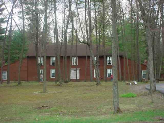
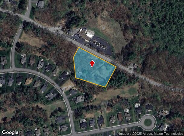
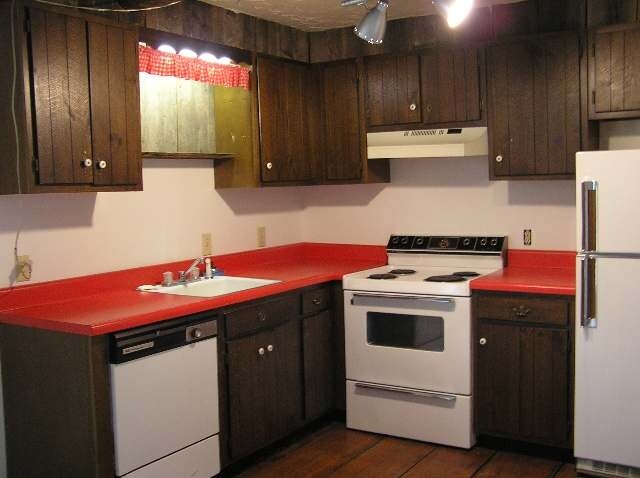
Property Record
48 State Route 9P Rd, Ballston Spa, NY 12020

NEARBY LISTINGS FOR SALE OR LEASE
Property Detail
48 State Route 9P Rd
Albany-Schenectady-Troy, NY
Saratoga
414089-218-000-0001-031-000-0000
New York
Apartment
31.000
2025
2.11 AC
2024
Outer Saratoga County
061905
Albany/Schenectady/Troy
4,536 SF
DEMOGRAPHICS near 48 State Route 9P Rd
1 Mile
3 Mile
5 Mile
2024 Total Population
2,560
13,618
38,698
2029 Population
2,699
14,184
40,436
Pop Growth 2024-2029
+ 5.43%
+ 4.16%
+ 4.49%
Average Age
43
43
43
2024 Total Households
1,210
6,102
16,954
HH Growth 2024-2029
+ 5.45%
+ 4.06%
+ 4.45%
Median Household Inc
$98,386
$98,485
$92,024
Avg Household Size
2.10
2.20
2.20
2024 Avg HH Vehicles
2.00
2.00
2.00
Median Home Value
$277,178
$300,539
$308,543
Median Year Built
1993
1991
1988
Nearby Places
- Restaurants
- Banks
- Shops
- Fitness
- Groceries
PUBLIC TRANSPORTATION
COMMUTER RAIL
Saratoga Springs Amtrak Station (Adirondack - Amtrak, Ethan Allen Express - Amtrak)
DRIVE
WALK
Distance
Saratoga Springs Amtrak Station (Adirondack - Amtrak, Ethan Allen Express - Amtrak)
14 min
8.4 mi
AIRPORT
Albany International
DRIVE
WALK
Distance
Albany International
28 min
20.6 mi
Freight Ports
Albany, NY Port
DRIVE
WALK
Distance
Albany, NY Port
44 min
31.1 mi
Nearby Properties
Address
Land Use
TOTAL SIZE
Lot Size
Zoning
Address
Land Use
TOTAL SIZE
Lot Size
Zoning
1,491,280 SF
163.04 AC
PDD
Address
Land Use
TOTAL SIZE
Lot Size
Zoning
131,572 SF
9.96 AC
C1
Address
Land Use
TOTAL SIZE
Lot Size
Zoning
11,884 SF
25.60 AC
RA-3
Address
Land Use
TOTAL SIZE
Lot Size
Zoning
10,322 SF
29.43 AC
PDD
Address
Land Use
TOTAL SIZE
Lot Size
Zoning
79,653 SF
8.84 AC
Address
Land Use
TOTAL SIZE
Lot Size
Zoning
3,030 SF
17.71 AC
PDD
Address
Land Use
TOTAL SIZE
Lot Size
Zoning
310,018 SF
58.71 AC
PDD
Address
Land Use
TOTAL SIZE
Lot Size
Zoning
952 SF
103.36 AC
Address
Land Use
TOTAL SIZE
Lot Size
Zoning
128,767 SF
16.51 AC
PDD
Address
Land Use
TOTAL SIZE
Lot Size
Zoning
1,377 SF
75.07 AC
Address
Land Use
TOTAL SIZE
Lot Size
Zoning
40,569 SF
7.90 AC
PDD
Address
Land Use
TOTAL SIZE
Lot Size
Zoning
102,726 SF
0.01 AC
C3
Address
Land Use
TOTAL SIZE
Lot Size
Zoning
59,652 SF
PDD
Address
Land Use
TOTAL SIZE
Lot Size
Zoning
101,312 SF
6 AC
C3
Address
Land Use
TOTAL SIZE
Lot Size
Zoning
101,312 SF
6 AC
C3
Address
Land Use
TOTAL SIZE
Lot Size
Zoning
12,923 SF
3.92 AC
PDD
Address
Land Use
TOTAL SIZE
Lot Size
Zoning
86,475 SF
0.14 AC
PDD
Address
Land Use
TOTAL SIZE
Lot Size
Zoning
5,248 SF
16.35 AC
PDD
Address
Land Use
TOTAL SIZE
Lot Size
Zoning
43,856 SF
235.70 AC
C3
Address
Land Use
TOTAL SIZE
Lot Size
Zoning
43,856 SF
235.70 AC
C3
Address
Land Use
TOTAL SIZE
Lot Size
Zoning
10,700 SF
36.54 AC
DN-4
Address
Land Use
TOTAL SIZE
Lot Size
Zoning
120,000 SF
PDD
Address
Land Use
TOTAL SIZE
Lot Size
Zoning
14,136 SF
20.64 AC
BP
Address
Land Use
TOTAL SIZE
Lot Size
Zoning
23,351 SF
134.48 AC
PDD
Address
Land Use
TOTAL SIZE
Lot Size
Zoning
600 SF
50.28 AC
R3
Address
Land Use
TOTAL SIZE
Lot Size
Zoning
58,692 SF
2.06 AC
PDD
Address
Land Use
TOTAL SIZE
Lot Size
Zoning
61,786 SF
0.78 AC
PDD
Address
Land Use
TOTAL SIZE
Lot Size
Zoning
53,752 SF
9.68 AC
C2&RT67
Address
Land Use
TOTAL SIZE
Lot Size
Zoning
58,334 SF
7.96 AC
PDD
Address
Land Use
TOTAL SIZE
Lot Size
Zoning
23,280 SF
25.19 AC
PDD
The World's #1 Commercial Real Estate Marketplace
Connect with us
© 2025 CoStar Group
The information above has been obtained from sources believed reliable. While we do not doubt its accuracy we have not verified it and make no guarantee, warranty or representation about it. It is your responsibility to independently confirm its accuracy and completeness. Any projections, opinions, assumptions, or estimates used are for example only and do not represent the current or future performance of the property. The value of this transaction to you depends on tax and other factors which should be evaluated by your tax, financial, and legal advisors. You and your advisors should conduct a careful, independent investigation of the property to determine to your satisfaction the suitability of the property for your needs.