Property Record
480 Housatonic St, Lenox, MA 01240


NEARBY LISTINGS FOR SALE OR LEASE
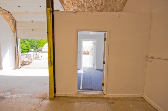
Property Detail
480 Housatonic St
LENO-000008-000102
Berkshire
Commercialbuilding
Massachusetts
2025
3.80 AC
2025
Massachusetts North/West Area
913100
Other Market Areas
5,040 SF
Pittsfield, MA
DEMOGRAPHICS near 480 Housatonic St
1 Mile
3 Mile
5 Mile
2024 Total Population
841
7,277
13,907
2029 Population
848
7,352
14,003
Pop Growth 2024-2029
+ 0.83%
+ 1.03%
+ 0.69%
Average Age
48
51
50
2024 Total Households
358
3,446
6,414
HH Growth 2024-2029
+ 0.56%
+ 1.02%
+ 0.73%
Median Household Inc
$129,573
$74,858
$75,907
Avg Household Size
2.20
2.00
2.00
2024 Avg HH Vehicles
2.00
2.00
2.00
Median Home Value
$376,723
$337,646
$336,723
Median Year Built
1965
1964
1964
Nearby Places
Map Layers
Map Styles
 Street
 Aerial
- Restaurants
- Banks
- Shops
- Fitness
- Groceries
PUBLIC TRANSPORTATION
COMMUTER RAIL
Pittsfield Amtrak Station (Empire Service - Amtrak, Lake Shore Limited - Amtrak)
DRIVE
WALK
Distance
Pittsfield Amtrak Station (Empire Service - Amtrak, Lake Shore Limited - Amtrak)
17 min
8.3 mi
Freight Ports
Albany, NY Port
DRIVE
WALK
Distance
Albany, NY Port
67 min
48.4 mi
SALE & LEASE HISTORY
LISTING DATE
SALE/LEASE

Jun 06, 2019
For Sale
Nearby Properties
Address
Land Use
TOTAL SIZE
Lot Size
Zoning
Address
Land Use
TOTAL SIZE
Lot Size
Zoning
27,163 SF
43.27 AC
R-1A
Address
Land Use
TOTAL SIZE
Lot Size
Zoning
91.73 AC
R-1A
Address
Land Use
TOTAL SIZE
Lot Size
Zoning
60.39 AC
R-1A
Address
Land Use
TOTAL SIZE
Lot Size
Zoning
29.60 AC
R-1A
Address
Land Use
TOTAL SIZE
Lot Size
Zoning
87.50 AC
R-1A
Address
Land Use
TOTAL SIZE
Lot Size
Zoning
59,169 SF
10.10 AC
R-1A
Address
Land Use
TOTAL SIZE
Lot Size
Zoning
57,676 SF
6.68 AC
C-3A
Address
Land Use
TOTAL SIZE
Lot Size
Zoning
19,286 SF
32.70 AC
R-1A
Address
Land Use
TOTAL SIZE
Lot Size
Zoning
61,851 SF
13.20 AC
RB
Address
Land Use
TOTAL SIZE
Lot Size
Zoning
86 AC
R4
Address
Land Use
TOTAL SIZE
Lot Size
Zoning
30,003 SF
56 AC
R-1A
Address
Land Use
TOTAL SIZE
Lot Size
Zoning
12.16 AC
R-1A
Address
Land Use
TOTAL SIZE
Lot Size
Zoning
1.90 AC
COMMER
Address
Land Use
TOTAL SIZE
Lot Size
Zoning
54,323 SF
3.50 AC
R20
Address
Land Use
TOTAL SIZE
Lot Size
Zoning
48 AC
R-1A
Address
Land Use
TOTAL SIZE
Lot Size
Zoning
49,256 SF
7 AC
RA40
Address
Land Use
TOTAL SIZE
Lot Size
Zoning
12.76 AC
R-1A
Address
Land Use
TOTAL SIZE
Lot Size
Zoning
64,836 SF
11.05 AC
C-3A
Address
Land Use
TOTAL SIZE
Lot Size
Zoning
2,295.68 AC
R1
Address
Land Use
TOTAL SIZE
Lot Size
Zoning
38,500 SF
4.80 AC
R-15
Address
Land Use
TOTAL SIZE
Lot Size
Zoning
7.79 AC
R-30
Address
Land Use
TOTAL SIZE
Lot Size
Zoning
18.74 AC
R-1A
Address
Land Use
TOTAL SIZE
Lot Size
Zoning
7.60 AC
R-1A
Address
Land Use
TOTAL SIZE
Lot Size
Zoning
7,136 SF
31.10 AC
C-3A
Address
Land Use
TOTAL SIZE
Lot Size
Zoning
312.94 AC
R-1A
Address
Land Use
TOTAL SIZE
Lot Size
Zoning
3,808 SF
1.87 AC
DCBC
Address
Land Use
TOTAL SIZE
Lot Size
Zoning
112,374 SF
19.30 AC
INDUST
Address
Land Use
TOTAL SIZE
Lot Size
Zoning
19,364 SF
21.25 AC
R4
Address
Land Use
TOTAL SIZE
Lot Size
Zoning
192,156 SF
37.82 AC
I
Address
Land Use
TOTAL SIZE
Lot Size
Zoning
4,749 SF
13.70 AC
R4
The World's #1 Commercial Real Estate Marketplace
Connect with us
© 2026 CoStar Group
The information above has been obtained from sources believed reliable. While we do not doubt its accuracy we have not verified it and make no guarantee, warranty or representation about it. It is your responsibility to independently confirm its accuracy and completeness. Any projections, opinions, assumptions, or estimates used are for example only and do not represent the current or future performance of the property. The value of this transaction to you depends on tax and other factors which should be evaluated by your tax, financial, and legal advisors. You and your advisors should conduct a careful, independent investigation of the property to determine to your satisfaction the suitability of the property for your needs.