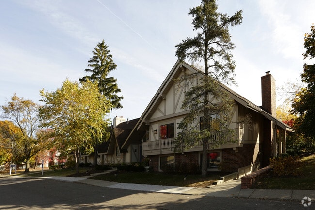
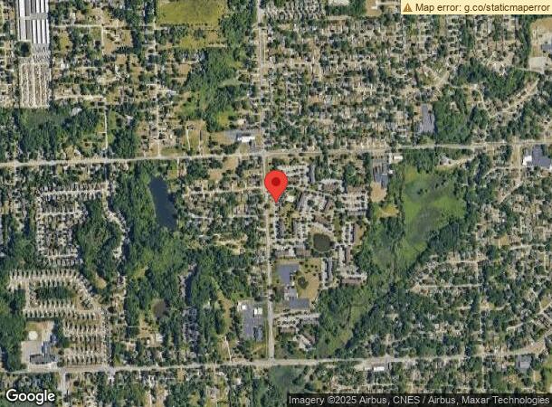
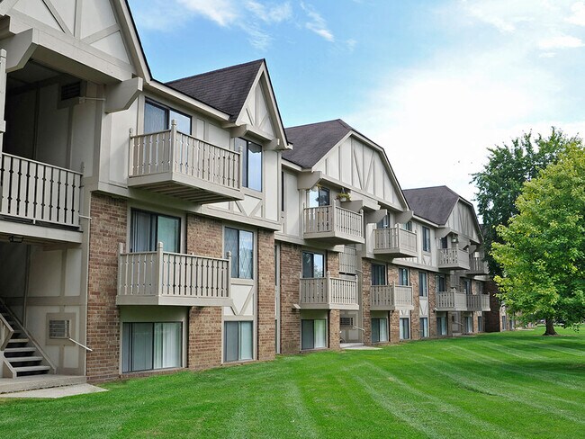
Property Record
480 Maplebrook Ln, Waterford, MI 48327
NEARBY LISTINGS FOR SALE OR LEASE
-
-
View all Waterford listings for sale on LoopNet.com
Property Detail
480 Maplebrook Ln
13-21-301-014
T3N, R9E, SEC 21 PART OF SW 1/4 BEG AT W 1/4 COR, TH S 89-54-27 E 679.44 FT, TH S 00-07-48 W 575.61 FT, TH S 24-37-37 W
Clubslodgesprofessionalassociations
Oakland
X
Michigan
26125C0344F
12.43 AC
2024
Waterford
2025
Detroit
144900
Detroit-Warren-Dearborn, MI
95,592 SF
DEMOGRAPHICS near 480 Maplebrook Ln
1 Mile
3 Mile
5 Mile
2024 Total Population
7,568
55,191
133,099
2029 Population
7,460
54,742
131,955
Pop Growth 2024-2029
(1.43%)
(0.81%)
(0.86%)
Average Age
42
42
43
2024 Total Households
3,589
23,920
56,633
HH Growth 2024-2029
(1.50%)
(0.82%)
(0.88%)
Median Household Inc
$55,555
$71,078
$74,387
Avg Household Size
2.10
2.20
2.30
2024 Avg HH Vehicles
2.00
2.00
2.00
Median Home Value
$186,547
$230,407
$250,713
Median Year Built
1973
1974
1971
Nearby Places
Map Layers
Map Styles
 Street
 Aerial
- Restaurants
- Banks
- Shops
- Fitness
- Groceries
PUBLIC TRANSPORTATION
COMMUTER RAIL
Pontiac Amtrak Station (Wolverine - Amtrak)
DRIVE
WALK
Distance
Pontiac Amtrak Station (Wolverine - Amtrak)
13 min
6.7 mi
AIRPORT
Bishop International
DRIVE
WALK
Distance
Bishop International
52 min
33.0 mi
Freight Ports
Port of Toledo
DRIVE
WALK
Distance
Port of Toledo
102 min
81.1 mi
Nearby Properties
Address
Land Use
TOTAL SIZE
Lot Size
Zoning
Address
Land Use
TOTAL SIZE
Lot Size
Zoning
232,743 SF
40 AC
BI
Address
Land Use
TOTAL SIZE
Lot Size
Zoning
426,034 SF
24.99 AC
AI
Address
Land Use
TOTAL SIZE
Lot Size
Zoning
300,934 SF
25.30 AC
AI
Address
Land Use
TOTAL SIZE
Lot Size
Zoning
178,417 SF
39.45 AC
Address
Land Use
TOTAL SIZE
Lot Size
Zoning
240,398 SF
23.50 AC
AI
Address
Land Use
TOTAL SIZE
Lot Size
Zoning
16,640 SF
13.07 AC
ME
Address
Land Use
TOTAL SIZE
Lot Size
Zoning
86,192 SF
19.27 AC
Address
Land Use
TOTAL SIZE
Lot Size
Zoning
219,124 SF
18.63 AC
AI
Address
Land Use
TOTAL SIZE
Lot Size
Zoning
415,169 SF
27.93 AC
II
Address
Land Use
TOTAL SIZE
Lot Size
Zoning
150,669 SF
16.57 AC
AI
Address
Land Use
TOTAL SIZE
Lot Size
Zoning
130,414 SF
10.75 AC
AI
Address
Land Use
TOTAL SIZE
Lot Size
Zoning
145,872 SF
14.81 AC
AI
Address
Land Use
TOTAL SIZE
Lot Size
Zoning
147,624 SF
6.59 AC
AI
Address
Land Use
TOTAL SIZE
Lot Size
Zoning
151,611 SF
12.16 AC
AI
Address
Land Use
TOTAL SIZE
Lot Size
Zoning
126,844 SF
3.20 AC
ME
Address
Land Use
TOTAL SIZE
Lot Size
Zoning
235,395 SF
Address
Land Use
TOTAL SIZE
Lot Size
Zoning
93,541 SF
21.75 AC
SV
Address
Land Use
TOTAL SIZE
Lot Size
Zoning
93,555 SF
3.15 AC
AI
Address
Land Use
TOTAL SIZE
Lot Size
Zoning
235,395 SF
Address
Land Use
TOTAL SIZE
Lot Size
Zoning
205,961 SF
16.57 AC
II
Address
Land Use
TOTAL SIZE
Lot Size
Zoning
105,874 SF
13.07 AC
BI
Address
Land Use
TOTAL SIZE
Lot Size
Zoning
235,395 SF
37.19 AC
Address
Land Use
TOTAL SIZE
Lot Size
Zoning
235,395 SF
34.42 AC
Address
Land Use
TOTAL SIZE
Lot Size
Zoning
102,042 SF
7.07 AC
AI
Address
Land Use
TOTAL SIZE
Lot Size
Zoning
65,034 SF
10.28 AC
AI
Address
Land Use
TOTAL SIZE
Lot Size
Zoning
120,132 SF
9.29 AC
AI
Address
Land Use
TOTAL SIZE
Lot Size
Zoning
104,296 SF
11.10 AC
BI
Address
Land Use
TOTAL SIZE
Lot Size
Zoning
105,312 SF
12.64 AC
AI
Address
Land Use
TOTAL SIZE
Lot Size
Zoning
91,921 SF
2.51 AC
BI
The World's #1 Commercial Real Estate Marketplace
Connect with us
© 2026 CoStar Group
The information above has been obtained from sources believed reliable. While we do not doubt its accuracy we have not verified it and make no guarantee, warranty or representation about it. It is your responsibility to independently confirm its accuracy and completeness. Any projections, opinions, assumptions, or estimates used are for example only and do not represent the current or future performance of the property. The value of this transaction to you depends on tax and other factors which should be evaluated by your tax, financial, and legal advisors. You and your advisors should conduct a careful, independent investigation of the property to determine to your satisfaction the suitability of the property for your needs.