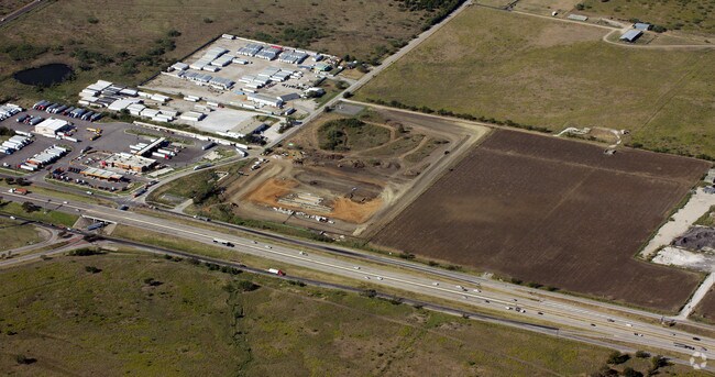
Property Record
4800 Barthold Rd, Denton, TX 76207

Property Detail
4800 Barthold Rd
Dallas-Fort Worth-Arlington, TX
BLUE BEACON INTERNATIONAL ADDITION BLK A LOT 1(PT)
R754965
DENTON
Commercialnec
Texas
B and X Area of moderate flood hazard, usually the area between the limits of the 100-year and 500-year floods.
1
2024
9.52 AC
2025
Denton
020405
Dallas/Ft Worth
9,591 SF
NEARBY LISTINGS FOR SALE OR LEASE
-
-
View all Denton listings for sale on LoopNet.com
DEMOGRAPHICS near 4800 Barthold Rd
1 mile
3 mile
5 mile
2025 Total Population
35
20,479
82,483
2030 Population
40
23,506
93,328
Pop Growth 2025-2030
+ 14.29%
+ 14.78%
+ 13.15%
Average Age
40
39
35
2025 Total Households
12
7,993
32,746
HH Growth 2025-2030
+ 16.67%
+ 15.13%
+ 13.51%
Median Household Inc
$118,749
$87,099
$65,415
Avg Household Size
2.60
2.50
2.30
2025 Avg HH Vehicles
2.00
2.00
2.00
Median Home Value
$374,999
$335,439
$322,236
Median Year Built
2010
2002
1988
Nearby Places
Map Layers
Map Styles
 Street
 Aerial
Layers
 Traffic
 Biking
Places
Listings with unknown addresses are not visible on the map
- Restaurants
- Banks
- Shops
- Fitness
- Groceries
PUBLIC TRANSPORTATION
COMMUTER RAIL
Downtown Denton Transit Center (A-train - Denton County Transportation Authority)
Drive
Walk
Distance
Downtown Denton Transit Center (A-train - Denton County Transportation Authority)
11 min
5.7 mi
Medpark Station (A-train - Denton County Transportation Authority)
Drive
Walk
Distance
Medpark Station (A-train - Denton County Transportation Authority)
14 min
9.3 mi
AIRPORT
Dallas-Fort Worth International
Drive
Walk
Distance
Dallas-Fort Worth International
39 min
31.8 mi
Freight Ports
Port of Shreveport
Drive
Walk
Distance
Port of Shreveport
258 min
238.4 mi
Nearby Properties
Address
Land Use
TOTAL SIZE
Lot Size
Zoning
Address
Land Use
TOTAL SIZE
Lot Size
Zoning
490,000 SF
144.26 AC
Address
Land Use
TOTAL SIZE
Lot Size
Zoning
347,844 SF
14.09 AC
Address
Land Use
TOTAL SIZE
Lot Size
Zoning
1,121,760 SF
73.87 AC
Address
Land Use
TOTAL SIZE
Lot Size
Zoning
576,664 SF
189.26 AC
Address
Land Use
TOTAL SIZE
Lot Size
Zoning
368,434 SF
16.39 AC
Address
Land Use
TOTAL SIZE
Lot Size
Zoning
343,800 SF
10.95 AC
Address
Land Use
TOTAL SIZE
Lot Size
Zoning
373,498 SF
54.27 AC
Address
Land Use
TOTAL SIZE
Lot Size
Zoning
262,008 SF
11.11 AC
Address
Land Use
TOTAL SIZE
Lot Size
Zoning
285,578 SF
42.28 AC
Address
Land Use
TOTAL SIZE
Lot Size
Zoning
334,834 SF
11.95 AC
Address
Land Use
TOTAL SIZE
Lot Size
Zoning
298,744 SF
32.12 AC
Address
Land Use
TOTAL SIZE
Lot Size
Zoning
702,810 SF
37.91 AC
Address
Land Use
TOTAL SIZE
Lot Size
Zoning
216,314 SF
22.10 AC
Address
Land Use
TOTAL SIZE
Lot Size
Zoning
374,520 SF
23.62 AC
Address
Land Use
TOTAL SIZE
Lot Size
Zoning
216,321 SF
16.97 AC
Address
Land Use
TOTAL SIZE
Lot Size
Zoning
167,850 SF
48.14 AC
Address
Land Use
TOTAL SIZE
Lot Size
Zoning
213,040 SF
11.59 AC
Address
Land Use
TOTAL SIZE
Lot Size
Zoning
452,000 SF
23.94 AC
Address
Land Use
TOTAL SIZE
Lot Size
Zoning
448,514 SF
19.27 AC
Address
Land Use
TOTAL SIZE
Lot Size
Zoning
265,448 SF
6.67 AC
Address
Land Use
TOTAL SIZE
Lot Size
Zoning
367,488 SF
22.80 AC
Address
Land Use
TOTAL SIZE
Lot Size
Zoning
175,943 SF
5.88 AC
Address
Land Use
TOTAL SIZE
Lot Size
Zoning
141,468 SF
24.72 AC
Address
Land Use
TOTAL SIZE
Lot Size
Zoning
269,400 SF
22.20 AC
Address
Land Use
TOTAL SIZE
Lot Size
Zoning
164,211 SF
11.95 AC
Address
Land Use
TOTAL SIZE
Lot Size
Zoning
126,126 SF
9.45 AC
Address
Land Use
TOTAL SIZE
Lot Size
Zoning
86,702 SF
15.16 AC
Address
Land Use
TOTAL SIZE
Lot Size
Zoning
17,417 SF
143.72 AC
Address
Land Use
TOTAL SIZE
Lot Size
Zoning
190,380 SF
26.31 AC
Address
Land Use
TOTAL SIZE
Lot Size
Zoning
147,588 SF
7.77 AC
14G
The World's #1 Commercial Real Estate Marketplace
Connect with us
© 2026 CoStar Group
The information above has been obtained from sources believed reliable. While we do not doubt its accuracy we have not verified it and make no guarantee, warranty or representation about it. It is your responsibility to independently confirm its accuracy and completeness. Any projections, opinions, assumptions, or estimates used are for example only and do not represent the current or future performance of the property. The value of this transaction to you depends on tax and other factors which should be evaluated by your tax, financial, and legal advisors. You and your advisors should conduct a careful, independent investigation of the property to determine to your satisfaction the suitability of the property for your needs.