Property Record
4800 E I 240 Service Rd, Oklahoma City, OK 73135


NEARBY LISTINGS FOR SALE OR LEASE
Property Detail
4800 E I 240 Service Rd
Oklahoma City, OK
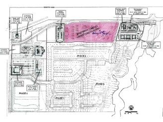
Sunny Pointe Sec 2
206122640
SUNNY POINTE SEC 2 012 000 PT OF LOT 1 BEG SE/C SD LOT TH W680.63FT NW82.46FT W189.55FT SW82.46FT W194.74FT N449.12FT LEFT ON CURVE NE140.11FT RIGHT ON CURVE NE145.96FT E892.07FT RIGHT ON CURVE E170.07FT SE30.39FT SW500.92FT TO BEG
Multifamilydwelling
Oklahoma
X
Oklahoma
40109C0320H
1
2023
12.98 AC
2024
South
107405
Oklahoma City
232,344 SF
DEMOGRAPHICS near 4800 E I 240 Service Rd
1 Mile
3 Mile
5 Mile
2024 Total Population
5,159
46,108
126,182
2029 Population
5,300
48,220
130,624
Pop Growth 2024-2029
+ 2.73%
+ 4.58%
+ 3.52%
Average Age
36
35
36
2024 Total Households
2,013
16,889
47,631
HH Growth 2024-2029
+ 2.98%
+ 4.50%
+ 3.50%
Median Household Inc
$64,227
$59,821
$54,450
Avg Household Size
2.50
2.60
2.50
2024 Avg HH Vehicles
2.00
2.00
2.00
Median Home Value
$164,337
$145,817
$133,662
Median Year Built
2000
1989
1976
Nearby Places
Map Layers
Map Styles
 Street
 Aerial
- Restaurants
- Banks
- Shops
- Fitness
- Groceries
PUBLIC TRANSPORTATION
COMMUTER RAIL
Oklahoma City (Heartland Flyer - Amtrak)
DRIVE
WALK
Distance
Oklahoma City (Heartland Flyer - Amtrak)
15 min
10.0 mi
AIRPORT
Will Rogers World
DRIVE
WALK
Distance
Will Rogers World
22 min
11.9 mi
Freight Ports
Tulsa Port Of Catoosa
DRIVE
WALK
Distance
Tulsa Port Of Catoosa
141 min
131.8 mi
Nearby Properties
Address
Land Use
TOTAL SIZE
Lot Size
Zoning
Address
Land Use
TOTAL SIZE
Lot Size
Zoning
7.39 AC
AA
Address
Land Use
TOTAL SIZE
Lot Size
Zoning
Address
Land Use
TOTAL SIZE
Lot Size
Zoning
32,004 SF
80.40 AC
PUD
Address
Land Use
TOTAL SIZE
Lot Size
Zoning
179,855 SF
36.19 AC
PUD
Address
Land Use
TOTAL SIZE
Lot Size
Zoning
320,100 SF
10.41 AC
I-2
Address
Land Use
TOTAL SIZE
Lot Size
Zoning
998,813 SF
167.96 AC
I-2
Address
Land Use
TOTAL SIZE
Lot Size
Zoning
70.01 AC
Address
Land Use
TOTAL SIZE
Lot Size
Zoning
292,188 SF
20.23 AC
Address
Land Use
TOTAL SIZE
Lot Size
Zoning
200,784 SF
9.28 AC
I-2
Address
Land Use
TOTAL SIZE
Lot Size
Zoning
35.11 AC
Address
Land Use
TOTAL SIZE
Lot Size
Zoning
296,429 SF
33.05 AC
I-2
Address
Land Use
TOTAL SIZE
Lot Size
Zoning
313,650 SF
44.50 AC
I-2
Address
Land Use
TOTAL SIZE
Lot Size
Zoning
78,452 SF
5.19 AC
I-2
Address
Land Use
TOTAL SIZE
Lot Size
Zoning
72,504 SF
3.76 AC
PUD
Address
Land Use
TOTAL SIZE
Lot Size
Zoning
40,481 SF
9.07 AC
I-2
Address
Land Use
TOTAL SIZE
Lot Size
Zoning
5.01 AC
A1
Address
Land Use
TOTAL SIZE
Lot Size
Zoning
7.95 AC
A1
Address
Land Use
TOTAL SIZE
Lot Size
Zoning
141,387 SF
41 AC
PUD
Address
Land Use
TOTAL SIZE
Lot Size
Zoning
90,798 SF
11.07 AC
Address
Land Use
TOTAL SIZE
Lot Size
Zoning
80,994 SF
7.64 AC
I-2
Address
Land Use
TOTAL SIZE
Lot Size
Zoning
38,430 SF
5.02 AC
PUD
Address
Land Use
TOTAL SIZE
Lot Size
Zoning
126,556 SF
6.74 AC
R-4
Address
Land Use
TOTAL SIZE
Lot Size
Zoning
1,200 SF
73.73 AC
Address
Land Use
TOTAL SIZE
Lot Size
Zoning
145,328 SF
14.95 AC
R-4
Address
Land Use
TOTAL SIZE
Lot Size
Zoning
209,552 SF
11.67 AC
R-4
Address
Land Use
TOTAL SIZE
Lot Size
Zoning
109,980 SF
6.99 AC
I-2
Address
Land Use
TOTAL SIZE
Lot Size
Zoning
Address
Land Use
TOTAL SIZE
Lot Size
Zoning
144,000 SF
17.72 AC
PUD
The World's #1 Commercial Real Estate Marketplace
Connect with us
© 2026 CoStar Group
The information above has been obtained from sources believed reliable. While we do not doubt its accuracy we have not verified it and make no guarantee, warranty or representation about it. It is your responsibility to independently confirm its accuracy and completeness. Any projections, opinions, assumptions, or estimates used are for example only and do not represent the current or future performance of the property. The value of this transaction to you depends on tax and other factors which should be evaluated by your tax, financial, and legal advisors. You and your advisors should conduct a careful, independent investigation of the property to determine to your satisfaction the suitability of the property for your needs.