Property Record
4800 E Rancier Ave, Killeen, TX 76543
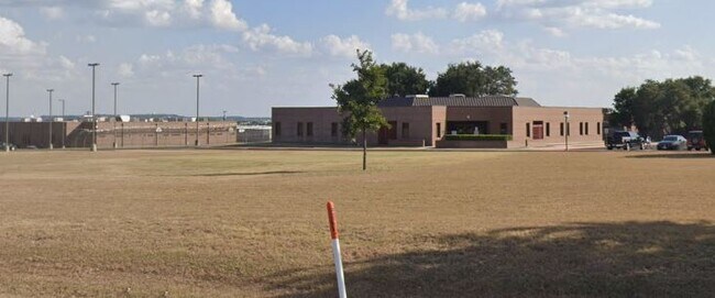

Property Detail
4800 E Rancier Ave
Killeen-Temple, TX
WOODS HEALTH CARE ADDITION, BLOCK 001, LOT PT 1, (N PT OF 1), ACRES 26.324
130658
Bell
Commercialnec
Texas
AE The base floodplain where base flood elevations are provided. AE Zones are now used on new format FIRMs instead of A1-A30 Zones.
1
0
26.32 AC
2025
Greater Killeen
022200
Killeen/Temple/Fort Hood
20,393 SF
NEARBY LISTINGS FOR SALE OR LEASE
DEMOGRAPHICS near 4800 E Rancier Ave
1 mile
3 mile
5 mile
2025 Total Population
10,876
50,046
135,315
2030 Population
11,491
53,192
143,404
Pop Growth 2025-2030
+ 5.65%
+ 6.29%
+ 5.98%
Average Age
33
35
34
2025 Total Households
4,500
20,297
51,169
HH Growth 2025-2030
+ 5.76%
+ 6.48%
+ 6.20%
Median Household Inc
$53,055
$51,224
$60,135
Avg Household Size
2.40
2.40
2.50
2025 Avg HH Vehicles
2.00
2.00
2.00
Median Home Value
$181,590
$160,591
$224,227
Median Year Built
1987
1983
1989
Nearby Places
Map Layers
Map Styles
 Street
 Aerial
Layers
 Traffic
 Biking
Places
Listings with unknown addresses are not visible on the map
- Restaurants
- Banks
- Shops
- Fitness
- Groceries
PUBLIC TRANSPORTATION
AIRPORT
Killeen Municipal
Drive
Walk
Distance
Killeen Municipal
9 min
3.3 mi
Robert Gray AAF
Drive
Walk
Distance
Robert Gray AAF
28 min
14.8 mi
Freight Ports
Port of Houston
Drive
Walk
Distance
Port of Houston
257 min
200.4 mi
Nearby Properties
Address
Land Use
TOTAL SIZE
Lot Size
Zoning
Address
Land Use
TOTAL SIZE
Lot Size
Zoning
4 SF
55.08 AC
Address
Land Use
TOTAL SIZE
Lot Size
Zoning
1 SF
7.81 AC
Address
Land Use
TOTAL SIZE
Lot Size
Zoning
194,952 SF
38.61 AC
Address
Land Use
TOTAL SIZE
Lot Size
Zoning
Address
Land Use
TOTAL SIZE
Lot Size
Zoning
200,345 SF
42.44 AC
CUP
Address
Land Use
TOTAL SIZE
Lot Size
Zoning
160,143 SF
13.30 AC
Address
Land Use
TOTAL SIZE
Lot Size
Zoning
151,969 SF
10 AC
R-3
Address
Land Use
TOTAL SIZE
Lot Size
Zoning
13,000 SF
31.72 AC
Address
Land Use
TOTAL SIZE
Lot Size
Zoning
146,182 SF
8.59 AC
Address
Land Use
TOTAL SIZE
Lot Size
Zoning
386,344 SF
171.40 AC
B-5
Address
Land Use
TOTAL SIZE
Lot Size
Zoning
132,202 SF
11.52 AC
R-3
Address
Land Use
TOTAL SIZE
Lot Size
Zoning
89,117 SF
5.31 AC
Address
Land Use
TOTAL SIZE
Lot Size
Zoning
62,226 SF
0.68 AC
Address
Land Use
TOTAL SIZE
Lot Size
Zoning
114,585 SF
4.64 AC
Address
Land Use
TOTAL SIZE
Lot Size
Zoning
121,285 SF
11.75 AC
Address
Land Use
TOTAL SIZE
Lot Size
Zoning
162,090 SF
8.28 AC
R-3
Address
Land Use
TOTAL SIZE
Lot Size
Zoning
366,112 SF
44.17 AC
Address
Land Use
TOTAL SIZE
Lot Size
Zoning
120,948 SF
32.68 AC
Address
Land Use
TOTAL SIZE
Lot Size
Zoning
152,393 SF
9.78 AC
Address
Land Use
TOTAL SIZE
Lot Size
Zoning
72,368 SF
9.34 AC
Address
Land Use
TOTAL SIZE
Lot Size
Zoning
1 SF
24.80 AC
Address
Land Use
TOTAL SIZE
Lot Size
Zoning
91,475 SF
11.33 AC
Address
Land Use
TOTAL SIZE
Lot Size
Zoning
112,176 SF
4.28 AC
Address
Land Use
TOTAL SIZE
Lot Size
Zoning
57,219 SF
10.35 AC
Address
Land Use
TOTAL SIZE
Lot Size
Zoning
117,988 SF
7.77 AC
Address
Land Use
TOTAL SIZE
Lot Size
Zoning
1 SF
13.02 AC
Address
Land Use
TOTAL SIZE
Lot Size
Zoning
66,839 SF
38.45 AC
Address
Land Use
TOTAL SIZE
Lot Size
Zoning
26,950 SF
7.67 AC
B-5
Address
Land Use
TOTAL SIZE
Lot Size
Zoning
117,040 SF
7.99 AC
Address
Land Use
TOTAL SIZE
Lot Size
Zoning
86,972 SF
4.05 AC
B-1/B-5
The World's #1 Commercial Real Estate Marketplace
Connect with us
© 2026 CoStar Group
The information above has been obtained from sources believed reliable. While we do not doubt its accuracy we have not verified it and make no guarantee, warranty or representation about it. It is your responsibility to independently confirm its accuracy and completeness. Any projections, opinions, assumptions, or estimates used are for example only and do not represent the current or future performance of the property. The value of this transaction to you depends on tax and other factors which should be evaluated by your tax, financial, and legal advisors. You and your advisors should conduct a careful, independent investigation of the property to determine to your satisfaction the suitability of the property for your needs.