Property Record
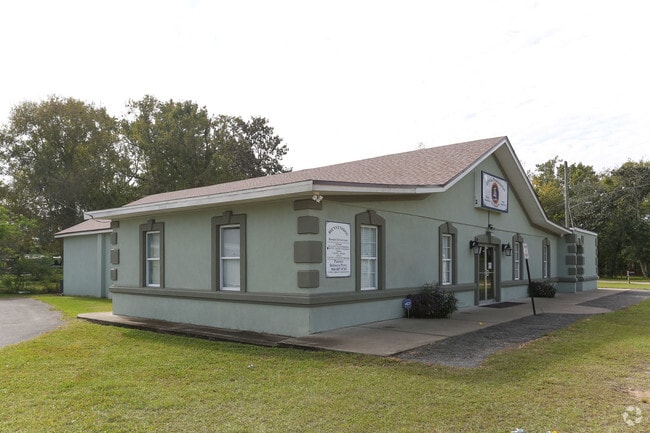
4800 Spring Glen Rd, Jacksonville, FL 32207


NEARBY LISTINGS FOR SALE OR LEASE
Property Detail
4800 Spring Glen Rd
127946-0000
Englewood, D B Turners Rp
Religious
32-2S-27E D B TURNERS R/P PT ENGLEWOOD PT TRACT 12 RECD D BK 1561-211, O/R BK 2758-1044
X
Duval
12031C0386J
Florida
2025
0.63 AC
2026
Southside
016102
Jacksonville (Florida)
7,728 SF
Jacksonville, FL
DEMOGRAPHICS near 4800 Spring Glen Rd
1 mile
3 mile
5 mile
2024 Total Population
11,755
71,589
186,549
2029 Population
12,397
75,409
196,815
Pop Growth 2024-2029
+ 5.46%
+ 5.34%
+ 5.50%
Average Age
37
40
39
2024 Total Households
4,367
29,764
79,711
HH Growth 2024-2029
+ 5.63%
+ 5.52%
+ 5.79%
Median Household Inc
$48,222
$49,036
$53,573
Avg Household Size
2.60
2.30
2.20
2024 Avg HH Vehicles
2.00
2.00
1.00
Median Home Value
$164,645
$243,478
$225,364
Median Year Built
1963
1966
1974
Nearby Places
Map Layers
Map Styles
 Street
 Aerial
Transit
 Traffic
 Biking
Places
Listings with unknown addresses are not visible on the map
- Restaurants
- Banks
- Shops
- Fitness
- Groceries
PUBLIC TRANSPORTATION
AIRPORT
Jacksonville International
Drive
Walk
Distance
Jacksonville International
30 min
19.4 mi
Freight Ports
Jacksonville Port
Drive
Walk
Distance
Jacksonville Port
13 min
7.5 mi
Nearby Properties
Address
Land Use
TOTAL SIZE
Lot Size
Zoning
Address
Land Use
TOTAL SIZE
Lot Size
Zoning
875,866 SF
22.33 AC
PBF-3
Address
Land Use
TOTAL SIZE
Lot Size
Zoning
257,667 SF
3.91 AC
CCBD
Address
Land Use
TOTAL SIZE
Lot Size
Zoning
371,466 SF
49.16 AC
PBF-2
Address
Land Use
TOTAL SIZE
Lot Size
Zoning
253,858 SF
4.93 AC
PUD
Address
Land Use
TOTAL SIZE
Lot Size
Zoning
316,705 SF
15.44 AC
PUD
Address
Land Use
TOTAL SIZE
Lot Size
Zoning
250,989 SF
19.48 AC
PUD
Address
Land Use
TOTAL SIZE
Lot Size
Zoning
211,073 SF
8.99 AC
PUD
Address
Land Use
TOTAL SIZE
Lot Size
Zoning
203,763 SF
9.97 AC
PUD
Address
Land Use
TOTAL SIZE
Lot Size
Zoning
181,522 SF
6.56 AC
PUD
Address
Land Use
TOTAL SIZE
Lot Size
Zoning
313,009 SF
22.50 AC
RMD-D
Address
Land Use
TOTAL SIZE
Lot Size
Zoning
415,146 SF
19.27 AC
RMD-D
Address
Land Use
TOTAL SIZE
Lot Size
Zoning
304,461 SF
62.44 AC
PBF-2
Address
Land Use
TOTAL SIZE
Lot Size
Zoning
187,581 SF
3.13 AC
PUD
Address
Land Use
TOTAL SIZE
Lot Size
Zoning
286,223 SF
28.01 AC
PBF-2
Address
Land Use
TOTAL SIZE
Lot Size
Zoning
93,059 SF
8.54 AC
CCG-2
Address
Land Use
TOTAL SIZE
Lot Size
Zoning
379,026 SF
24.02 AC
PUD
Address
Land Use
TOTAL SIZE
Lot Size
Zoning
259,291 SF
15.01 AC
RMD-D
Address
Land Use
TOTAL SIZE
Lot Size
Zoning
242,630 SF
22.85 AC
PUD
Address
Land Use
TOTAL SIZE
Lot Size
Zoning
341,920 SF
8.56 AC
PUD
Address
Land Use
TOTAL SIZE
Lot Size
Zoning
39,855 SF
0.72 AC
PUD
Address
Land Use
TOTAL SIZE
Lot Size
Zoning
191,207 SF
23.44 AC
IBP
Address
Land Use
TOTAL SIZE
Lot Size
Zoning
372,759 SF
25.01 AC
RMD-D
Address
Land Use
TOTAL SIZE
Lot Size
Zoning
202,447 SF
2.10 AC
PUD
Address
Land Use
TOTAL SIZE
Lot Size
Zoning
225,282 SF
15.36 AC
RMD-D
Address
Land Use
TOTAL SIZE
Lot Size
Zoning
266,156 SF
11.54 AC
RMD-D
Address
Land Use
TOTAL SIZE
Lot Size
Zoning
275,005 SF
28.48 AC
PUD
Address
Land Use
TOTAL SIZE
Lot Size
Zoning
172,591 SF
8.40 AC
CRO
Address
Land Use
TOTAL SIZE
Lot Size
Zoning
155,267 SF
13.33 AC
CRO
Address
Land Use
TOTAL SIZE
Lot Size
Zoning
72,315 SF
7.15 AC
CCG-1
Address
Land Use
TOTAL SIZE
Lot Size
Zoning
150,073 SF
11.23 AC
CCG-1
The World's #1 Commercial Real Estate Marketplace
Connect with us
© 2026 CoStar Group
The information above has been obtained from sources believed reliable. While we do not doubt its accuracy we have not verified it and make no guarantee, warranty or representation about it. It is your responsibility to independently confirm its accuracy and completeness. Any projections, opinions, assumptions, or estimates used are for example only and do not represent the current or future performance of the property. The value of this transaction to you depends on tax and other factors which should be evaluated by your tax, financial, and legal advisors. You and your advisors should conduct a careful, independent investigation of the property to determine to your satisfaction the suitability of the property for your needs.