Property Record
4800 State Highway 101, Eureka, CA 95503
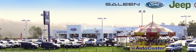


Property Detail
4800 State Highway 101
017-102-010-000
T 5N R 1W SEC 36N R01W /00600775C080086C C C
Storebuilding
HUMBOLDT
AC,CS
California
A Areas with a 1% annual chance of flooding and a 26% chance of flooding over the life of a 30-year mortgage.
16.77 AC
2024
Other Market Areas
2025
Eureka-Arcata, CA
000400
NEARBY LISTINGS FOR SALE OR LEASE
DEMOGRAPHICS near 4800 State Highway 101
1 mile
3 mile
5 mile
2025 Total Population
139
21,227
54,073
2030 Population
136
20,884
53,188
Pop Growth 2025-2030
(2.16%)
(1.62%)
(1.64%)
Average Age
41
43
41
2025 Total Households
59
9,193
22,918
HH Growth 2025-2030
(3.39%)
(1.61%)
(1.67%)
Median Household Inc
$74,249
$62,157
$64,132
Avg Household Size
2.40
2.20
2.20
2025 Avg HH Vehicles
2.00
2.00
2.00
Median Home Value
$630,952
$491,417
$475,848
Median Year Built
1973
1959
1962
Nearby Places
Map Layers
Map Styles
 Street
 Aerial
Transit
 Traffic
 Biking
Places
Listings with unknown addresses are not visible on the map
- Restaurants
- Banks
- Shops
- Fitness
- Groceries
PUBLIC TRANSPORTATION
AIRPORT
California Redwood Coast-Humboldt County
Drive
Walk
Distance
California Redwood Coast-Humboldt County
20 min
13.7 mi
Freight Ports
Port of Coos Bay, OR
Drive
Walk
Distance
Port of Coos Bay, OR
287 min
213.7 mi
Nearby Properties
Address
Land Use
TOTAL SIZE
Lot Size
Zoning
Address
Land Use
TOTAL SIZE
Lot Size
Zoning
8.22 AC
HM,RS-6000
Address
Land Use
TOTAL SIZE
Lot Size
Zoning
126,563 SF
10.81 AC
CS
Address
Land Use
TOTAL SIZE
Lot Size
Zoning
10.57 AC
R-1
Address
Land Use
TOTAL SIZE
Lot Size
Zoning
3.96 AC
RM-1000,NR
Address
Land Use
TOTAL SIZE
Lot Size
Zoning
2.11 AC
RM-1000
Address
Land Use
TOTAL SIZE
Lot Size
Zoning
3.72 AC
C-1/GO
Address
Land Use
TOTAL SIZE
Lot Size
Zoning
4.65 AC
HM
Address
Land Use
TOTAL SIZE
Lot Size
Zoning
1.19 AC
C-1-Q
Address
Land Use
TOTAL SIZE
Lot Size
Zoning
7.14 AC
CS
Address
Land Use
TOTAL SIZE
Lot Size
Zoning
0.61 AC
Address
Land Use
TOTAL SIZE
Lot Size
Zoning
2.06 AC
R-4*;RM-30
Address
Land Use
TOTAL SIZE
Lot Size
Zoning
41,346 SF
0.32 AC
Address
Land Use
TOTAL SIZE
Lot Size
Zoning
7,148 SF
0.46 AC
OR-AR
Address
Land Use
TOTAL SIZE
Lot Size
Zoning
26,829 SF
2.47 AC
C-1
Address
Land Use
TOTAL SIZE
Lot Size
Zoning
0.45 AC
CC-LW
Address
Land Use
TOTAL SIZE
Lot Size
Zoning
1.32 AC
CC-AR
Address
Land Use
TOTAL SIZE
Lot Size
Zoning
1.23 AC
RS-5
Address
Land Use
TOTAL SIZE
Lot Size
Zoning
1.32 AC
CS
Address
Land Use
TOTAL SIZE
Lot Size
Zoning
0.19 AC
CC-LW
Address
Land Use
TOTAL SIZE
Lot Size
Zoning
77,699 SF
2.79 AC
CS
Address
Land Use
TOTAL SIZE
Lot Size
Zoning
22,776 SF
0.99 AC
CS
Address
Land Use
TOTAL SIZE
Lot Size
Zoning
4,041 SF
5.98 AC
WC,MG/F
Address
Land Use
TOTAL SIZE
Lot Size
Zoning
5,348 SF
1.17 AC
CW
Address
Land Use
TOTAL SIZE
Lot Size
Zoning
1.46 AC
C-1/GO
Address
Land Use
TOTAL SIZE
Lot Size
Zoning
4.30 AC
CS
Address
Land Use
TOTAL SIZE
Lot Size
Zoning
4,798 SF
0.15 AC
CW
Address
Land Use
TOTAL SIZE
Lot Size
Zoning
0.90 AC
CS
Address
Land Use
TOTAL SIZE
Lot Size
Zoning
3.25 AC
RM-1000,NR
Address
Land Use
TOTAL SIZE
Lot Size
Zoning
20,025 SF
1.65 AC
CN
Address
Land Use
TOTAL SIZE
Lot Size
Zoning
14,484 SF
0.61 AC
CS
The World's #1 Commercial Real Estate Marketplace
Connect with us
© 2026 CoStar Group
The information above has been obtained from sources believed reliable. While we do not doubt its accuracy we have not verified it and make no guarantee, warranty or representation about it. It is your responsibility to independently confirm its accuracy and completeness. Any projections, opinions, assumptions, or estimates used are for example only and do not represent the current or future performance of the property. The value of this transaction to you depends on tax and other factors which should be evaluated by your tax, financial, and legal advisors. You and your advisors should conduct a careful, independent investigation of the property to determine to your satisfaction the suitability of the property for your needs.