Property Record
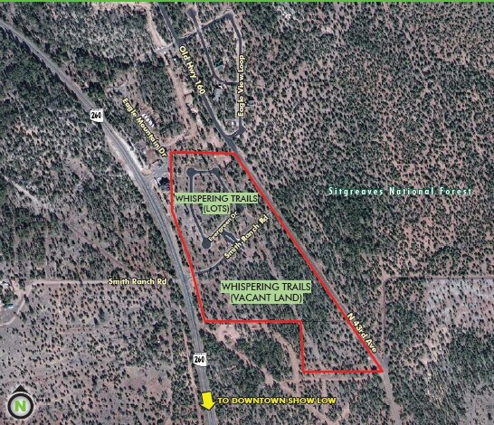
4800 W Mountain Hollow Loop, Show Low, AZ 85901
Property Detail
4800 W Mountain Hollow Loop
309-03-014
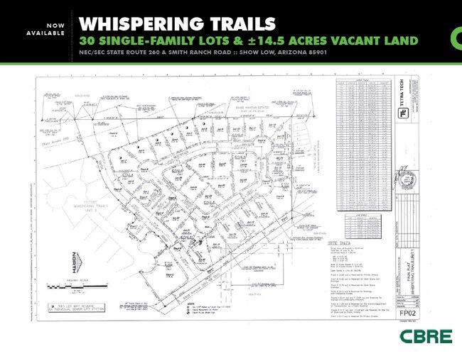
SECTION 11, T10,R21E:WHISPERING TRAILS UNIT I LOT 5 PER PLAT 29-2 8&29 OUT OF 309-27-014B FOR 2009 ROLL
Commercialnec
Navajo
MUNICIPAL
Arizona
B and X Area of moderate flood hazard, usually the area between the limits of the 100-year and 500-year floods.
5
2025
0.35 AC
2027
Arizona Northeast & Holbrook Area
965302
Other Market Areas
2,247 SF
Show Low, AZ
NEARBY LISTINGS FOR SALE OR LEASE
DEMOGRAPHICS near 4800 W Mountain Hollow Loop
1 mile
3 mile
5 mile
2025 Total Population
1,466
11,303
18,858
2030 Population
1,501
12,137
20,132
Pop Growth 2025-2030
+ 2.39%
+ 7.38%
+ 6.76%
Average Age
43
45
44
2025 Total Households
516
4,572
7,600
HH Growth 2025-2030
+ 2.71%
+ 7.35%
+ 6.55%
Median Household Inc
$61,389
$58,066
$62,186
Avg Household Size
2.70
2.40
2.40
2025 Avg HH Vehicles
2.00
2.00
2.00
Median Home Value
$352,343
$355,186
$346,881
Median Year Built
1996
1998
1996
Nearby Places
Map Layers
Map Styles
 Street
 Aerial
Layers
 Traffic
 Biking
Places
Listings with unknown addresses are not visible on the map
- Restaurants
- Banks
- Shops
- Fitness
- Groceries
Nearby Properties
Address
Land Use
TOTAL SIZE
Lot Size
Zoning
Address
Land Use
TOTAL SIZE
Lot Size
Zoning
32,308 SF
10.46 AC
MUNICIPAL
Address
Land Use
TOTAL SIZE
Lot Size
Zoning
39,242 SF
4.91 AC
MUNICIPAL
Address
Land Use
TOTAL SIZE
Lot Size
Zoning
24,876 SF
1.89 AC
MUNICIPAL
Address
Land Use
TOTAL SIZE
Lot Size
Zoning
7,604 SF
1.45 AC
Address
Land Use
TOTAL SIZE
Lot Size
Zoning
9,217 SF
0.76 AC
MUNICIPAL
Address
Land Use
TOTAL SIZE
Lot Size
Zoning
12,480 SF
1.51 AC
C-R
Address
Land Use
TOTAL SIZE
Lot Size
Zoning
37,056 SF
6.04 AC
C-R
Address
Land Use
TOTAL SIZE
Lot Size
Zoning
6,154 SF
0.86 AC
MUNICIPAL
Address
Land Use
TOTAL SIZE
Lot Size
Zoning
8,366 SF
5 AC
A-GENERAL
Address
Land Use
TOTAL SIZE
Lot Size
Zoning
84.12 AC
MUNICIPAL
Address
Land Use
TOTAL SIZE
Lot Size
Zoning
12,421 SF
7.88 AC
A-GENERAL
Address
Land Use
TOTAL SIZE
Lot Size
Zoning
5,515 SF
2.13 AC
SD
Address
Land Use
TOTAL SIZE
Lot Size
Zoning
4,861 SF
6.67 AC
A-GENERAL
Address
Land Use
TOTAL SIZE
Lot Size
Zoning
3,262 SF
0.88 AC
MUNICIPAL
Address
Land Use
TOTAL SIZE
Lot Size
Zoning
4,926 SF
1 AC
MUNICIPAL
Address
Land Use
TOTAL SIZE
Lot Size
Zoning
9,396 SF
1.52 AC
MUNICIPAL
Address
Land Use
TOTAL SIZE
Lot Size
Zoning
3,319 SF
343.95 AC
A-GENERAL
Address
Land Use
TOTAL SIZE
Lot Size
Zoning
3,563 SF
1.10 AC
R1-10
Address
Land Use
TOTAL SIZE
Lot Size
Zoning
3,709 SF
1.11 AC
MUNICIPAL
Address
Land Use
TOTAL SIZE
Lot Size
Zoning
1,625 SF
16.12 AC
A-GENERAL
Address
Land Use
TOTAL SIZE
Lot Size
Zoning
3,135 SF
9.86 AC
SD
Address
Land Use
TOTAL SIZE
Lot Size
Zoning
6,307 SF
0.61 AC
MUNICIPAL
Address
Land Use
TOTAL SIZE
Lot Size
Zoning
18.20 AC
MUNICIPAL
Address
Land Use
TOTAL SIZE
Lot Size
Zoning
2,582 SF
0.95 AC
SD
Address
Land Use
TOTAL SIZE
Lot Size
Zoning
2,655 SF
4 AC
MUNICIPAL
Address
Land Use
TOTAL SIZE
Lot Size
Zoning
3,800 SF
4.28 AC
MUNICIPAL
Address
Land Use
TOTAL SIZE
Lot Size
Zoning
3,525 SF
0.42 AC
MUNICIPAL
Address
Land Use
TOTAL SIZE
Lot Size
Zoning
2,926 SF
0.28 AC
MUNICIPAL
Address
Land Use
TOTAL SIZE
Lot Size
Zoning
2,137 SF
0.14 AC
MUNICIPAL
Address
Land Use
TOTAL SIZE
Lot Size
Zoning
16.42 AC
MUNICIPAL
The World's #1 Commercial Real Estate Marketplace
Connect with us
© 2026 CoStar Group
The information above has been obtained from sources believed reliable. While we do not doubt its accuracy we have not verified it and make no guarantee, warranty or representation about it. It is your responsibility to independently confirm its accuracy and completeness. Any projections, opinions, assumptions, or estimates used are for example only and do not represent the current or future performance of the property. The value of this transaction to you depends on tax and other factors which should be evaluated by your tax, financial, and legal advisors. You and your advisors should conduct a careful, independent investigation of the property to determine to your satisfaction the suitability of the property for your needs.