Property Record
4801 Harry Hines Blvd, Dallas, TX 75235
NEARBY LISTINGS FOR SALE OR LEASE
Property Detail
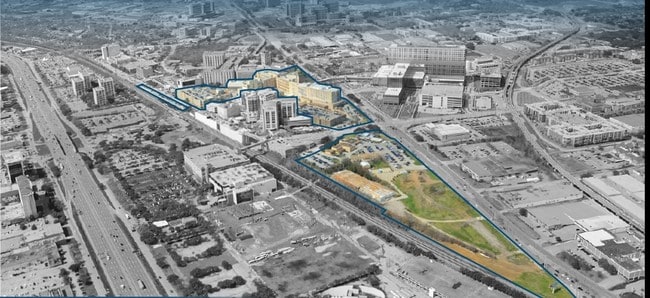
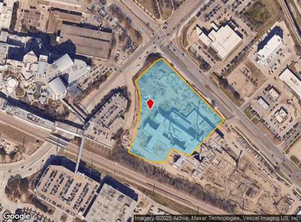
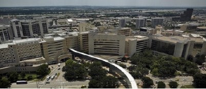
4801 Harry Hines Blvd
00000502630000000
BLK 6056 ACS 6.506 INT202200229522 DD08222022 CO-DC 6056 000 00000 2006056 000
Hospitalpublic
Dallas
X
Texas
48113C0340J
6.51 AC
0
Stemmons Freeway
2025
Dallas/Ft Worth
010001
Dallas-Fort Worth-Arlington, TX
525,016 SF
DEMOGRAPHICS near 4801 Harry Hines Blvd
1 Mile
3 Mile
5 Mile
2024 Total Population
12,009
153,476
367,705
2029 Population
12,192
155,550
371,198
Pop Growth 2024-2029
+ 1.52%
+ 1.35%
+ 0.95%
Average Age
35
37
37
2024 Total Households
5,843
82,390
172,452
HH Growth 2024-2029
+ 1.44%
+ 1.37%
+ 1.13%
Median Household Inc
$55,689
$76,425
$72,555
Avg Household Size
1.80
1.80
2.00
2024 Avg HH Vehicles
1.00
1.00
2.00
Median Home Value
$325,589
$407,985
$458,014
Median Year Built
2004
2002
1992
Nearby Places
Map Layers
Map Styles
 Street
 Aerial
- Restaurants
- Banks
- Shops
- Fitness
- Groceries
PUBLIC TRANSPORTATION
TRANSIT/SUBWAY
Southwestern Medical District/Parkland Station (DART LIGHT RAIL - GREEN LINE - Dallas Area Rapid Transit (DART), DART LIGHT RAIL - ORANGE LINE - Dallas Area Rapid Transit (DART), Green Line - Dallas Area Rapid Transit (DART), Orange Line - Dallas Area Rapid Transit (DART))
DRIVE
WALK
Distance
Southwestern Medical District/Parkland Station (DART LIGHT RAIL - GREEN LINE - Dallas Area Rapid Transit (DART), DART LIGHT RAIL - ORANGE LINE - Dallas Area Rapid Transit (DART), Green Line - Dallas Area Rapid Transit (DART), Orange Line - Dallas Area Rapid Transit (DART))
2 min
8 min
0.4 mi
Market Center (DART LIGHT RAIL - GREEN LINE - Dallas Area Rapid Transit (DART), DART LIGHT RAIL - ORANGE LINE - Dallas Area Rapid Transit (DART), Green Line - Dallas Area Rapid Transit (DART), Orange Line - Dallas Area Rapid Transit (DART))
DRIVE
WALK
Distance
Market Center (DART LIGHT RAIL - GREEN LINE - Dallas Area Rapid Transit (DART), DART LIGHT RAIL - ORANGE LINE - Dallas Area Rapid Transit (DART), Green Line - Dallas Area Rapid Transit (DART), Orange Line - Dallas Area Rapid Transit (DART))
2 min
16 min
0.9 mi
Inwood/Love Field Station (DART LIGHT RAIL - GREEN LINE - Dallas Area Rapid Transit (DART), DART LIGHT RAIL - ORANGE LINE - Dallas Area Rapid Transit (DART), Green Line - Dallas Area Rapid Transit (DART), Orange Line - Dallas Area Rapid Transit (DART))
DRIVE
WALK
Distance
Inwood/Love Field Station (DART LIGHT RAIL - GREEN LINE - Dallas Area Rapid Transit (DART), DART LIGHT RAIL - ORANGE LINE - Dallas Area Rapid Transit (DART), Green Line - Dallas Area Rapid Transit (DART), Orange Line - Dallas Area Rapid Transit (DART))
3 min
20 min
1.1 mi
COMMUTER RAIL
Medical/Market Ctr Station (TRINITY RAILWAY - Dallas Area Rapid Transit (DART))
DRIVE
WALK
Distance
Medical/Market Ctr Station (TRINITY RAILWAY - Dallas Area Rapid Transit (DART))
2 min
7 min
0.4 mi
Medical/Market Center (Trinity Railway Express - Dallas Area Rapid Transit (DART))
DRIVE
WALK
Distance
Medical/Market Center (Trinity Railway Express - Dallas Area Rapid Transit (DART))
2 min
7 min
0.4 mi
AIRPORT
Dallas Love Field
DRIVE
WALK
Distance
Dallas Love Field
8 min
3.4 mi
Dallas-Fort Worth International
DRIVE
WALK
Distance
Dallas-Fort Worth International
23 min
17.5 mi
Freight Ports
Port of Shreveport
DRIVE
WALK
Distance
Port of Shreveport
218 min
200.7 mi
SALE & LEASE HISTORY
LISTING DATE
SALE/LEASE

Apr 18, 2018
For Sale
Nearby Properties
Address
Land Use
TOTAL SIZE
Lot Size
Zoning
Address
Land Use
TOTAL SIZE
Lot Size
Zoning
2,658,374 SF
37.70 AC
Z116
Address
Land Use
TOTAL SIZE
Lot Size
Zoning
2,476 SF
1,203.03 AC
Z116
Address
Land Use
TOTAL SIZE
Lot Size
Zoning
2,271,924 SF
Address
Land Use
TOTAL SIZE
Lot Size
Zoning
3,713,071 SF
9.94 AC
Address
Land Use
TOTAL SIZE
Lot Size
Zoning
4,407,366 SF
1,300 AC
IR
Address
Land Use
TOTAL SIZE
Lot Size
Zoning
815,000 SF
7.20 AC
Z239
Address
Land Use
TOTAL SIZE
Lot Size
Zoning
1,676,176 SF
2.18 AC
Z239
Address
Land Use
TOTAL SIZE
Lot Size
Zoning
906,730 SF
3.09 AC
Z239
Address
Land Use
TOTAL SIZE
Lot Size
Zoning
1,003,498 SF
22.15 AC
Z116
Address
Land Use
TOTAL SIZE
Lot Size
Zoning
1,308,710 SF
8.42 AC
Z21
Address
Land Use
TOTAL SIZE
Lot Size
Zoning
299,170 SF
9.71 AC
Z97
Address
Land Use
TOTAL SIZE
Lot Size
Zoning
731,849 SF
3.13 AC
Z239
Address
Land Use
TOTAL SIZE
Lot Size
Zoning
1,896,570 SF
18.08 AC
Z151
Address
Land Use
TOTAL SIZE
Lot Size
Zoning
1,480,246 SF
1.86 AC
Z21
Address
Land Use
TOTAL SIZE
Lot Size
Zoning
1,291,660 SF
2.56 AC
Z248
Address
Land Use
TOTAL SIZE
Lot Size
Zoning
1,026,046 SF
2.89 AC
Z248
Address
Land Use
TOTAL SIZE
Lot Size
Zoning
864,909 SF
3.02 AC
Z248
Address
Land Use
TOTAL SIZE
Lot Size
Zoning
504,533 SF
9.95 AC
Z151
Address
Land Use
TOTAL SIZE
Lot Size
Zoning
1,001,504 SF
3.37 AC
Z151
Address
Land Use
TOTAL SIZE
Lot Size
Zoning
1,424,070 SF
1.36 AC
Z21
Address
Land Use
TOTAL SIZE
Lot Size
Zoning
1,228,418 SF
24.51 AC
Z151
Address
Land Use
TOTAL SIZE
Lot Size
Zoning
724,979 SF
1.05 AC
Z239
Address
Land Use
TOTAL SIZE
Lot Size
Zoning
893,159 SF
1.17 AC
Z21
Address
Land Use
TOTAL SIZE
Lot Size
Zoning
1,980,000 SF
2.57 AC
Z21
Address
Land Use
TOTAL SIZE
Lot Size
Zoning
857,292 SF
1.47 AC
Z239
Address
Land Use
TOTAL SIZE
Lot Size
Zoning
602,716 SF
11.21 AC
Z239
Address
Land Use
TOTAL SIZE
Lot Size
Zoning
763,198 SF
3.01 AC
Z248
Address
Land Use
TOTAL SIZE
Lot Size
Zoning
638,046 SF
2.11 AC
Z239
Address
Land Use
TOTAL SIZE
Lot Size
Zoning
486,300 SF
1.55 AC
Z239
Address
Land Use
TOTAL SIZE
Lot Size
Zoning
906,627 SF
3.83 AC
Z239
The World's #1 Commercial Real Estate Marketplace
Connect with us
© 2025 CoStar Group
The information above has been obtained from sources believed reliable. While we do not doubt its accuracy we have not verified it and make no guarantee, warranty or representation about it. It is your responsibility to independently confirm its accuracy and completeness. Any projections, opinions, assumptions, or estimates used are for example only and do not represent the current or future performance of the property. The value of this transaction to you depends on tax and other factors which should be evaluated by your tax, financial, and legal advisors. You and your advisors should conduct a careful, independent investigation of the property to determine to your satisfaction the suitability of the property for your needs.