Property Record
4801 Pods Way, Chesapeake, VA 23320
NEARBY LISTINGS FOR SALE OR LEASE
Property Detail
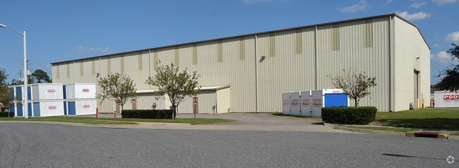
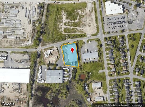
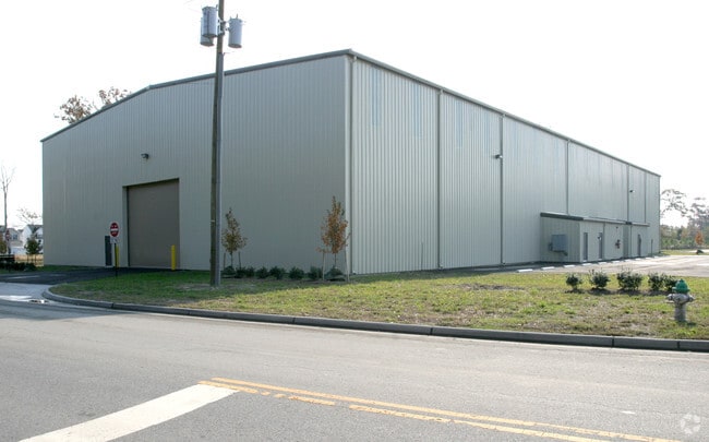
4801 Pods Way
0350000001220
Washington - Commercial
Warehouse
3 WATERWAY INDUSTRIAL PARK PH 2 1.266AC
AE
Chesapeake
5100340024D
Virginia
2024
1.27 AC
2025
Bainbridge
020805
Hampton Roads
23,100 SF
Virginia Beach-Chesapeake-Norfolk, VA-NC
DEMOGRAPHICS near 4801 Pods Way
1 Mile
3 Mile
5 Mile
2024 Total Population
4,338
58,439
201,440
2029 Population
4,505
60,310
207,000
Pop Growth 2024-2029
+ 3.85%
+ 3.20%
+ 2.76%
Average Age
36
38
38
2024 Total Households
1,532
22,689
76,432
HH Growth 2024-2029
+ 4.05%
+ 3.32%
+ 2.81%
Median Household Inc
$49,404
$69,703
$70,856
Avg Household Size
2.80
2.50
2.60
2024 Avg HH Vehicles
2.00
2.00
2.00
Median Home Value
$235,795
$264,188
$265,717
Median Year Built
1991
1988
1985
Nearby Places
Map Layers
Map Styles
 Street
 Aerial
- Restaurants
- Banks
- Shops
- Fitness
- Groceries
PUBLIC TRANSPORTATION
COMMUTER RAIL
DRIVE
WALK
Distance
12 min
6.8 mi
AIRPORT
Norfolk International
DRIVE
WALK
Distance
Norfolk International
24 min
12.8 mi
Newport News/Williamsburg International
DRIVE
WALK
Distance
Newport News/Williamsburg International
55 min
39.3 mi
Freight Ports
Virginia Port Authority - Portsmouth
DRIVE
WALK
Distance
Virginia Port Authority - Portsmouth
21 min
10.7 mi
Nearby Properties
Address
Land Use
TOTAL SIZE
Lot Size
Zoning
Address
Land Use
TOTAL SIZE
Lot Size
Zoning
470,098 SF
14.10 AC
O-I: OFFIC
Address
Land Use
TOTAL SIZE
Lot Size
Zoning
405,992 SF
40.22 AC
PUD: PLANN
Address
Land Use
TOTAL SIZE
Lot Size
Zoning
6,820 SF
89.90 AC
R15S: RESI
Address
Land Use
TOTAL SIZE
Lot Size
Zoning
482.38 AC
MULTI: MUL
Address
Land Use
TOTAL SIZE
Lot Size
Zoning
358,908 SF
22.21 AC
MULTI: MUL
Address
Land Use
TOTAL SIZE
Lot Size
Zoning
299,727 SF
170.79 AC
C1: CONSER
Address
Land Use
TOTAL SIZE
Lot Size
Zoning
209,403 SF
2.81 AC
PUD: PLANN
Address
Land Use
TOTAL SIZE
Lot Size
Zoning
252,524 SF
20 AC
R8S: RESID
Address
Land Use
TOTAL SIZE
Lot Size
Zoning
286,936 SF
15 AC
RMF1: MULT
Address
Land Use
TOTAL SIZE
Lot Size
Zoning
32,163 SF
17.59 AC
MULTI: MUL
Address
Land Use
TOTAL SIZE
Lot Size
Zoning
26.63 AC
Address
Land Use
TOTAL SIZE
Lot Size
Zoning
92,723 SF
28.83 AC
R6: RESIDE
Address
Land Use
TOTAL SIZE
Lot Size
Zoning
142,656 SF
22.17 AC
RMF1: MULT
Address
Land Use
TOTAL SIZE
Lot Size
Zoning
277,846 SF
12.50 AC
RMF1: MULT
Address
Land Use
TOTAL SIZE
Lot Size
Zoning
178,068 SF
14.72 AC
M1: LIGHT
Address
Land Use
TOTAL SIZE
Lot Size
Zoning
75,936 SF
11.13 AC
MULTI: MUL
Address
Land Use
TOTAL SIZE
Lot Size
Zoning
127,755 SF
14.68 AC
PUD: PLANN
Address
Land Use
TOTAL SIZE
Lot Size
Zoning
162,291 SF
2.98 AC
PUD: PLANN
Address
Land Use
TOTAL SIZE
Lot Size
Zoning
166,753 SF
1.46 AC
PUD: PLANN
Address
Land Use
TOTAL SIZE
Lot Size
Zoning
63,050 SF
27.71 AC
O-I: OFFIC
Address
Land Use
TOTAL SIZE
Lot Size
Zoning
12,240 SF
20.98 AC
MULTI: MUL
Address
Land Use
TOTAL SIZE
Lot Size
Zoning
28,253 SF
32.34 AC
M3: WATERF
Address
Land Use
TOTAL SIZE
Lot Size
Zoning
119,946 SF
9.76 AC
M2: GENERA
Address
Land Use
TOTAL SIZE
Lot Size
Zoning
88,000 SF
37.05 AC
M2: GENERA
Address
Land Use
TOTAL SIZE
Lot Size
Zoning
144,984 SF
6.34 AC
O-I: OFFIC
Address
Land Use
TOTAL SIZE
Lot Size
Zoning
121,111 SF
16.68 AC
B3: HIGHWA
Address
Land Use
TOTAL SIZE
Lot Size
Zoning
119,870 SF
12.21 AC
B3: HIGHWA
Address
Land Use
TOTAL SIZE
Lot Size
Zoning
1,921 SF
9.46 AC
RMF1: MULT
Address
Land Use
TOTAL SIZE
Lot Size
Zoning
201,130 SF
5.44 AC
RMF1: MULT
Address
Land Use
TOTAL SIZE
Lot Size
Zoning
149,989 SF
12.06 AC
M2: GENERA
The World's #1 Commercial Real Estate Marketplace
Connect with us
© 2026 CoStar Group
The information above has been obtained from sources believed reliable. While we do not doubt its accuracy we have not verified it and make no guarantee, warranty or representation about it. It is your responsibility to independently confirm its accuracy and completeness. Any projections, opinions, assumptions, or estimates used are for example only and do not represent the current or future performance of the property. The value of this transaction to you depends on tax and other factors which should be evaluated by your tax, financial, and legal advisors. You and your advisors should conduct a careful, independent investigation of the property to determine to your satisfaction the suitability of the property for your needs.