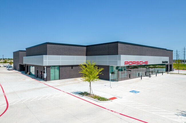
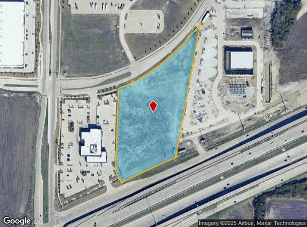
Property Record
4801 S Hardin Blvd, Mckinney, TX 75070

NEARBY LISTINGS FOR SALE OR LEASE
Property Detail
4801 S Hardin Blvd
Dallas-Fort Worth-Arlington, TX
Jonathan Phillips Survey
R-6719-000-0300-1
ABS A0719 JONATHAN PHILLIPS SURVEY, TRACT 30, 6.82 ACRES
Commercialacreage
Collin
X
Texas
48085C0270K
30
2024
6.82 AC
2025
McKinney
030606
Dallas/Ft Worth
30,571 SF
DEMOGRAPHICS near 4801 S Hardin Blvd
1 Mile
3 Mile
5 Mile
2024 Total Population
9,191
112,566
289,395
2029 Population
11,208
137,641
353,813
Pop Growth 2024-2029
+ 21.95%
+ 22.28%
+ 22.26%
Average Age
37
37
38
2024 Total Households
3,214
41,413
103,374
HH Growth 2024-2029
+ 21.97%
+ 22.58%
+ 22.61%
Median Household Inc
$99,958
$101,821
$106,904
Avg Household Size
2.80
2.70
2.70
2024 Avg HH Vehicles
2.00
2.00
2.00
Median Home Value
$387,948
$421,385
$414,375
Median Year Built
2003
2007
2005
Nearby Places
Map Layers
Map Styles
 Street
 Aerial
- Restaurants
- Banks
- Shops
- Fitness
- Groceries
PUBLIC TRANSPORTATION
AIRPORT
Dallas Love Field
DRIVE
WALK
Distance
Dallas Love Field
40 min
31.0 mi
Dallas-Fort Worth International
DRIVE
WALK
Distance
Dallas-Fort Worth International
37 min
31.9 mi
Freight Ports
Port of Shreveport
DRIVE
WALK
Distance
Port of Shreveport
236 min
216.4 mi
Nearby Properties
Address
Land Use
TOTAL SIZE
Lot Size
Zoning
Address
Land Use
TOTAL SIZE
Lot Size
Zoning
638,539 SF
42.76 AC
Address
Land Use
TOTAL SIZE
Lot Size
Zoning
472,185 SF
63.51 AC
AO
Address
Land Use
TOTAL SIZE
Lot Size
Zoning
611,780 SF
59.06 AC
L1
Address
Land Use
TOTAL SIZE
Lot Size
Zoning
720,571 SF
68.28 AC
Address
Land Use
TOTAL SIZE
Lot Size
Zoning
256,445 SF
10.42 AC
Address
Land Use
TOTAL SIZE
Lot Size
Zoning
162,000 SF
34 AC
L1
Address
Land Use
TOTAL SIZE
Lot Size
Zoning
387,377 SF
64.34 AC
Address
Land Use
TOTAL SIZE
Lot Size
Zoning
585,170 SF
18.69 AC
MF RG-18
Address
Land Use
TOTAL SIZE
Lot Size
Zoning
495,048 SF
7.37 AC
Address
Land Use
TOTAL SIZE
Lot Size
Zoning
557,288 SF
9.18 AC
Address
Land Use
TOTAL SIZE
Lot Size
Zoning
518,353 SF
28.51 AC
MF-M
Address
Land Use
TOTAL SIZE
Lot Size
Zoning
479,620 SF
14.02 AC
Address
Land Use
TOTAL SIZE
Lot Size
Zoning
435,382 SF
6.95 AC
MF-E
Address
Land Use
TOTAL SIZE
Lot Size
Zoning
288,826 SF
18.71 AC
CC
Address
Land Use
TOTAL SIZE
Lot Size
Zoning
556,741 SF
8.70 AC
MF-R
Address
Land Use
TOTAL SIZE
Lot Size
Zoning
586,110 SF
10.50 AC
LI
Address
Land Use
TOTAL SIZE
Lot Size
Zoning
369,702 SF
5.10 AC
Address
Land Use
TOTAL SIZE
Lot Size
Zoning
291,577 SF
69.24 AC
APTTOWNH
Address
Land Use
TOTAL SIZE
Lot Size
Zoning
414,198 SF
72.67 AC
Address
Land Use
TOTAL SIZE
Lot Size
Zoning
464,454 SF
11.04 AC
PD
Address
Land Use
TOTAL SIZE
Lot Size
Zoning
397,395 SF
12.25 AC
Address
Land Use
TOTAL SIZE
Lot Size
Zoning
199,115 SF
1.36 AC
Address
Land Use
TOTAL SIZE
Lot Size
Zoning
350,018 SF
7.02 AC
MF-E
Address
Land Use
TOTAL SIZE
Lot Size
Zoning
370,860 SF
25.48 AC
Address
Land Use
TOTAL SIZE
Lot Size
Zoning
260,340 SF
18.64 AC
RG-18
Address
Land Use
TOTAL SIZE
Lot Size
Zoning
379,701 SF
17.58 AC
MULTI-FAMI
Address
Land Use
TOTAL SIZE
Lot Size
Zoning
344,076 SF
15.49 AC
MULTI-FAMI
Address
Land Use
TOTAL SIZE
Lot Size
Zoning
337,425 SF
7.44 AC
MF-E
Address
Land Use
TOTAL SIZE
Lot Size
Zoning
442,463 SF
17.34 AC
Address
Land Use
TOTAL SIZE
Lot Size
Zoning
439,754 SF
13.09 AC
SF
The World's #1 Commercial Real Estate Marketplace
Connect with us
© 2026 CoStar Group
The information above has been obtained from sources believed reliable. While we do not doubt its accuracy we have not verified it and make no guarantee, warranty or representation about it. It is your responsibility to independently confirm its accuracy and completeness. Any projections, opinions, assumptions, or estimates used are for example only and do not represent the current or future performance of the property. The value of this transaction to you depends on tax and other factors which should be evaluated by your tax, financial, and legal advisors. You and your advisors should conduct a careful, independent investigation of the property to determine to your satisfaction the suitability of the property for your needs.