Property Record
4802 E Van Buren St, Phoenix, AZ 85008
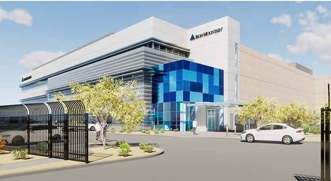

Property Detail
4802 E Van Buren St
125-08-002C
S2 SW4 SW4 SEC 5 T1N R4E EX TH PT LY W/IN VAN BUREN ST & EX W 40F & EX COM SW COR SEC E 683.02F N 46.80F TPOB CONT N 613.59F E 639.34F S 648.16F W TPOB & EX S 50F RD & EX TRI IN SW COR P/F 85-141934
Datacentre
Maricopa
C-C
Arizona
C and X Area of minimal flood hazard, usually depicted on FIRMs as above the 500-year flood level.
9.01 AC
2025
Tempe Northwest
2025
Phoenix
111203
Phoenix-Mesa-Chandler, AZ
498,595 SF
NEARBY LISTINGS FOR SALE OR LEASE
DEMOGRAPHICS near 4802 E Van Buren St
1 mile
3 mile
5 mile
2025 Total Population
14,085
113,227
348,403
2030 Population
14,770
118,516
364,665
Pop Growth 2025-2030
+ 4.86%
+ 4.67%
+ 4.67%
Average Age
32
35
36
2025 Total Households
6,720
47,115
149,526
HH Growth 2025-2030
+ 5.18%
+ 4.95%
+ 5.01%
Median Household Inc
$68,318
$69,059
$73,267
Avg Household Size
2.10
2.30
2.20
2025 Avg HH Vehicles
1.00
2.00
2.00
Median Home Value
$308,594
$503,208
$520,096
Median Year Built
1992
1980
1979
Nearby Places
Map Layers
Map Styles
 Street
 Aerial
Layers
 Traffic
 Biking
Places
Listings with unknown addresses are not visible on the map
- Restaurants
- Banks
- Shops
- Fitness
- Groceries
PUBLIC TRANSPORTATION
TRANSIT/SUBWAY
50Th St/Washington St (Valley Metro Rail - Valley Metro (Phoenix Light Rail))
Drive
Walk
Distance
50Th St/Washington St (Valley Metro Rail - Valley Metro (Phoenix Light Rail))
2 min
12 min
0.6 mi
44Th St/Washington (METRO Light Rail - Valley Metro (Phoenix Light Rail))
Drive
Walk
Distance
44Th St/Washington (METRO Light Rail - Valley Metro (Phoenix Light Rail))
3 min
20 min
1.0 mi
AIRPORT
Phoenix Sky Harbor International
Drive
Walk
Distance
Phoenix Sky Harbor International
8 min
3.2 mi
Phoenix-Mesa Gateway
Drive
Walk
Distance
Phoenix-Mesa Gateway
40 min
27.4 mi
Freight Ports
Port of San Diego
Drive
Walk
Distance
Port of San Diego
403 min
361.0 mi
Nearby Properties
Address
Land Use
TOTAL SIZE
Lot Size
Zoning
Address
Land Use
TOTAL SIZE
Lot Size
Zoning
2,901,193 SF
20.73 AC
A-1
Address
Land Use
TOTAL SIZE
Lot Size
Zoning
75,000 SF
12.19 AC
I-1
Address
Land Use
TOTAL SIZE
Lot Size
Zoning
1,748,324 SF
29.35 AC
M-H
Address
Land Use
TOTAL SIZE
Lot Size
Zoning
103,415 SF
4.61 AC
C-T
Address
Land Use
TOTAL SIZE
Lot Size
Zoning
1,949,842 SF
40 AC
I-1
Address
Land Use
TOTAL SIZE
Lot Size
Zoning
2.63 AC
I-1
Address
Land Use
TOTAL SIZE
Lot Size
Zoning
111,886 SF
3.46 AC
C-G
Address
Land Use
TOTAL SIZE
Lot Size
Zoning
3.62 AC
Address
Land Use
TOTAL SIZE
Lot Size
Zoning
Address
Land Use
TOTAL SIZE
Lot Size
Zoning
199,677 SF
14.55 AC
C-3
Address
Land Use
TOTAL SIZE
Lot Size
Zoning
2,089,643 SF
33.80 AC
MU-ED
Address
Land Use
TOTAL SIZE
Lot Size
Zoning
106,575 SF
2.50 AC
I-1
Address
Land Use
TOTAL SIZE
Lot Size
Zoning
94,162 SF
9.40 AC
I-2
Address
Land Use
TOTAL SIZE
Lot Size
Zoning
925,428 SF
86.02 AC
M-H
Address
Land Use
TOTAL SIZE
Lot Size
Zoning
4.76 AC
C-G
Address
Land Use
TOTAL SIZE
Lot Size
Zoning
462,201 SF
6.74 AC
I-1
Address
Land Use
TOTAL SIZE
Lot Size
Zoning
522,676 SF
264.16 AC
I-1
Address
Land Use
TOTAL SIZE
Lot Size
Zoning
58,061 SF
5.43 AC
C-C
Address
Land Use
TOTAL SIZE
Lot Size
Zoning
697,894 SF
8.43 AC
PAD
Address
Land Use
TOTAL SIZE
Lot Size
Zoning
50,161 SF
2.05 AC
M-H
Address
Land Use
TOTAL SIZE
Lot Size
Zoning
3,010 SF
35.44 AC
R110
Address
Land Use
TOTAL SIZE
Lot Size
Zoning
76,801 SF
4.79 AC
R1-6
Address
Land Use
TOTAL SIZE
Lot Size
Zoning
5.18 AC
Address
Land Use
TOTAL SIZE
Lot Size
Zoning
82,581 SF
3.06 AC
C3
Address
Land Use
TOTAL SIZE
Lot Size
Zoning
635,169 SF
92.76 AC
I-1
Address
Land Use
TOTAL SIZE
Lot Size
Zoning
511,014 SF
5.01 AC
I-1
Address
Land Use
TOTAL SIZE
Lot Size
Zoning
9,344 SF
134.45 AC
R3
The World's #1 Commercial Real Estate Marketplace
Connect with us
© 2026 CoStar Group
The information above has been obtained from sources believed reliable. While we do not doubt its accuracy we have not verified it and make no guarantee, warranty or representation about it. It is your responsibility to independently confirm its accuracy and completeness. Any projections, opinions, assumptions, or estimates used are for example only and do not represent the current or future performance of the property. The value of this transaction to you depends on tax and other factors which should be evaluated by your tax, financial, and legal advisors. You and your advisors should conduct a careful, independent investigation of the property to determine to your satisfaction the suitability of the property for your needs.