Property Record
4805 Campbell Dr, Fort Scott, KS 66701
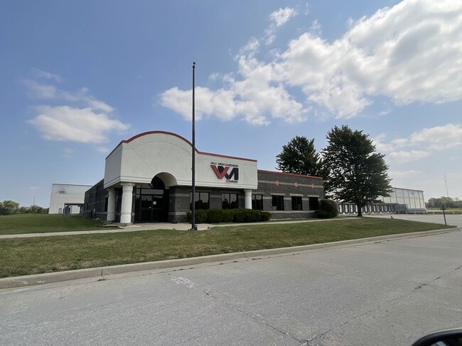
This Property Is For Sale
NEARBY LISTINGS FOR SALE OR LEASE
-
-
View all Fort Scott listings for sale on LoopNet.com
Property Detail
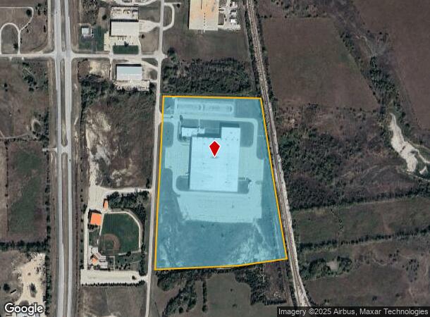
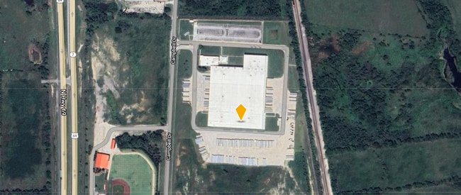
4805 Campbell Dr
204-17-0-00-00-003.01-0
S17, T26, R25, ACRES 35.1, LOTS 1,2,3,4,6,7 & 8 BLK 3 & VAC RR R/W & 1/2 VAC CUL DE SAC & 1/2 VAC ST ADJ TO PROPERTY
Officebuilding
Bourbon
X
Kansas
20011C0337F
1-4,6-8
0
35.10 AC
2025
Kansas Area
955900
Other Market Areas
10,064 SF
DEMOGRAPHICS near 4805 Campbell Dr
1 Mile
3 Mile
5 Mile
2024 Total Population
140
3,737
9,593
2029 Population
139
3,744
9,665
Pop Growth 2024-2029
(0.71%)
+ 0.19%
+ 0.75%
Average Age
40
41
40
2024 Total Households
49
1,467
3,868
HH Growth 2024-2029
(2.04%)
+ 0.27%
+ 0.80%
Median Household Inc
$70,908
$45,784
$45,373
Avg Household Size
2.60
2.40
2.30
2024 Avg HH Vehicles
2.00
2.00
2.00
Median Home Value
$150,000
$97,420
$81,882
Median Year Built
1974
1962
1957
Nearby Places
Map Layers
Map Styles
 Street
 Aerial
- Restaurants
- Banks
- Shops
- Fitness
- Groceries
Nearby Properties
Address
Land Use
TOTAL SIZE
Lot Size
Zoning
Address
Land Use
TOTAL SIZE
Lot Size
Zoning
275,486 SF
126 AC
RS
Address
Land Use
TOTAL SIZE
Lot Size
Zoning
185,420 SF
26.70 AC
RL
Address
Land Use
TOTAL SIZE
Lot Size
Zoning
136,112 SF
5.54 AC
R3
Address
Land Use
TOTAL SIZE
Lot Size
Zoning
21,318 SF
4.40 AC
Address
Land Use
TOTAL SIZE
Lot Size
Zoning
61,200 SF
8.46 AC
R1
Address
Land Use
TOTAL SIZE
Lot Size
Zoning
39,425 SF
4.47 AC
C2
Address
Land Use
TOTAL SIZE
Lot Size
Zoning
8,301 SF
16.27 AC
C2
Address
Land Use
TOTAL SIZE
Lot Size
Zoning
30,091 SF
4.25 AC
R2
Address
Land Use
TOTAL SIZE
Lot Size
Zoning
164,527 SF
17.15 AC
C2
Address
Land Use
TOTAL SIZE
Lot Size
Zoning
13,945 SF
1.78 AC
R2
Address
Land Use
TOTAL SIZE
Lot Size
Zoning
30,000 SF
10.90 AC
AL
Address
Land Use
TOTAL SIZE
Lot Size
Zoning
9,392 SF
16.20 AC
AL
Address
Land Use
TOTAL SIZE
Lot Size
Zoning
6,404 SF
10.20 AC
AL
Address
Land Use
TOTAL SIZE
Lot Size
Zoning
19,304 SF
4.50 AC
I2
Address
Land Use
TOTAL SIZE
Lot Size
Zoning
196,406 SF
9.40 AC
RS
Address
Land Use
TOTAL SIZE
Lot Size
Zoning
137,170 SF
9.93 AC
C2
Address
Land Use
TOTAL SIZE
Lot Size
Zoning
10,542 SF
2.46 AC
C0
Address
Land Use
TOTAL SIZE
Lot Size
Zoning
13,440 SF
1.32 AC
C2
Address
Land Use
TOTAL SIZE
Lot Size
Zoning
259.57 AC
AL
Address
Land Use
TOTAL SIZE
Lot Size
Zoning
118,700 SF
7.50 AC
RS
Address
Land Use
TOTAL SIZE
Lot Size
Zoning
12,960 SF
2.66 AC
R1
Address
Land Use
TOTAL SIZE
Lot Size
Zoning
2,714 SF
5.03 AC
Address
Land Use
TOTAL SIZE
Lot Size
Zoning
126,284 SF
15.20 AC
I2
Address
Land Use
TOTAL SIZE
Lot Size
Zoning
64,336 SF
9.28 AC
C2
Address
Land Use
TOTAL SIZE
Lot Size
Zoning
127,160 SF
17 AC
RS
Address
Land Use
TOTAL SIZE
Lot Size
Zoning
111,973 SF
6.75 AC
AL
Address
Land Use
TOTAL SIZE
Lot Size
Zoning
12,250 SF
10.76 AC
R1
Address
Land Use
TOTAL SIZE
Lot Size
Zoning
6,344 SF
4.60 AC
RS
Address
Land Use
TOTAL SIZE
Lot Size
Zoning
5,535 SF
11.70 AC
AL
The World's #1 Commercial Real Estate Marketplace
Connect with us
© 2026 CoStar Group
The information above has been obtained from sources believed reliable. While we do not doubt its accuracy we have not verified it and make no guarantee, warranty or representation about it. It is your responsibility to independently confirm its accuracy and completeness. Any projections, opinions, assumptions, or estimates used are for example only and do not represent the current or future performance of the property. The value of this transaction to you depends on tax and other factors which should be evaluated by your tax, financial, and legal advisors. You and your advisors should conduct a careful, independent investigation of the property to determine to your satisfaction the suitability of the property for your needs.