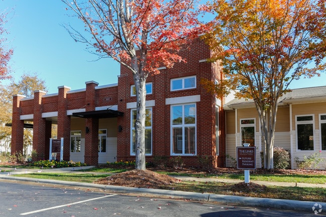
Property Record
4805 Community Cir, Charlotte, NC 28215

NEARBY LISTINGS FOR SALE OR LEASE
Property Detail
4805 Community Cir
Charlotte-Concord-Gastonia, NC-SC
Citiside
099-026-97
SEE 9902695
Multifamilydwelling
Mecklenburg
X
North Carolina
3710456400K
95
2024
12.44 AC
2025
Shannon Park
001504
Charlotte
162,547 SF
DEMOGRAPHICS near 4805 Community Cir
1 Mile
3 Mile
5 Mile
2024 Total Population
11,674
110,848
280,848
2029 Population
12,405
118,496
298,799
Pop Growth 2024-2029
+ 6.26%
+ 6.90%
+ 6.39%
Average Age
36
36
36
2024 Total Households
4,557
46,035
120,815
HH Growth 2024-2029
+ 6.30%
+ 7.01%
+ 6.58%
Median Household Inc
$48,563
$53,548
$59,897
Avg Household Size
2.40
2.30
2.20
2024 Avg HH Vehicles
2.00
2.00
2.00
Median Home Value
$250,452
$282,904
$285,407
Median Year Built
1971
1979
1989
Nearby Places
Map Layers
Map Styles
 Street
 Aerial
- Restaurants
- Banks
- Shops
- Fitness
- Groceries
PUBLIC TRANSPORTATION
TRANSIT/SUBWAY
Sugar Creek Station (Light Rail - Lynx Blue Line - CATS)
DRIVE
WALK
Distance
Sugar Creek Station (Light Rail - Lynx Blue Line - CATS)
5 min
20 min
1.1 mi
COMMUTER RAIL
Charlotte Amtrak Station (Carolinian - Amtrak, Crescent - Amtrak, Piedmont - Amtrak)
DRIVE
WALK
Distance
Charlotte Amtrak Station (Carolinian - Amtrak, Crescent - Amtrak, Piedmont - Amtrak)
9 min
3.9 mi
AIRPORT
Charlotte/Douglas International
DRIVE
WALK
Distance
Charlotte/Douglas International
26 min
12.3 mi
Concord-Padgett Regional
DRIVE
WALK
Distance
Concord-Padgett Regional
22 min
13.3 mi
Freight Ports
North Charleston Terminal
DRIVE
WALK
Distance
North Charleston Terminal
238 min
205.1 mi
Nearby Properties
Address
Land Use
TOTAL SIZE
Lot Size
Zoning
Address
Land Use
TOTAL SIZE
Lot Size
Zoning
729,709 SF
10.67 AC
B2
Address
Land Use
TOTAL SIZE
Lot Size
Zoning
690,862 SF
136.80 AC
R17MF
Address
Land Use
TOTAL SIZE
Lot Size
Zoning
533,477 SF
3.15 AC
I2
Address
Land Use
TOTAL SIZE
Lot Size
Zoning
419,364 SF
17.40 AC
Address
Land Use
TOTAL SIZE
Lot Size
Zoning
499,729 SF
3.90 AC
I2
Address
Land Use
TOTAL SIZE
Lot Size
Zoning
584,543 SF
4.42 AC
I2
Address
Land Use
TOTAL SIZE
Lot Size
Zoning
335,338 SF
3.37 AC
B1
Address
Land Use
TOTAL SIZE
Lot Size
Zoning
285,032 SF
9.43 AC
UR2CD
Address
Land Use
TOTAL SIZE
Lot Size
Zoning
500,761 SF
3.18 AC
TOD-CC
Address
Land Use
TOTAL SIZE
Lot Size
Zoning
388,364 SF
3.26 AC
I2
Address
Land Use
TOTAL SIZE
Lot Size
Zoning
437,989 SF
4.30 AC
B2
Address
Land Use
TOTAL SIZE
Lot Size
Zoning
465,134 SF
3.65 AC
I2
Address
Land Use
TOTAL SIZE
Lot Size
Zoning
499,296 SF
6.04 AC
Address
Land Use
TOTAL SIZE
Lot Size
Zoning
373,451 SF
3.06 AC
I2
Address
Land Use
TOTAL SIZE
Lot Size
Zoning
450,292 SF
28.95 AC
R22MF
Address
Land Use
TOTAL SIZE
Lot Size
Zoning
378,072 SF
2.11 AC
TOD-NC
Address
Land Use
TOTAL SIZE
Lot Size
Zoning
436,898 SF
3.20 AC
Address
Land Use
TOTAL SIZE
Lot Size
Zoning
344,404 SF
3.57 AC
MUDDO
Address
Land Use
TOTAL SIZE
Lot Size
Zoning
402,661 SF
2.91 AC
I2
Address
Land Use
TOTAL SIZE
Lot Size
Zoning
322,996 SF
10.45 AC
I2
Address
Land Use
TOTAL SIZE
Lot Size
Zoning
17,192 SF
3.50 AC
I-2
Address
Land Use
TOTAL SIZE
Lot Size
Zoning
234,540 SF
2.62 AC
R-22MF
Address
Land Use
TOTAL SIZE
Lot Size
Zoning
311,358 SF
8.95 AC
B2
Address
Land Use
TOTAL SIZE
Lot Size
Zoning
312,445 SF
4.28 AC
I1
Address
Land Use
TOTAL SIZE
Lot Size
Zoning
68,352 SF
3.83 AC
TOD-M(O)
Address
Land Use
TOTAL SIZE
Lot Size
Zoning
441,665 SF
3.24 AC
MUDDO
Address
Land Use
TOTAL SIZE
Lot Size
Zoning
261,810 SF
46.15 AC
R3
Address
Land Use
TOTAL SIZE
Lot Size
Zoning
40,940 SF
3.53 AC
TOD-UC
Address
Land Use
TOTAL SIZE
Lot Size
Zoning
5.60 AC
MUDD(CD)
Address
Land Use
TOTAL SIZE
Lot Size
Zoning
299,998 SF
19.55 AC
R17MF
The World's #1 Commercial Real Estate Marketplace
Connect with us
© 2025 CoStar Group
The information above has been obtained from sources believed reliable. While we do not doubt its accuracy we have not verified it and make no guarantee, warranty or representation about it. It is your responsibility to independently confirm its accuracy and completeness. Any projections, opinions, assumptions, or estimates used are for example only and do not represent the current or future performance of the property. The value of this transaction to you depends on tax and other factors which should be evaluated by your tax, financial, and legal advisors. You and your advisors should conduct a careful, independent investigation of the property to determine to your satisfaction the suitability of the property for your needs.