Property Record
4805 Musson Rd, Howell, MI 48855

NEARBY LISTINGS FOR SALE OR LEASE
-
-
View all Howell listings for sale on LoopNet.com
Property Detail
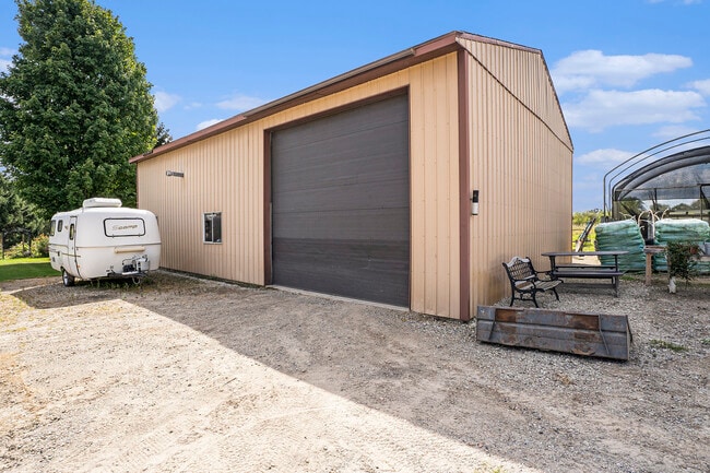
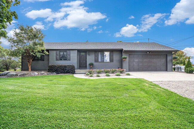
4805 Musson Rd
Detroit-Warren-Dearborn, MI
Livingston
07-12-100-011
Michigan
Sfr
5 AC
X
Livingston County
26093C0216D
Detroit
990 SF
DEMOGRAPHICS near 4805 Musson Rd
1 Mile
3 Mile
5 Mile
2024 Total Population
341
6,034
23,120
2029 Population
341
6,203
23,683
Pop Growth 2024-2029
0.00%
+ 2.80%
+ 2.44%
Average Age
43
41
41
2024 Total Households
120
2,122
8,029
HH Growth 2024-2029
0.00%
+ 2.87%
+ 2.44%
Median Household Inc
$129,348
$111,024
$109,038
Avg Household Size
2.80
2.80
2.80
2024 Avg HH Vehicles
3.00
2.00
2.00
Median Home Value
$335,000
$363,202
$351,627
Median Year Built
1985
1994
1994
Nearby Places
Map Layers
Map Styles
 Street
 Aerial
- Restaurants
- Banks
- Shops
- Fitness
- Groceries
PUBLIC TRANSPORTATION
AIRPORT
Bishop International
DRIVE
WALK
Distance
Bishop International
42 min
25.4 mi
SALE & LEASE HISTORY
LISTING DATE
SALE/LEASE

Sep 23, 2024
For Sale
Nearby Properties
Address
Land Use
TOTAL SIZE
Lot Size
Zoning
Address
Land Use
TOTAL SIZE
Lot Size
Zoning
7,662 SF
150 AC
MHP
Address
Land Use
TOTAL SIZE
Lot Size
Zoning
2.48 AC
GC
Address
Land Use
TOTAL SIZE
Lot Size
Zoning
94.50 AC
LI
Address
Land Use
TOTAL SIZE
Lot Size
Zoning
845 SF
29.60 AC
PDRR
Address
Land Use
TOTAL SIZE
Lot Size
Zoning
1,344 SF
341.70 AC
PDRR
Address
Land Use
TOTAL SIZE
Lot Size
Zoning
19,220 SF
38.65 AC
RE
Address
Land Use
TOTAL SIZE
Lot Size
Zoning
5,096 SF
2.02 AC
GC
Address
Land Use
TOTAL SIZE
Lot Size
Zoning
4,574 SF
18.99 AC
CA
Address
Land Use
TOTAL SIZE
Lot Size
Zoning
1,440 SF
148.16 AC
AR
Address
Land Use
TOTAL SIZE
Lot Size
Zoning
2,358 SF
56.29 AC
AR
Address
Land Use
TOTAL SIZE
Lot Size
Zoning
3,438 SF
91.68 AC
CA
Address
Land Use
TOTAL SIZE
Lot Size
Zoning
2,784 SF
160.44 AC
AR
Address
Land Use
TOTAL SIZE
Lot Size
Zoning
4,176 SF
80 AC
CR1
Address
Land Use
TOTAL SIZE
Lot Size
Zoning
4,564 SF
80 AC
AR
Address
Land Use
TOTAL SIZE
Lot Size
Zoning
146 AC
A-1
Address
Land Use
TOTAL SIZE
Lot Size
Zoning
115.25 AC
AR
Address
Land Use
TOTAL SIZE
Lot Size
Zoning
152.99 AC
CA
Address
Land Use
TOTAL SIZE
Lot Size
Zoning
152 AC
AR
Address
Land Use
TOTAL SIZE
Lot Size
Zoning
2,478 SF
30 AC
AR
Address
Land Use
TOTAL SIZE
Lot Size
Zoning
2,516 SF
41.73 AC
AR
Address
Land Use
TOTAL SIZE
Lot Size
Zoning
1,584 SF
79.04 AC
AR
Address
Land Use
TOTAL SIZE
Lot Size
Zoning
175.98 AC
CA
Address
Land Use
TOTAL SIZE
Lot Size
Zoning
1,588 SF
70.64 AC
AR
Address
Land Use
TOTAL SIZE
Lot Size
Zoning
6,528 SF
144.30 AC
PDRR
Address
Land Use
TOTAL SIZE
Lot Size
Zoning
1,552 SF
88 AC
A-1
Address
Land Use
TOTAL SIZE
Lot Size
Zoning
4,323 SF
74 AC
CA
Address
Land Use
TOTAL SIZE
Lot Size
Zoning
100 AC
A-2
Address
Land Use
TOTAL SIZE
Lot Size
Zoning
100 AC
A-2
Address
Land Use
TOTAL SIZE
Lot Size
Zoning
3,280 SF
38.86 AC
AR
Address
Land Use
TOTAL SIZE
Lot Size
Zoning
1,949 SF
81.46 AC
AR
The World's #1 Commercial Real Estate Marketplace
Connect with us
© 2025 CoStar Group
The information above has been obtained from sources believed reliable. While we do not doubt its accuracy we have not verified it and make no guarantee, warranty or representation about it. It is your responsibility to independently confirm its accuracy and completeness. Any projections, opinions, assumptions, or estimates used are for example only and do not represent the current or future performance of the property. The value of this transaction to you depends on tax and other factors which should be evaluated by your tax, financial, and legal advisors. You and your advisors should conduct a careful, independent investigation of the property to determine to your satisfaction the suitability of the property for your needs.