Property Record
4806 Vue Du Lac Pl, Manhattan, KS 66503
NEARBY LISTINGS FOR SALE OR LEASE
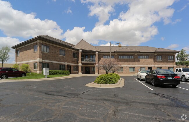
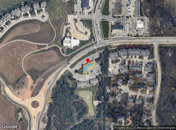
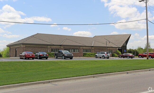
Property Detail
4806 Vue Du Lac Pl
Manhattan, KS
Jentre Pud Unit 1
212-10-0-20-02-002.00-0
JENTRE PUD UNIT 1, LOT 1 - A
Officebuilding
Riley
X
Kansas
20161C0334G
1-a
2024
0.16 AC
2025
Kansas Area
000601
Other Market Areas
7,042 SF
DEMOGRAPHICS near 4806 Vue Du Lac Pl
1 Mile
3 Mile
5 Mile
2024 Total Population
5,181
31,434
57,613
2029 Population
5,192
31,468
57,660
Pop Growth 2024-2029
+ 0.21%
+ 0.11%
+ 0.08%
Average Age
40
34
33
2024 Total Households
2,148
12,080
22,935
HH Growth 2024-2029
+ 0.09%
+ 0.09%
0.00%
Median Household Inc
$121,206
$83,136
$57,465
Avg Household Size
2.30
2.20
2.20
2024 Avg HH Vehicles
2.00
2.00
2.00
Median Home Value
$298,884
$263,557
$231,663
Median Year Built
1992
1986
1983
Nearby Places
Map Layers
Map Styles
 Street
 Aerial
- Restaurants
- Banks
- Shops
- Fitness
- Groceries
PUBLIC TRANSPORTATION
AIRPORT
Manhattan Regional
DRIVE
WALK
Distance
Manhattan Regional
15 min
7.0 mi
SALE & LEASE HISTORY
LISTING DATE
SALE/LEASE

Jul 26, 2018
For Lease
Nearby Properties
Address
Land Use
TOTAL SIZE
Lot Size
Zoning
Address
Land Use
TOTAL SIZE
Lot Size
Zoning
45.61 AC
U
Address
Land Use
TOTAL SIZE
Lot Size
Zoning
4,748,887 SF
261.83 AC
U
Address
Land Use
TOTAL SIZE
Lot Size
Zoning
125.53 AC
U
Address
Land Use
TOTAL SIZE
Lot Size
Zoning
1,084,753 SF
69.85 AC
U
Address
Land Use
TOTAL SIZE
Lot Size
Zoning
518,756 SF
11.88 AC
U
Address
Land Use
TOTAL SIZE
Lot Size
Zoning
69,440 SF
27.76 AC
U
Address
Land Use
TOTAL SIZE
Lot Size
Zoning
41,664 SF
22.69 AC
U
Address
Land Use
TOTAL SIZE
Lot Size
Zoning
132.41 AC
U
Address
Land Use
TOTAL SIZE
Lot Size
Zoning
347,291 SF
21.20 AC
R
Address
Land Use
TOTAL SIZE
Lot Size
Zoning
114,793 SF
9.46 AC
U
Address
Land Use
TOTAL SIZE
Lot Size
Zoning
10,315 SF
128.74 AC
U
Address
Land Use
TOTAL SIZE
Lot Size
Zoning
126,616 SF
33.30 AC
R1
Address
Land Use
TOTAL SIZE
Lot Size
Zoning
1,920 SF
4.47 AC
Address
Land Use
TOTAL SIZE
Lot Size
Zoning
71,182 SF
11.80 AC
R
Address
Land Use
TOTAL SIZE
Lot Size
Zoning
89,898 SF
5.48 AC
R3
Address
Land Use
TOTAL SIZE
Lot Size
Zoning
46,653 SF
0.85 AC
U
Address
Land Use
TOTAL SIZE
Lot Size
Zoning
91,968 SF
5.69 AC
PUD
Address
Land Use
TOTAL SIZE
Lot Size
Zoning
71,899 SF
5.50 AC
R
Address
Land Use
TOTAL SIZE
Lot Size
Zoning
32,402 SF
5.76 AC
R
Address
Land Use
TOTAL SIZE
Lot Size
Zoning
67,276 SF
9 AC
R
Address
Land Use
TOTAL SIZE
Lot Size
Zoning
44,800 SF
4.49 AC
Address
Land Use
TOTAL SIZE
Lot Size
Zoning
25,505 SF
2.46 AC
U
Address
Land Use
TOTAL SIZE
Lot Size
Zoning
64,310 SF
9.64 AC
R
Address
Land Use
TOTAL SIZE
Lot Size
Zoning
46,607 SF
3 AC
Address
Land Use
TOTAL SIZE
Lot Size
Zoning
37,416 SF
0.29 AC
R1
Address
Land Use
TOTAL SIZE
Lot Size
Zoning
15.72 AC
Address
Land Use
TOTAL SIZE
Lot Size
Zoning
7,914 SF
5.70 AC
R3
Address
Land Use
TOTAL SIZE
Lot Size
Zoning
58,446 SF
8.45 AC
R
Address
Land Use
TOTAL SIZE
Lot Size
Zoning
1,387 SF
19 AC
R
Address
Land Use
TOTAL SIZE
Lot Size
Zoning
7,320 SF
55.90 AC
R
The World's #1 Commercial Real Estate Marketplace
Connect with us
© 2026 CoStar Group
The information above has been obtained from sources believed reliable. While we do not doubt its accuracy we have not verified it and make no guarantee, warranty or representation about it. It is your responsibility to independently confirm its accuracy and completeness. Any projections, opinions, assumptions, or estimates used are for example only and do not represent the current or future performance of the property. The value of this transaction to you depends on tax and other factors which should be evaluated by your tax, financial, and legal advisors. You and your advisors should conduct a careful, independent investigation of the property to determine to your satisfaction the suitability of the property for your needs.