Property Record
4807 S State Highway 349, Midland, TX 79706


NEARBY LISTINGS FOR SALE OR LEASE
Property Detail
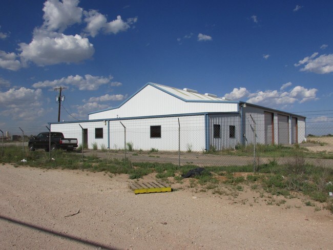
4807 S State Highway 349
Midland, TX
ACRES: 4.570 NW/4 SEC: 23 BLK: 39-T2S
R000006-205
Midland
Officebuilding
Texas
2025
4.57 AC
2025
Midland & Odessa
010127
Other Market Areas
1,848 SF
DEMOGRAPHICS near 4807 S State Highway 349
1 Mile
3 Mile
5 Mile
2024 Total Population
2,086
10,922
39,532
2029 Population
2,088
11,073
40,341
Pop Growth 2024-2029
+ 0.10%
+ 1.38%
+ 2.05%
Average Age
34
33
34
2024 Total Households
686
3,611
12,982
HH Growth 2024-2029
+ 0.44%
+ 1.74%
+ 2.36%
Median Household Inc
$96,616
$72,181
$54,407
Avg Household Size
2.90
2.90
2.90
2024 Avg HH Vehicles
3.00
2.00
2.00
Median Home Value
$224,292
$240,597
$200,625
Median Year Built
1997
1992
1978
Nearby Places
Map Layers
Map Styles
 Street
 Aerial
- Restaurants
- Banks
- Shops
- Fitness
- Groceries
PUBLIC TRANSPORTATION
AIRPORT
Midland International Air And Space Port
DRIVE
WALK
Distance
Midland International Air And Space Port
19 min
14.1 mi
SALE & LEASE HISTORY
LISTING DATE
SALE/LEASE

Nov 09, 2023
For Sale
May 12, 2017
For Lease
Feb 23, 2022
For Lease
Apr 02, 2020
For Lease
Nearby Properties
Address
Land Use
TOTAL SIZE
Lot Size
Zoning
Address
Land Use
TOTAL SIZE
Lot Size
Zoning
245,203 SF
18.40 AC
Address
Land Use
TOTAL SIZE
Lot Size
Zoning
10,228 SF
15.98 AC
Address
Land Use
TOTAL SIZE
Lot Size
Zoning
800 SF
75.53 AC
Address
Land Use
TOTAL SIZE
Lot Size
Zoning
215,322 SF
19.80 AC
PDSC
Address
Land Use
TOTAL SIZE
Lot Size
Zoning
3,399 SF
648 AC
Address
Land Use
TOTAL SIZE
Lot Size
Zoning
15,068 SF
2.77 AC
LR2
Address
Land Use
TOTAL SIZE
Lot Size
Zoning
720 SF
1.86 AC
Address
Land Use
TOTAL SIZE
Lot Size
Zoning
4,263 SF
8.01 AC
Address
Land Use
TOTAL SIZE
Lot Size
Zoning
17,022 SF
1.60 AC
Address
Land Use
TOTAL SIZE
Lot Size
Zoning
13,440 SF
53.69 AC
Address
Land Use
TOTAL SIZE
Lot Size
Zoning
3,300 SF
18.80 AC
LR2
Address
Land Use
TOTAL SIZE
Lot Size
Zoning
15,000 SF
19.27 AC
Address
Land Use
TOTAL SIZE
Lot Size
Zoning
15,132 SF
2.54 AC
1F3
Address
Land Use
TOTAL SIZE
Lot Size
Zoning
58,900 SF
34.20 AC
IP3
Address
Land Use
TOTAL SIZE
Lot Size
Zoning
12,942 SF
1.68 AC
BP
Address
Land Use
TOTAL SIZE
Lot Size
Zoning
11,058 SF
1.85 AC
PDSC
Address
Land Use
TOTAL SIZE
Lot Size
Zoning
12,994 SF
1.44 AC
Address
Land Use
TOTAL SIZE
Lot Size
Zoning
2,300 SF
3.33 AC
Address
Land Use
TOTAL SIZE
Lot Size
Zoning
14,025 SF
17.47 AC
Address
Land Use
TOTAL SIZE
Lot Size
Zoning
Address
Land Use
TOTAL SIZE
Lot Size
Zoning
11,656 SF
1.55 AC
BP
Address
Land Use
TOTAL SIZE
Lot Size
Zoning
32,250 SF
Address
Land Use
TOTAL SIZE
Lot Size
Zoning
5,000 SF
12.81 AC
Address
Land Use
TOTAL SIZE
Lot Size
Zoning
3,442 SF
15.18 AC
Address
Land Use
TOTAL SIZE
Lot Size
Zoning
33,200 SF
30.80 AC
Address
Land Use
TOTAL SIZE
Lot Size
Zoning
9,399 SF
0.99 AC
LR2
Address
Land Use
TOTAL SIZE
Lot Size
Zoning
58,665 SF
2.99 AC
LR2
Address
Land Use
TOTAL SIZE
Lot Size
Zoning
7,600 SF
2 AC
PDSC
Address
Land Use
TOTAL SIZE
Lot Size
Zoning
42,500 SF
8.56 AC
C3
Address
Land Use
TOTAL SIZE
Lot Size
Zoning
15,000 SF
10.01 AC
The World's #1 Commercial Real Estate Marketplace
Connect with us
© 2026 CoStar Group
The information above has been obtained from sources believed reliable. While we do not doubt its accuracy we have not verified it and make no guarantee, warranty or representation about it. It is your responsibility to independently confirm its accuracy and completeness. Any projections, opinions, assumptions, or estimates used are for example only and do not represent the current or future performance of the property. The value of this transaction to you depends on tax and other factors which should be evaluated by your tax, financial, and legal advisors. You and your advisors should conduct a careful, independent investigation of the property to determine to your satisfaction the suitability of the property for your needs.