Property Record
4808 W State St, Rockford, IL 61102


Property Detail
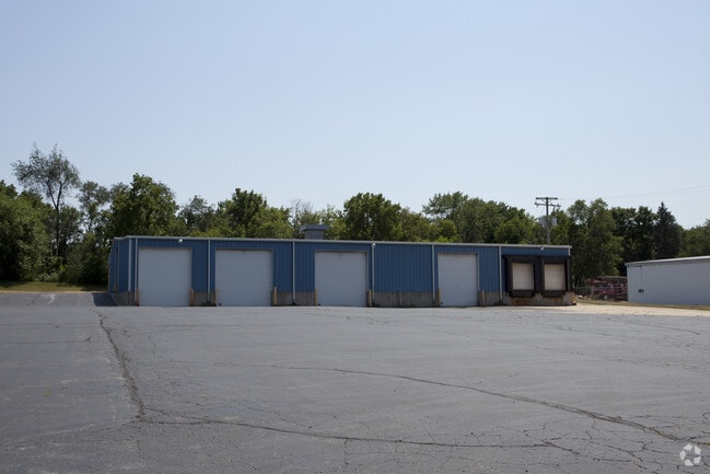
4808 W State St
11-19-252-002
WESTMORELAND SUB NE 1/4 & SE 1/4 SEC 19-44-1 12-27 E 254.96 FT W 509.92 FT LT LOT 157
Industrialgeneral
Winnebago
CG
Illinois
B and X Area of moderate flood hazard, usually the area between the limits of the 100-year and 500-year floods.
157
2024
2.34 AC
2024
I-39 Cor/Winnebago Cy
002302
Chicago
16,940 SF
Rockford, IL
NEARBY LISTINGS FOR SALE OR LEASE
-
-
View all Rockford listings for sale on LoopNet.com
DEMOGRAPHICS near 4808 W State St
1 mile
3 mile
5 mile
2025 Total Population
2,836
23,690
77,648
2030 Population
2,849
24,093
78,194
Pop Growth 2025-2030
+ 0.46%
+ 1.70%
+ 0.70%
Average Age
40
37
38
2025 Total Households
1,144
8,402
30,898
HH Growth 2025-2030
+ 0.52%
+ 1.59%
+ 0.66%
Median Household Inc
$38,571
$45,171
$44,496
Avg Household Size
2.40
2.60
2.40
2025 Avg HH Vehicles
2.00
2.00
2.00
Median Home Value
$92,821
$86,687
$108,471
Median Year Built
1957
1954
1954
Nearby Places
Map Layers
Map Styles
 Street
 Aerial
Layers
 Traffic
 Biking
Places
Listings with unknown addresses are not visible on the map
- Restaurants
- Banks
- Shops
- Fitness
- Groceries
PUBLIC TRANSPORTATION
AIRPORT
Chicago/Rockford International
Drive
Walk
Distance
Chicago/Rockford International
20 min
10.5 mi
Nearby Properties
Address
Land Use
TOTAL SIZE
Lot Size
Zoning
Address
Land Use
TOTAL SIZE
Lot Size
Zoning
43.23 AC
I1
Address
Land Use
TOTAL SIZE
Lot Size
Zoning
238,884 SF
15.96 AC
R3
Address
Land Use
TOTAL SIZE
Lot Size
Zoning
153,461 SF
19.35 AC
I2
Address
Land Use
TOTAL SIZE
Lot Size
Zoning
299,238 SF
18.84 AC
I2
Address
Land Use
TOTAL SIZE
Lot Size
Zoning
111,696 SF
11.99 AC
CG
Address
Land Use
TOTAL SIZE
Lot Size
Zoning
118,780 SF
30.47 AC
I2
Address
Land Use
TOTAL SIZE
Lot Size
Zoning
24.05 AC
IH
Address
Land Use
TOTAL SIZE
Lot Size
Zoning
195,360 SF
28.13 AC
I1
Address
Land Use
TOTAL SIZE
Lot Size
Zoning
104,956 SF
3.82 AC
R4
Address
Land Use
TOTAL SIZE
Lot Size
Zoning
113,902 SF
16.26 AC
R3
Address
Land Use
TOTAL SIZE
Lot Size
Zoning
4,972 SF
2 AC
C2
Address
Land Use
TOTAL SIZE
Lot Size
Zoning
168,222 SF
7.65 AC
I1
Address
Land Use
TOTAL SIZE
Lot Size
Zoning
91,708 SF
21.61 AC
CG
Address
Land Use
TOTAL SIZE
Lot Size
Zoning
17.82 AC
Address
Land Use
TOTAL SIZE
Lot Size
Zoning
15,589 SF
14.40 AC
AG
Address
Land Use
TOTAL SIZE
Lot Size
Zoning
15,500 SF
1.44 AC
C2
Address
Land Use
TOTAL SIZE
Lot Size
Zoning
27,527 SF
6.08 AC
AG
Address
Land Use
TOTAL SIZE
Lot Size
Zoning
12,642 SF
19.04 AC
AG
Address
Land Use
TOTAL SIZE
Lot Size
Zoning
10,738 SF
1.71 AC
C2
Address
Land Use
TOTAL SIZE
Lot Size
Zoning
12,380 SF
0.95 AC
C2
Address
Land Use
TOTAL SIZE
Lot Size
Zoning
14,860 SF
1.98 AC
C2
Address
Land Use
TOTAL SIZE
Lot Size
Zoning
183,488 SF
24.80 AC
I1
Address
Land Use
TOTAL SIZE
Lot Size
Zoning
7.80 AC
RA
Address
Land Use
TOTAL SIZE
Lot Size
Zoning
6,146 SF
1 AC
C3
Address
Land Use
TOTAL SIZE
Lot Size
Zoning
165,388 SF
5.09 AC
I1
Address
Land Use
TOTAL SIZE
Lot Size
Zoning
6,677 SF
1.18 AC
C2
Address
Land Use
TOTAL SIZE
Lot Size
Zoning
4,460 SF
0.94 AC
C3
Address
Land Use
TOTAL SIZE
Lot Size
Zoning
32,483 SF
5.50 AC
CG
Address
Land Use
TOTAL SIZE
Lot Size
Zoning
9,246 SF
2.02 AC
C3
Address
Land Use
TOTAL SIZE
Lot Size
Zoning
61,303 SF
38.79 AC
AG
The World's #1 Commercial Real Estate Marketplace
Connect with us
© 2026 CoStar Group
The information above has been obtained from sources believed reliable. While we do not doubt its accuracy we have not verified it and make no guarantee, warranty or representation about it. It is your responsibility to independently confirm its accuracy and completeness. Any projections, opinions, assumptions, or estimates used are for example only and do not represent the current or future performance of the property. The value of this transaction to you depends on tax and other factors which should be evaluated by your tax, financial, and legal advisors. You and your advisors should conduct a careful, independent investigation of the property to determine to your satisfaction the suitability of the property for your needs.